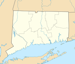
West Cornwall, Connecticut
Appearance
West Cornwall, Connecticut | |
|---|---|
 West Cornwall in March 2012 | |
| Coordinates: 41°52′17″N 73°21′42″W / 41.87139°N 73.36167°W | |
| Country | |
| State | Connecticut |
| County | Litchfield |
| Town | Cornwall |
| Area | |
• Total | 4.06 km2 (1.57 sq mi) |
| • Land | 4.06 km2 (1.57 sq mi) |
| • Water | 0.0 km2 (0.0 sq mi) |
| Elevation | 162 m (531 ft) |
| Time zone | UTC-5 (Eastern (EST)) |
| • Summer (DST) | UTC-4 (EDT) |
| ZIP Code | 06796 |
| Area code(s) | 860/959 |
| FIPS code | 09-82030 |
| GNIS feature ID | 2805985[2] |
West Cornwall is an unincorporated village and census-designated place (CDP) in the town of Cornwall, Litchfield County, Connecticut, United States. It is on the west side of the town, on the east side of the Housatonic River, which forms the border with the town of Sharon. Connecticut Route 128 runs through the village, joining U.S. Route 7 across the Housatonic in Sharon.
West Cornwall was first listed as a CDP prior to the 2020 census.
References
[edit]- ^ "2020 U.S. Gazetteer Files – Connecticut". United States Census Bureau. Retrieved April 12, 2021.
- ^ a b "West Cornwall Census Designated Place". Geographic Names Information System. United States Geological Survey, United States Department of the Interior.


