National Weather Service United States Department of Commerce

Extremely Critical Fire Weather in Southern California; Winter Storm To Impact the Southern U.S.

High winds and low relative humidity will continue critical to extremely critical fire weather in southern California through Thursday. A winter storm is expected to bring major impacts from areas of heavy snow, sleet, and freezing rain to portions of the southern Plains beginning on Thursday before intensifying as it shifts across the Mid-South Friday through Saturday morning. Read More >

Snow Amount Potential
Experimental -
 
Expected Snowfall - Official NWS Forecast
What's this?
High End Amount
1 in 10 Chance (10%) of Higher Snowfall

Maximum Potential Snow Accumulation
What's this?
Low End Amount
9 in 10 Chance (90%) of Higher Snowfall

Minimum Potential Snow Accumulation
What's this?

Low End Amount – 9 in 10 Chance (90%) of Higher Snowfall


This map depicts a reasonable lower-end snowfall amount for the time period shown on the graphic, based on many computer model simulations of possible snowfall totals. This lower amount is an unlikely scenario with a 9 in 10, or 90% chance that more snow will fall, and only a 1 in 10, or 10% chance that less snow will fall. This number can help serve as a lower-end scenario for planning purposes.

Expected Snowfall - Official NWS Forecast


This map is the official NWS snowfall forecast in inches during the time period shown on the graphic. This snowfall amount is determined by NWS forecasters to be the most likely outcome based on evaluation of data from computer models, satellite, radar, and other observations.

High End Amount – Only a 1 in 10 Chance (10%) of Higher Snowfall


This map depicts a reasonable upper-end snowfall amount for the time period shown on the graphic, based on many computer model simulations of possible snowfall totals. This higher amount is an unlikely scenario, with only a 1 in 10, or 10% chance that more snow will fall, and a 9 in 10, or 90% chance that less snow will fall. This number can help serve as an upper-end scenario for planning purposes.

 
The purpose of these experimental probabilistic snowfall products is to provide customers and partners a range of snowfall possibilities, in complement to existing NWS deterministic snowfall graphics, to better communicate forecast uncertainties during winter weather events. For more information visit this project's Product/Service Description Document, and please provide us your feedback here.
Percent Chance That Snow Amounts Will Be Greater Than...
Experimental -
 
What's this?

Percent Chance That Snow Amounts Will Be Greater Than


This series of maps shows the probability (that is, the likelihood) that snowfall will equal or exceed specific amounts during the time period shown on the graphic. These forecasts are based on many computer model simulations of possible snowfall totals.

Hover over thumbnails below to view larger image.
>=0.1"
>=0.1"
>=1"
>=1"
>=2"
>=2"
>=4"
>=4"
>=6"
>=6"
>=8"
>=8"
>=12"
>=12"
>=18"
>=18"

Snowfall Totals by Location
Experimental -
 
What's this?

Snowfall Totals by Location


These tables show the snowfall forecast for individual locations, and provide the same information as the graphics on this web page, just shown in a different way. All of these values are valid for the same time period as depicted on the graphics.

County:

Box Plots   Bar Plots

 
Ice Accumulation Potential
 

Expected Ice Accumulation - Official NWS Forecast

This is the elevated flat surface ice accumulation. It is not radial/line ice. Radial/line ice is typically 39% of the elevated flat surface ice. For more information on this, see this module.

Most Likely Ice Accumulation

What's this?

Most Likely Ice Accumulation

Represents our official ice forecast in inches within the next one to three days. The ice accumulation amounts are provided in ranges.

Winter Storm Severity Index (WSSI) Winter Storm Outlook (WSO)
Winter Storm Severity Index
Winter Storm Outlook
National Snow Reports National Snowfall Analysis
National Snow Reports
National Snowfall Analysis
 
Local Snow Reports
Latest snow report
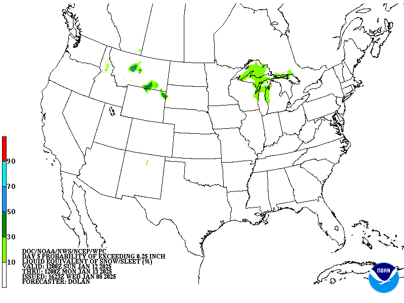
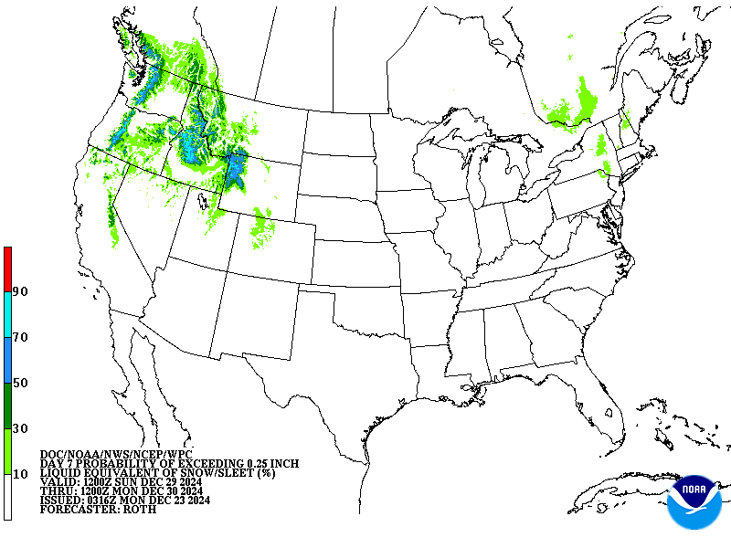
Days 4-7 Winter Weather Outlook
 
Day 4 Winter Weather Outlook Day 5 Winter Weather Outlook
 
Day 6 Winter Weather Outlook Day 7 Winter Weather Outlook


Click here for an interactive map

 
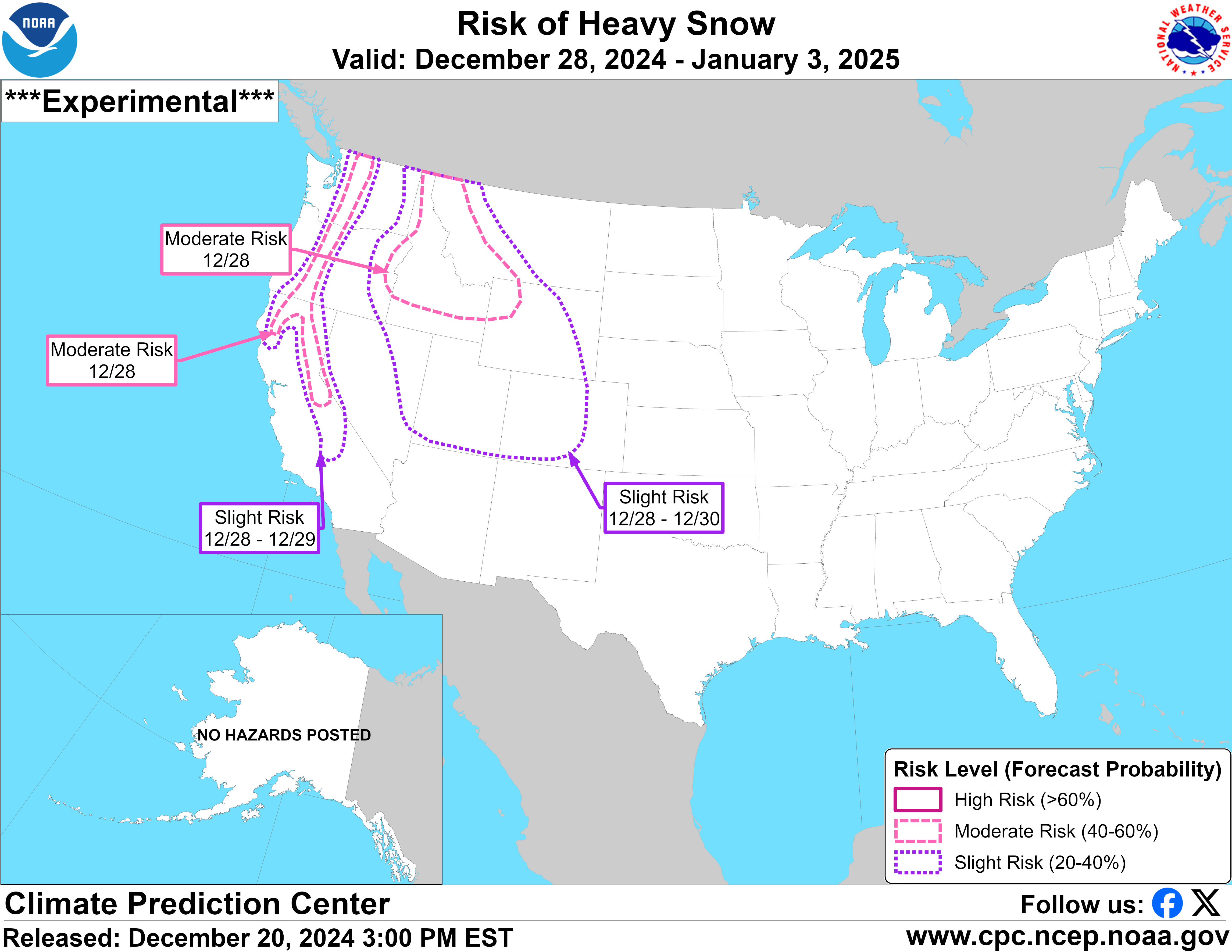
CPC Week-2 Experimental Heavy Snow Risk
 
CPC Week-2 Experimental Heavy Snow Risk
 
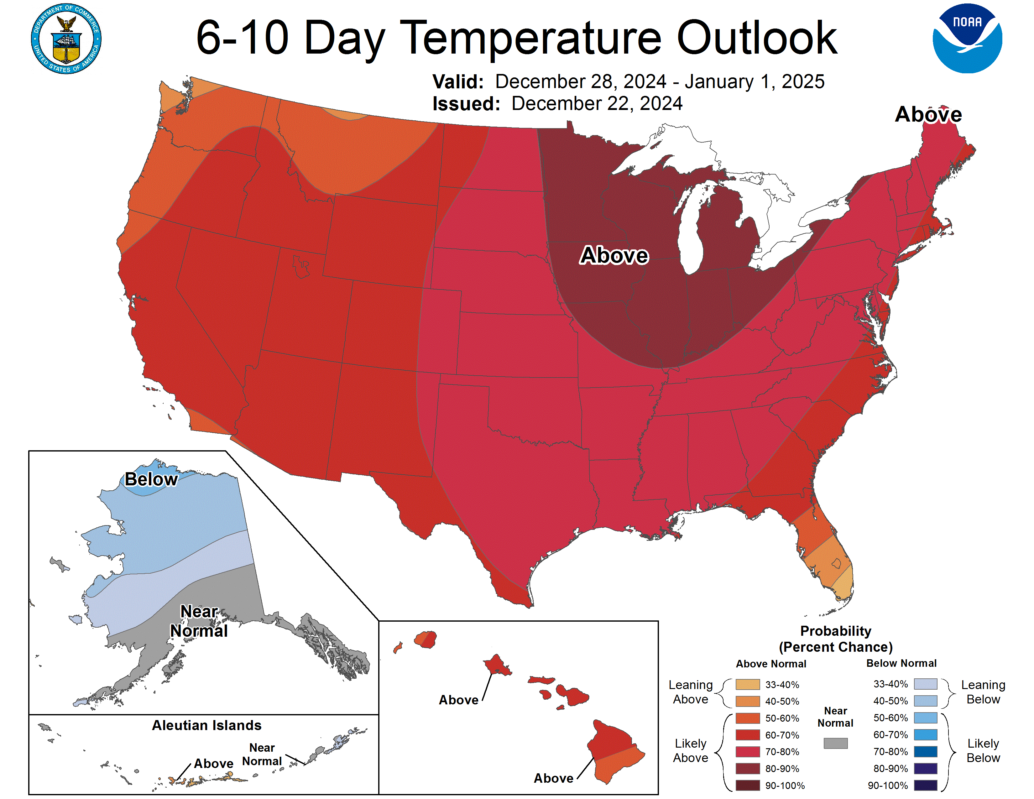
CPC Temperature & Precipitation Maps
 

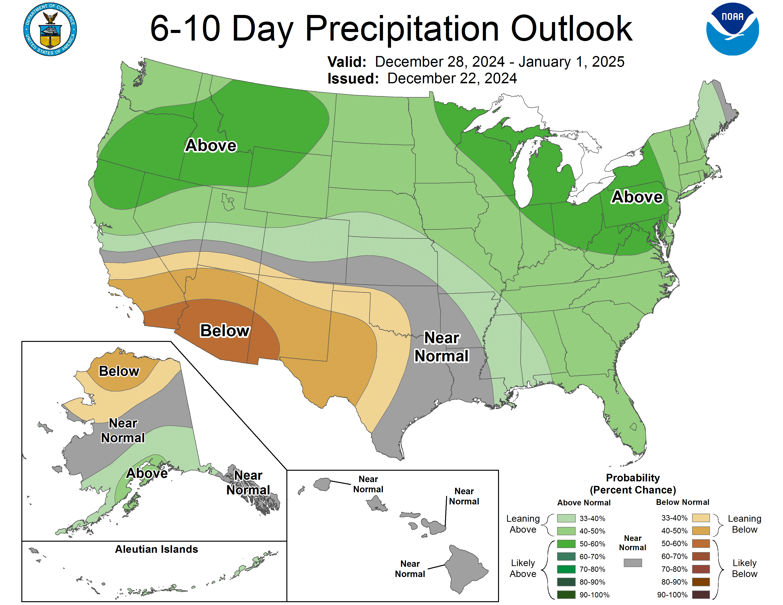
Days 6-10

Temperature  Precipitation
6-10 day temperature 6-10 day precipitation


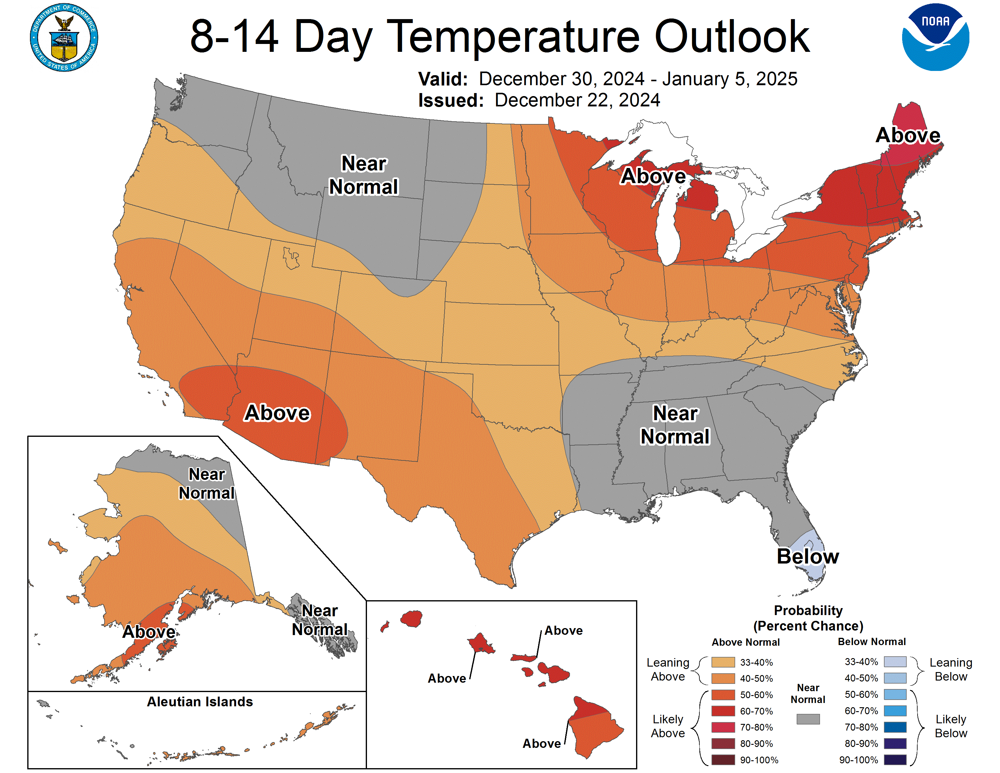
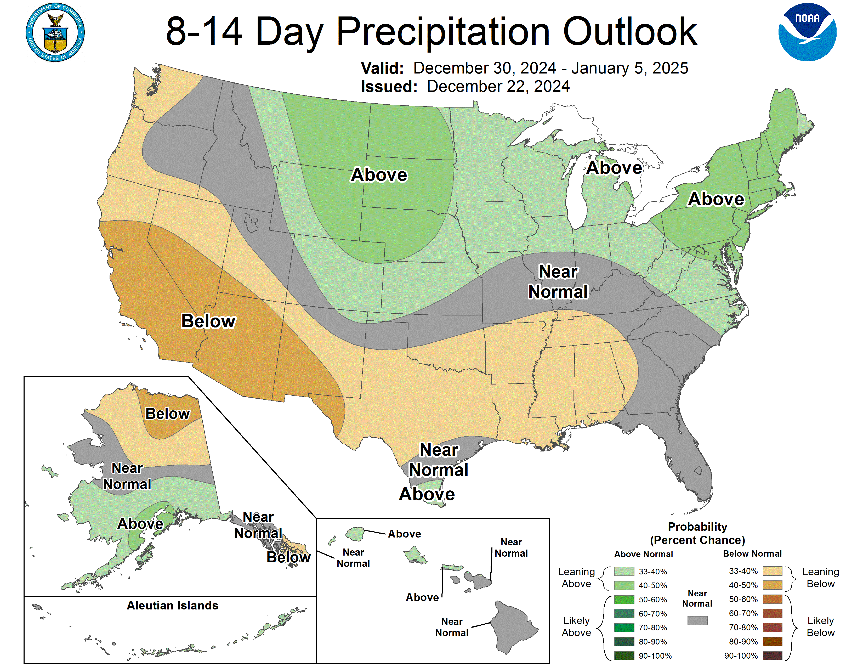
Days 8-14

TEMPERATURE  PRECIPITATION
8-14 day temperature 8-14 day precipitation


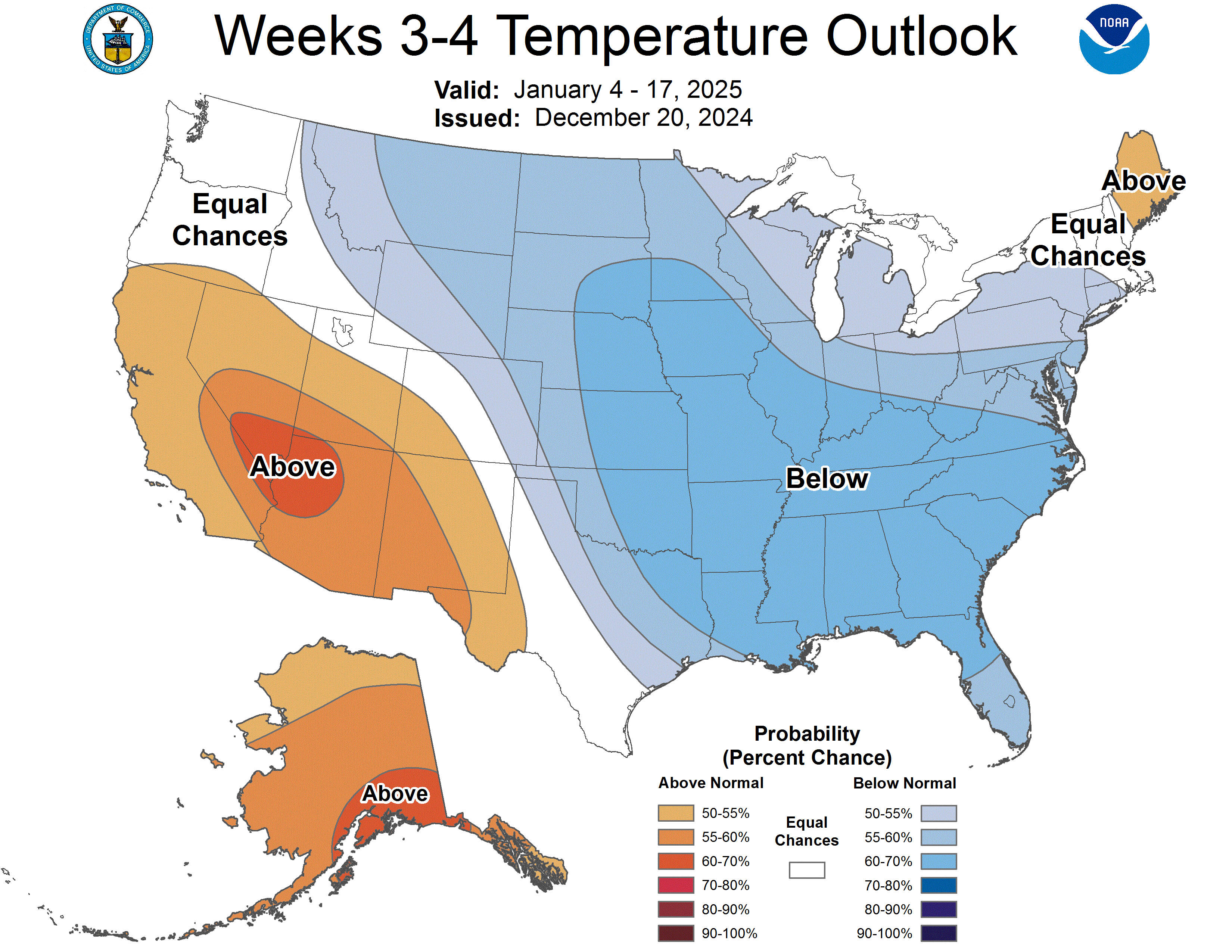
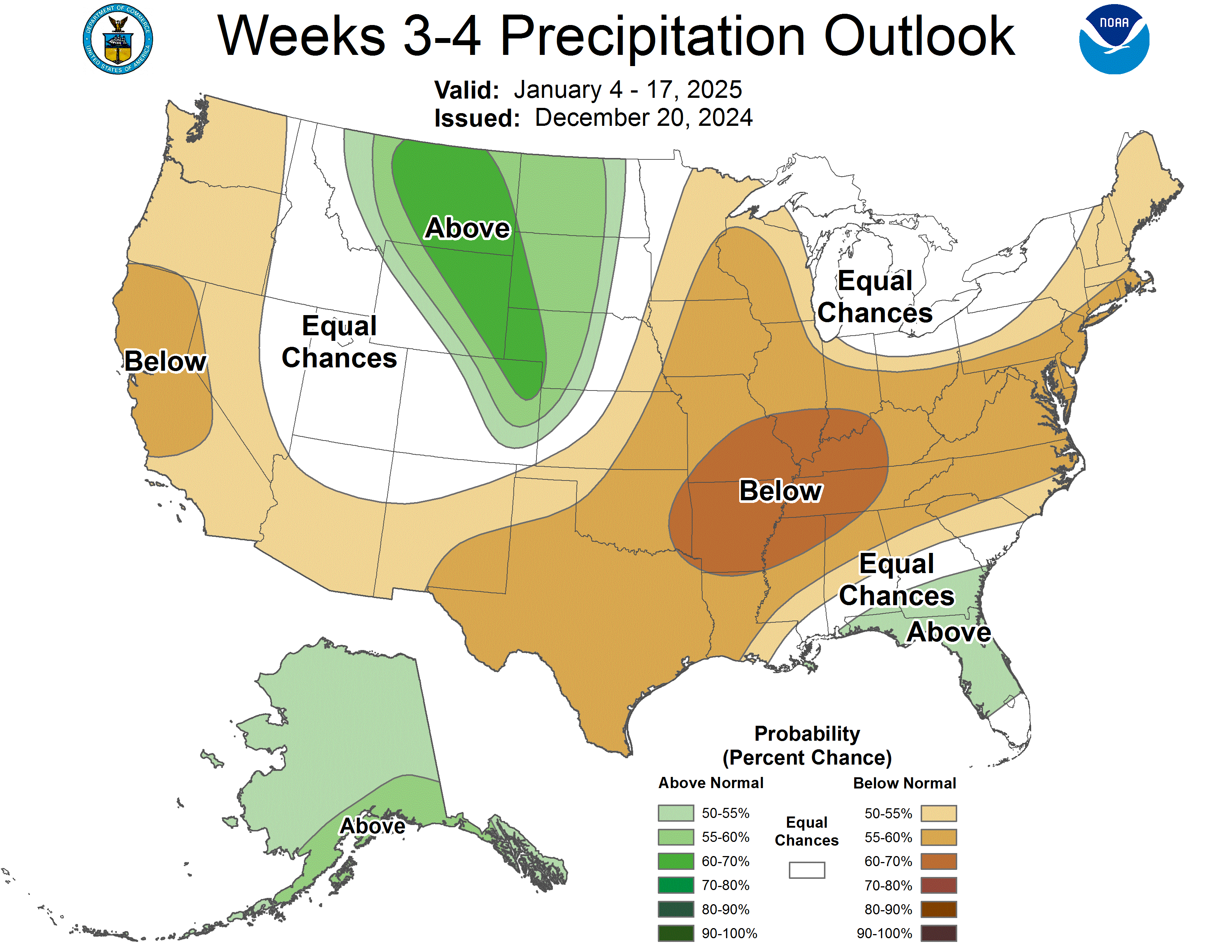
Week 3-4

TEMPERATURE

PRECIPITATION

Week 3-4 Temperature Week 3-4 precipitation
pFad - Phonifier reborn

Pfad - The Proxy pFad of © 2024 Garber Painting. All rights reserved.

Note: This service is not intended for secure transactions such as banking, social media, email, or purchasing. Use at your own risk. We assume no liability whatsoever for broken pages.


Alternative Proxies:

Alternative Proxy

pFad Proxy

pFad v3 Proxy

pFad v4 Proxy