This project is an effort to understand the projections of climate change on the Northwest's climate,hydrology and vegetation.
CMIP5 Projections The projections used for this project come from meteorological outputs from global climate models(GCMs) from the Coupled Model Intercomparison Project phase 5 (CMIP5) under two future experiments (RCP4.5/RCP8.5) over the years 2006 - 2100. The experiment RCP8.5 is a high emissions scenarios which represents a 'business as usual' continuation of our current emissions, while the experiment RCP4.5 is a medium emissions scenario which represents a future where we have adopted mitigation of global emissions.
Climate Downscaling Downscaling is the process of casting the global climate model outputs from their coarse resolution to a finer resolution that is more useful for place-based questions. We utilize the statistical downscaling method of MACA (Multivariate Adaptive Constructed Analogs method) which in addition to changing the resolution of the projections also removes biases from the outputs.
Hydrology/Vegetation Modeling The downscaled climate data is used in secondary modeling efforts for hydrology and vegetation. For this project, ran the climate data through two hydrology models: VIC (Variable Infiltration Capacity) and ULM (Unified Land Model) and two vegetation models: MC2(MAPPS-CENTURY 2) and 3-PG(Physiological Principles Predicting Growth).
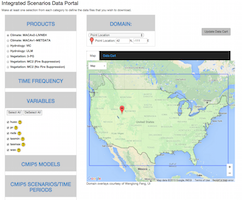
This Website Here we provide a repository of information about the different models and products, a data portal for the datasets and a set of visualizations from some of the projections from these different modeling efforts.
The Integrated Scenarios project was funded by the NW Climate Science Center(NW CSC) and the Climate Impacts Research Consortium(CIRC).


