Warning: Javascript must be enabled to use all the features on this page!
Click to hideNews Bulletins

USGS Current Water Data for Idaho

Click to hide state-specific text


Daily Streamflow Conditions

Select a site to retrieve data and station information.
Stream gage levels in Idaho, relative to 30 year average. 13213100: Flow=7450cfs,Stage=5.60ft,2025-01-02 18:45,Low,SNAKE RIVER AT NYSSA OR13346800: Flow=14.6cfs,Stage=5.26ft,Floodstage=9.2ft,2025-01-02 16:45,>90,PARADISE CR AT UNIVERSITY OF IDAHO AT MOSCOW ID13266000: Flow=1170cfs,Stage=5.60ft,Floodstage=9.5ft,2025-01-02 18:00,>90,WEISER RIVER NR WEISER ID12414900: Flow=285cfs,Stage=4.93ft,2025-01-02 17:15,>90,ST MARIES RIVER NR SANTA, ID13152500: Flow=0.07cfs,Stage=0.32ft,2025-01-02 18:45,<10,MALAD RIVER NR GOODING ID13108150: Flow=121cfs,Stage=4.36ft,2025-01-02 18:00,<10,SALMON FALLS CREEK NR HAGERMAN ID13095500: Flow=314cfs,Stage=1.26ft,2025-01-02 18:15,<10,BOX CANYON SPRINGS NR WENDELL ID13094000: Flow=1720cfs,Stage=1.16ft,2025-01-02 18:30,<10,SNAKE RIVER NR BUHL ID13090500: Flow=640cfs,Stage=2.08ft,2025-01-02 18:30,<10,SNAKE RIVER NR TWIN FALLS ID13307000: Flow=1190cfs,Stage=2.04ft,2025-01-02 18:30,<10,SALMON RIVER NR SHOUP ID13154500: Flow=6260cfs,Stage=5.74ft,2025-01-02 18:45,<10,SNAKE RIVER AT KING HILL ID13127000: Flow=65.0cfs,Stage=1.47ft,Floodstage=4.3ft,2025-01-02 18:45,<10,BIG LOST RIVER BL MACKAY RES NR MACKAY ID13081500: Flow=420cfs,Stage=2.65ft,Floodstage=11.5ft,2025-01-02 18:30,<10,SNAKE R NR MINIDOKA ID AT HOWELLS FERRY13077000: Flow=288cfs,Stage=2.04ft,Floodstage=9.5ft,2025-01-02 18:30,<10,SNAKE RIVER AT NEELEY ID13075983: Flow=257cfs,Stage=4.45ft,2025-01-02 18:15,<10,SPRING CREEK AT SHEEPSKIN RD NR FORT HALL ID13038000: Flow=0.00cfs,Stage=4.65ft,2025-01-02 18:45,<10,DRY BED NR RIRIE ID13345000: Flow=215cfs,Stage=6.67ft,Floodstage=15ft,2025-01-02 17:30,76-90,PALOUSE RIVER NR POTLATCH, ID13335050: Flow=83.5cfs,Stage=2.19ft,2025-01-02 16:45,76-90,ASOTIN CREEK AT ASOTIN, WA13316500: Flow=286cfs,Stage=2.83ft,Floodstage=10ft,2025-01-02 18:00,76-90,LITTLE SALMON RIVER AT RIGGINS ID13309220: Flow=568cfs,Stage=1.61ft,2025-01-02 18:45,76-90,MF SALMON RIVER AT MF LODGE NR YELLOW PINE ID13306385: Flow=10.2cfs,Stage=5.34ft,2025-01-02 18:00,76-90,NAPIAS CREEK BELOW ARNETT CREEK NEAR LEESBURG, ID13296500: Flow=472cfs,Stage=2.18ft,Floodstage=9.5ft,2025-01-02 18:45,76-90,SALMON RIVER BL YANKEE FORK NR CLAYTON ID13265500: Flow=22.3cfs,Stage=1.69ft,2025-01-02 18:00,76-90,CRANE CREEK AT MOUTH NR WEISER ID13258500: Flow=569cfs,Stage=4.39ft,Floodstage=12ft,2025-01-02 17:45,76-90,WEISER RIVER NR CAMBRIDGE ID13206000: Flow=282cfs,Stage=3.38ft,Floodstage=10.1ft,2025-01-02 18:45,76-90,BOISE RIVER AT GLENWOOD BRIDGE NR BOISE ID13200000: Flow=113cfs,Stage=2.43ft,Floodstage=8.8ft,2025-01-02 18:30,76-90,MORES CREEK AB ROBIE CREEK NR ARROWROCK DAM ID13159800: Flow=17.6cfs,Stage=2.34ft,2025-01-02 18:00,76-90,CANYON CR AT OREGON TRAIL XING NR MOUNTAIN HOME ID13068495: Flow=20.9cfs,Stage=4.79ft,2025-01-02 18:30,76-90,BLACKFOOT RIVER BYPASS NR BLACKFOOT ID12419000: Flow=5970cfs,Stage=10.77ft,2025-01-02 17:30,76-90,Spokane River near Post Falls, ID12413500: Flow=1920cfs,Stage=34.28ft,Floodstage=43ft,2025-01-02 17:15,76-90,COEUR D ALENE RIVER NR CATALDO ID12413470: Flow=360cfs,Stage=7.03ft,2025-01-02 16:45,76-90,SF Coeur D Alene River nr Pinehurst, ID12413210: Flow=187cfs,Stage=24.67ft,2025-01-02 17:30,76-90,SF COEUR D ALENE AT ELIZABETH PARK NR KELLOGG ID12413000: Flow=1530cfs,Stage=59.42ft,Floodstage=72ft,2025-01-02 17:45,76-90,NF COEUR D ALENE RIVER AT ENAVILLE ID12411000: Flow=433cfs,Stage=1.97ft,2025-01-02 17:15,76-90,NF COEUR D ALENE R AB SHOSHONE CK NR PRICHARD ID13305310: Flow=193cfs,Stage=1.90ft,2025-01-02 17:45,10-24,LEMHI RIVER BELOW L5 DIVERSION NEAR SALMON, ID13302005: Flow=217cfs,Stage=1.79ft,2025-01-02 18:00,10-24,PAHSIMEROI RIVER AT ELLIS ID13297330: Flow=2.76cfs,Stage=3.02ft,2025-01-02 18:45,10-24,THOMPSON CREEK NR CLAYTON ID13172500: Flow=7090cfs,Stage=21.43ft,2025-01-02 18:15,10-24,SNAKE RIVER NR MURPHY ID13150430: Flow=115cfs,Stage=6.82ft,Floodstage=8.3ft,2025-01-02 17:45,10-24,SILVER CREEK AT SPORTSMAN ACCESS NR PICABO ID13141500: Flow=7.44cfs,Stage=2.21ft,2025-01-02 18:45,10-24,CAMAS CREEK NR BLAINE ID13095175: Flow=94.0cfs,Stage=3.95ft,2025-01-02 18:30,10-24,BRIGGS SPRING AT HEAD NEAR BUHL ID13037500: Flow=1410cfs,Stage=1.64ft,Floodstage=8ft,2025-01-02 18:30,10-24,SNAKE RIVER NR HEISE ID13032500: Flow=925cfs,Stage=4.52ft,2025-01-02 18:30,10-24,SNAKE RIVER NR IRWIN ID12395500: Flow=8280cfs,Stage=31.37ft,2025-01-02 16:45,10-24,PEND OREILLE RIVER AT NEWPORT WA13342500: Flow=5390cfs,Stage=4.12ft,Floodstage=18ft,2025-01-02 17:00,25-75,CLEARWATER RIVER AT SPALDING ID13342450: Flow=30.8cfs,Stage=2.70ft,2025-01-02 17:45,25-75,LAPWAI CREEK NR LAPWAI, ID13341050: Flow=4680cfs,Stage=4.59ft,2025-01-02 17:30,25-75,CLEARWATER RIVER NR PECK ID13340600: Flow=1490cfs,Stage=6.41ft,2025-01-02 17:45,25-75,NF CLEARWATER RIVER NR CANYON RANGER STATION ID13340000: Flow=2980cfs,Stage=3.58ft,Floodstage=17ft,2025-01-02 17:15,25-75,CLEARWATER RIVER AT OROFINO ID13338500: Flow=265cfs,Stage=2.87ft,Floodstage=8ft,2025-01-02 17:15,25-75,SF CLEARWATER RIVER AT STITES ID13337000: Flow=739cfs,Stage=2.34ft,2025-01-02 17:00,25-75,LOCHSA RIVER NR LOWELL ID13336500: Flow=883cfs,Stage=3.43ft,Floodstage=14ft,2025-01-02 17:00,25-75,SELWAY RIVER NR LOWELL ID13334300: Flow=22600cfs,Stage=5.31ft,Floodstage=20ft,2025-01-02 17:15,25-75,SNAKE RIVER NEAR ANATONE, WA13317000: Flow=3540cfs,Stage=12.24ft,Floodstage=32ft,2025-01-02 17:45,25-75,SALMON RIVER AT WHITE BIRD ID13311000: Flow=7.83cfs,Stage=4.84ft,2025-01-02 18:00,25-75,EF OF SF SALMON RIVER AT STIBNITE, ID13310199: Flow=872cfs,2025-01-02 17:45,Stage=30.72ft,2025-01-02 18:45:00,25-75,MF SALMON RIVER AT MOUTH NR SHOUP, ID13305000: Flow=216cfs,Stage=3.96ft,Floodstage=6.5ft,2025-01-02 17:45,25-75,LEMHI RIVER NR LEMHI ID13302500: Flow=917cfs,Stage=2.15ft,Floodstage=7.5ft,2025-01-02 18:00,25-75,SALMON RIVER AT SALMON ID13297355: Flow=10.5cfs,Stage=3.43ft,Floodstage=6.2ft,2025-01-02 18:30,25-75,Paasasikwana Naokwaide bl Bruno Ck13269000: Flow=12200cfs,Stage=3.76ft,Floodstage=12ft,2025-01-02 18:00,25-75,SNAKE RIVER AT WEISER ID13251000: Flow=1520cfs,Stage=5.15ft,Floodstage=12ft,2025-01-02 18:30,25-75,PAYETTE RIVER NR PAYETTE ID13250000: Flow=1320cfs,Stage=8.84ft,2025-01-02 18:30,25-75,PAYETTE RIVER NR LETHA ID13249500: Flow=1330cfs,Stage=2.58ft,Floodstage=10.5ft,2025-01-02 17:45,25-75,PAYETTE RIVER NR EMMETT ID13247500: Flow=1000cfs,Stage=3.11ft,2025-01-02 18:30,25-75,PAYETTE RIVER NR HORSESHOE BEND ID13246000: Flow=323cfs,Stage=4.19ft,2025-01-02 18:00,25-75,NF PAYETTE RIVER NR BANKS ID13239000: Flow=58.8cfs,Stage=2.13ft,2025-01-02 17:30,25-75,NF PAYETTE RIVER AT MCCALL ID13236500: Flow=4.38cfs,Stage=1.36ft,2025-01-02 18:45,25-75,DEADWOOD RIVER BL DEADWOOD RES NR LOWMAN ID13235000: Flow=345cfs,Stage=3.27ft,Floodstage=7.5ft,2025-01-02 18:30,25-75,SOUTH FORK PAYETTE RIVER AT LOWMAN, ID13213000: Flow=923cfs,Stage=8.79ft,2025-01-02 18:00,25-75,BOISE RIVER NR PARMA ID13190500: Flow=312cfs,Stage=3.00ft,2025-01-02 18:15,25-75,SF BOISE RIVER AT ANDERSON RANCH DAM ID13186000: Flow=202cfs,Stage=1.75ft,Floodstage=7.2ft,2025-01-02 18:30,25-75,SF BOISE RIVER NR FEATHERVILLE ID13185000: Flow=429cfs,Stage=5.61ft,2025-01-02 18:30,25-75,BOISE RIVER NR TWIN SPRINGS ID13168500: Flow=92.8cfs,Stage=4.75ft,Floodstage=9.5ft,2025-01-02 18:00,25-75,BRUNEAU RIVER NR HOT SPRING ID13161500: Flow=32.1cfs,Stage=2.63ft,Floodstage=7ft,2025-01-02 17:40,25-75,BRUNEAU RV AT ROWLAND, NV13142500: Flow=4.61cfs,Stage=1.83ft,Floodstage=9ft,2025-01-02 18:45,25-75,BIG WOOD RIVER BL MAGIC DAM NR RICHFIELD ID13139510: Flow=130cfs,Stage=1.48ft,Floodstage=6ft,2025-01-02 18:00,25-75,BIG WOOD RIVER AT HAILEY ID TOTAL FLOW13135500: Flow=48.5cfs,Stage=4.88ft,Floodstage=8ft,2025-01-02 17:45,25-75,BIG WOOD RIVER NR KETCHUM ID13120000: Flow=20.0cfs,Stage=1.34ft,Floodstage=5.11ft,2025-01-02 18:15,25-75,NF BIG LOST RIVER AT WILD HORSE NR CHILLY ID13105000: Flow=59.4cfs,Stage=5.36ft,Floodstage=10ft,2025-01-02 17:45,25-75,SALMON FALLS CREEK NR SAN JACINTO NV13092747: Flow=52.8cfs,Stage=5.65ft,2025-01-02 18:45,25-75,ROCK CREEK AB HWY 30/93 XING AT TWIN FALLS ID13089500: Flow=11.1cfs,Stage=1.42ft,2025-01-02 18:30,25-75,DEVILS WASHBOWL SPRING NR KIMBERLY 10S 18E 04AAD1S13078000: Flow=9.26cfs,Stage=5.54ft,2025-01-02 18:15,25-75,RAFT RIVER AB ONEMILE CREEK NR MALTA ID13075910: Flow=414cfs,Stage=4.03ft,Floodstage=6.23ft,2025-01-02 18:00,25-75,PORTNEUF RIVER NR TYHEE ID13075500: Flow=245cfs,Stage=5.20ft,Floodstage=8.5ft,2025-01-02 17:45,25-75,PORTNEUF RIVER AT POCATELLO ID13075000: Flow=60.7cfs,Stage=2.98ft,Floodstage=5.55ft,2025-01-02 18:15,25-75,MARSH CREEK NR MCCAMMON ID13073000: Flow=136cfs,Stage=2.66ft,Floodstage=4.02ft,2025-01-02 18:15,25-75,PORTNEUF RIVER AT TOPAZ ID13069500: Flow=2310cfs,Stage=2.95ft,Floodstage=11ft,2025-01-02 18:15,25-75,SNAKE RIVER NR BLACKFOOT ID13068500: Flow=79.2cfs,Stage=2.54ft,Floodstage=5.8ft,2025-01-02 18:30,25-75,BLACKFOOT RIVER NR BLACKFOOT ID13062500: Flow=2260cfs,Stage=4.84ft,Floodstage=10.5ft,2025-01-02 18:15,25-75,SNAKE RIVER AT BLACKFOOT ID13060000: Flow=2600cfs,Stage=5.60ft,Floodstage=12.5ft,2025-01-02 18:15,25-75,SNAKE RIVER NR SHELLEY ID13056500: Flow=1590cfs,Stage=4.18ft,Floodstage=9.5ft,2025-01-02 18:15,25-75,HENRYS FORK NR REXBURG ID13055000: Flow=401cfs,Stage=2.03ft,Floodstage=6ft,2025-01-02 18:15,25-75,TETON RIVER NR ST ANTHONY ID13047600: Flow=431cfs,Stage=4.11ft,2025-01-02 18:45,25-75,FALL RIVER NR ASHTON ID13046000: Flow=1010cfs,Stage=2.97ft,2025-01-02 18:15,25-75,HENRYS FORK NR ASHTON ID13042500: Flow=276cfs,Stage=2.61ft,2025-01-02 18:45,25-75,HENRYS FORK NR ISLAND PARK ID13038500: Flow=986cfs,Stage=3.03ft,2025-01-02 18:15,25-75,SNAKE RIVER AT LORENZO ID13027500: Flow=483cfs,Stage=1.91ft,Floodstage=5.5ft,2025-01-02 18:30,25-75,SALT RIVER ABOVE RESERVOIR, NEAR ETNA, WY12414500: Flow=928cfs,Stage=6.27ft,Floodstage=13ft,2025-01-02 17:30,25-75,ST JOE RIVER AT CALDER, ID12395000: Flow=886cfs,Stage=1.75ft,2025-01-02 17:15,25-75,Priest River near Priest River, ID12392300: Flow=74.7cfs,Stage=16.43ft,2025-01-02 17:15,25-75,PACK RIVER NR COLBURN ID12392155: Flow=141cfs,Stage=10.67ft,2025-01-02 17:45,25-75,LIGHTNING CREEK AT CLARK FORK ID12305000: Flow=5440cfs,Stage=10.94ft,2025-01-02 17:15,25-75,KOOTENAI RIVER AT LEONIA, ID12304500: Flow=156cfs,Stage=3.07ft,Floodstage=8ft,2025-01-02 18:45,25-75,Yaak River near Troy MT10092700: Flow=513cfs,Stage=9.57ft,Floodstage=18.07ft,2025-01-02 17:45,25-75,BEAR RIVER AT IDAHO-UTAH STATE LINE132109867: Flow=16.2cfs,Stage=3.68ft,2025-01-02 18:30,Not ranked,EAST HARTLEY ABV BACKWATER NR CALDWELL, ID13341570: Flow=243cfs,Stage=6.16ft,2025-01-02 16:45,Not ranked,POTLATCH RIVER BEL LITTLE POTLATCH CR NR SPALDING13341140: Flow=20.5cfs,Stage=3.64ft,2025-01-02 17:45,Not ranked,BIG CANYON CREEK NR PECK ID13339500: Flow=97.5cfs,Stage=8.53ft,2024-12-02 14:30,Not ranked,LOLO CREEK NR GREER ID13338950: Flow=34.8cfs,Stage=62.75ft,2025-01-02 16:45,Not ranked,LAWYER CREEK AT KAMIAH ID13317660: Flow=22700cfs,Stage=7.69ft,2025-01-02 17:45,Not ranked,SNAKE RIVER AT McDUFF RAPIDS AT CHINA GARDEN ID13313000: Stage=2.12ft,2025-01-02 18:00:00,Not ranked,Ice affected,JOHNSON CREEK AT YELLOW PINE ID13311450: Flow=50.2cfs,Stage=7.25ft,2025-01-02 18:15,Not ranked,SUGAR CREEK NR STIBNITE, ID13311250: Flow=10.0cfs,Stage=10.35ft,2025-01-02 18:15,Not ranked,EFSF SALMON R ABV SUGAR CRK NR STIBNITE, ID13310850: Flow=2.09cfs,Stage=3.34ft,2024-10-16 12:15,Not ranked,MEADOW CREEK NR STIBNITE, ID13310800: Flow=5.41cfs,Stage=14.78ft,2024-10-24 10:45,Not ranked,EFSF SALMON R ABV MEADOW CRK NR STIBNITE, ID13310700: Flow=117cfs,Stage=1.66ft,2025-01-01 07:45,Not ranked,SF SALMON RIVER NR KRASSEL RANGER STATION ID13306370: Stage=5.91ft,2025-01-02 18:45:00,Not ranked,Ice affected,PANTHER CREEK AT COBALT, ID13297350: Flow=0.10cfs,Stage=2.48ft,2024-12-05 10:15,Not ranked,BRUNO CREEK NR CLAYTON ID13296000: Stage=7.54ft,2025-01-02 18:15:00,Floodstage=11ft,Not ranked,Ice affected,YANKEE FORK SALMON RIVER NR CLAYTON ID13295000: Stage=0.90ft,2025-01-02 18:00:00,Floodstage=3.1ft,Not ranked,Ice affected,VALLEY CREEK AT STANLEY ID13290450: Flow=13800cfs,2025-01-01 18:30,Not ranked,SNAKE RIVER AT HELLS CANYON DAM ID-OR STATE LINE13240000: Flow=10.7cfs,Stage=3.13ft,2024-10-01 01:00,Not ranked,LAKE FORK PAYETTE RIVER AB JUMBO CR NR MCCALL ID13238500: Stage=1.26ft,2025-01-02 18:15,Not ranked,PAYETTE LAKE AT MCCALL ID13237920: Flow=226cfs,Stage=5.86ft,Floodstage=11.8ft,2025-01-02 18:15,Not ranked,MIDDLE FORK PAYETTE RIVER NR CROUCH ID13213072: Flow=62.9cfs,Stage=3.67ft,2025-01-02 18:30,Not ranked,SAND RUN GULCH NR PARMA ID13212890: Flow=89.2cfs,Stage=1.33ft,2025-01-02 18:15,Not ranked,DIXIE DRAIN NR WILDER ID13212549: Flow=11.7cfs,Stage=5.99ft,2025-01-02 18:00,Not ranked,CONWAY GULCH BELOW 1ST ST AT NOTUS, ID13211205: Flow=631cfs,Stage=6.62ft,2025-01-02 18:45,Not ranked,BOISE RIVER AT CALDWELL, ID13210986: Flow=4.61cfs,Stage=0.84ft,2025-01-02 17:45,Not ranked,W HARTLEY GULCH NR CALDWELL ID13210980: Flow=60.6cfs,Stage=5.32ft,2025-01-02 18:30,Not ranked,MASON CREEK AT CALDWELL ID13210831: Flow=20.8cfs,Stage=0.77ft,2025-01-02 18:15,Not ranked,SOUTH MIDDLETON DRAIN AT MIDDLETON ID13210824: Flow=12.2cfs,Stage=4.82ft,2025-01-02 18:00,Not ranked,N MIDDLETON DRAIN MILL SLOUGH AT MIDDLETON ID13210810: Flow=45.9cfs,Stage=0.94ft,2025-01-02 18:15,Not ranked,FIFTEENMILE CREEK NR MIDLAND BLVD NR MIDDLETON, ID13206400: Flow=9.72cfs,Stage=10.70ft,2025-01-02 18:00,Not ranked,EAGLE DRAIN AT EAGLE, ID13206305: Flow=222cfs,Stage=2.58ft,2025-01-02 18:00,Not ranked,BOISE RIVER SOUTH CHANNEL AT EAGLE ID13201500: Stage=2954.20ft,2025-01-02 18:15,Not ranked,LUCKY PEAK LAKE NR BOISE ID13176400: Flow=164cfs,Stage=9.17ft,2025-01-02 18:00,Not ranked,EF OWYHEE RIVER AT CRUTCHER CROSSING, ID13171500: Stage=54.65ft,2025-01-02 18:15,Not ranked,CJ STRIKE RES NR GRAND VIEW ID13148500: Stage=0.80ft,2025-01-02 18:45:00,Floodstage=5.8ft,Not ranked,Ice affected,LITTLE WOOD RIVER NR CAREY ID13147900: Stage=1.62ft,2025-01-02 18:45:00,Floodstage=5.4ft,Not ranked,Ice affected,LITTLE WOOD RIVER AB HIGH FIVE CREEK NR CAREY ID13140800: Flow=10.6cfs,Stage=4.15ft,2025-01-02 18:00,Not ranked,BIG WOOD RIVER AT STANTON CROSSING NR BELLEVUE ID13140335: Flow=94.4cfs,Stage=5.94ft,Floodstage=11ft,2025-01-02 18:45,Not ranked,BIG WOOD R AT S BROADFORD BRIDGE NR BELLEVUE, ID13138000: Stage=7.52ft,2025-01-02 18:15:00,Floodstage=8.4ft,Not ranked,Ice affected,EAST FORK BIG WOOD RIVER AT GIMLET ID13137500: Stage=5.85ft,2025-01-02 18:15:00,Floodstage=7ft,Not ranked,Ice affected,TRAIL CREEK AT KETCHUM ID13137300: Stage=5.78ft,2025-01-02 18:30:00,Not ranked,Ice affected,TRAIL CREEK NR SUN VALLEY, ID13135520: Stage=6.80ft,2025-01-02 18:30:00,Floodstage=7.3ft,Not ranked,Ice affected,NF BIG WOOD RIVER NR SAWTOOTH NRA HQ NR KETCHUM ID13132565: Not ranked,Seasonal site,BIG LOST RIVER AB BIG LOST RIVER SINKS NR HOWE ID13132535: Not ranked,Seasonal site,BIG LOST R AT LINCOLN BLVD BRIDGE NR ATOMIC CITY13132520: Not ranked,Seasonal site,BIG LOST RIVER BL INL DIV NEAR ARCO ID13132513: Not ranked,Seasonal site,INL DIVERSION AT HEAD NEAR ARCO ID13132500: Flow=0.00cfs,Stage=2.01ft,Floodstage=6.5ft,2025-01-02 18:00,Not ranked,BIG LOST RIVER NR ARCO ID13131000: Stage=4.98ft,2025-01-02 18:00:00,Floodstage=6ft,Not ranked,Ice affected,ANTELOPE CREEK NR DARLINGTON, ID13126000: Stage=43.95ft,2025-01-02 18:00,Not ranked,MACKAY RES NR MACKAY ID13120500: Stage=2.55ft,2025-01-02 18:00:00,Floodstage=4.05ft,Not ranked,Ice affected,BIG LOST RIVER AT HOWELL RANCH NR CHILLY ID13119000: Stage=1.06ft,2025-01-02 18:15:00,Floodstage=4.5ft,Not ranked,Ice affected,LITTLE LOST RIVER NR HOWE, ID13118975: Stage=6.37ft,2025-01-02 18:15:00,Not ranked,Ice affected,LITTLE LOST RIVER AB FLOOD DIVERSION NR HOWE ID13118700: Stage=1.15ft,2025-01-02 18:30:00,Floodstage=3.4ft,Not ranked,Ice affected,LITTLE LOST RIVER BL WET CREEK NR HOWE ID13116500: Stage=7.90ft,2025-01-02 18:15:00,Floodstage=7.7ft,Not ranked,Ice affected,MEDICINE LODGE CREEK NR SMALL ID13115000: Stage=1.43ft,2025-01-02 18:30,Not ranked,MUD LAKE NR TERRETON ID13112000: Flow=0.00cfs,Stage=2.41ft,Floodstage=9.2ft,2025-01-02 18:30,Not ranked,CAMAS CREEK AT CAMAS ID13106500: Stage=16.33ft,2025-01-02 18:30,Not ranked,SALMON RIVER CANAL CO RES NR ROGERSON ID13087995: Flow=0.00cfs,Stage=0.86ft,2025-01-02 18:30,Not ranked,SNAKE RIVER GAGING STATION AT MILNER ID13087900: Stage=9.76ft,2025-01-02 18:45,Not ranked,MILNER LAKE AT MILNER DAM ID13082500: Stage=2.06ft,2025-01-02 18:30:00,Floodstage=5.5ft,Not ranked,Ice affected,GOOSE CREEK AB TRAPPER CREEK NR OAKLEY ID13068300: Flow=121cfs,Stage=3.01ft,2025-01-02 17:45,Not ranked,BLACKFOOT RIVER BELOW NORTH CANAL AT BLACKFOOT ID13066000: Stage=5.63ft,2025-01-02 18:30:00,Floodstage=8.5ft,Not ranked,Ice affected,BLACKFOOT RIVER NR SHELLEY ID13063000: Not ranked,Temporarily unavailable,BLACKFOOT RIVER AB RESERVOIR NR HENRY ID13058530: Flow=0.00cfs,Stage=2.42ft,2025-01-02 18:30,Not ranked,WILLOW CREEK BLW FLOODWAY CHANNEL NR UCON ID13058529: Flow=0.00cfs,Stage=8.07ft,2025-01-02 18:30,Not ranked,WILLOW CR FLOODWAY CHANNEL AT MOUTH NR ID FALLS ID13058520: Flow=0.00cfs,Stage=0.60ft,2025-01-02 18:30,Not ranked,WILLOW CREEK FLOODWAY CHANNEL NR UCON ID13058510: Flow=0.00cfs,Stage=0.24ft,2025-01-02 18:30,Not ranked,SAND CREEK NEAR UCON ID13058000: Flow=0.00cfs,Stage=0.29ft,Floodstage=12.1ft,2025-01-02 18:30,Not ranked,WILLOW CREEK NR RIRIE ID13057940: Stage=2.75ft,2025-01-02 18:45:00,Not ranked,Ice affected,WILLOW CREEK BL TEX CREEK NR RIRIE ID13057300: Flow=2.71cfs,Stage=3.04ft,2025-01-02 18:15,Not ranked,GRAYS LAKE DIV TO BLACKFOOT R BASIN NR WAYAN, ID13057155: Stage=6.11ft,2025-01-02 18:15:00,Floodstage=13.2ft,Not ranked,Ice affected,SNAKE RIVER AB EAGLE ROCK NR IDAHO FALLS ID13057132: Flow=0.00cfs,Stage=-0.43ft,2025-01-02 18:30,Not ranked,GREAT WESTERN SPILLBACK NR IDAHO FALLS ID13057000: Flow=2680cfs,Stage=2.38ft,Floodstage=8.5ft,2025-01-02 18:30,Not ranked,SNAKE RIVER NR MENAN ID13055340: Stage=5.21ft,2025-01-02 17:45:00,Not ranked,Ice affected,SF TETON RIVER NEAR REXBURG ID13055250: Stage=4.10ft,2025-01-02 18:45:00,Not ranked,Ice affected,NF TETON RIVER NR SUGAR CITY ID13052200: Stage=1.68ft,2025-01-02 18:00:00,Floodstage=4.2ft,Not ranked,Ice affected,TETON RIVER AB SOUTH LEIGH CREEK NR DRIGGS ID13050500: Stage=3.71ft,2025-01-02 18:45:00,Floodstage=7ft,Not ranked,Ice affected,HENRYS FORK AT ST ANTHONY ID13049500: Stage=2.34ft,2025-01-02 18:15:00,Floodstage=6.5ft,Not ranked,Ice affected,FALL RIVER NR CHESTER ID13047500: Stage=0.75ft,2025-01-02 18:45:00,Not ranked,Ice affected,FALL RIVER NR SQUIRREL ID13046995: Stage=5.36ft,2025-01-02 18:45:00,Not ranked,Ice affected,FALL RIVER AB YELLOWSTONE CANAL NR SQUIRREL ID13039500: Stage=4.28ft,2025-01-02 18:45:00,Not ranked,Ice affected,HENRYS FORK NR LAKE ID13039000: Stage=15.06ft,2025-01-02 18:30,Not ranked,HENRYS LAKE NR LAKE ID13023000: Stage=1.36ft,2025-01-02 18:30:00,Not ranked,Ice affected,GREYS RIVER ABOVE RESERVOIR, NEAR ALPINE, WY12422990: Stage=12.58ft,2025-01-02 17:30:00,Not ranked,Rating being developed or revised,HANGMAN CREEK AT STATE LINE ROAD NEAR TEKOA, WA12417650: Flow=5930cfs,Stage=22.97ft,2025-01-02 17:06,Not ranked,SPOKANE RIVER BLW BLACKWELL NR COEUR D ALENE ID12415500: Stage=23.48ft,Floodstage=2133ft,2025-01-02 17:45,Not ranked,COEUR D ALENE LAKE AT COEUR D ALENE ID12415135: Flow=1720cfs,Stage=24.44ft,2025-01-02 17:45,Not ranked,ST JOE RIVER AT RAMSDELL NR ST MARIES ID12415070: Stage=24.46ft,Floodstage=32.5ft,2025-01-02 17:30,Not ranked,ST JOE RIVER AT SAINT MARIES, ID12413875: Flow=80.9cfs,Stage=1.52ft,2025-01-02 17:00,Not ranked,St Joe River at Red Ives Ranger Station, ID12413860: Stage=20.77ft,2025-01-02 17:20:00,Not ranked,Equipment malfunction,COEUR D ALENE RIVER NR HARRISON ID12413355: Flow=165cfs,Stage=88.10ft,2025-01-02 17:15,Not ranked,SF COEUR D ALENE RIVER ABV PINE CR NR PINEHURST ID12413131: Flow=99.0cfs,Stage=12.38ft,2025-01-02 16:45,Not ranked,SF COEUR D ALENE R ABV PLACER CR AT WALLACE ID12413130: Flow=8.38cfs,Stage=12.50ft,2025-01-02 17:15,Not ranked,NINEMILE CREEK AB MOUTH AT WALLACE, ID12413125: Flow=15.1cfs,Stage=20.15ft,2025-01-02 16:45,Not ranked,CANYON CREEK AB MOUTH AT WALLACE, ID12393501: Flow=571cfs,Stage=15.22ft,2025-01-02 17:30,Not ranked,PRIEST R OUTFLOW NR COOLIN, ID12393000: Stage=0.42ft,2025-01-02 17:30,Not ranked,PRIEST LAKE AT OUTLET NR COOLIN ID12391950: Flow=26600cfs,Stage=13.01ft,2025-01-02 16:45,Not ranked,CLARK FORK RIVER BELOW CABINET GORGE DAM ID12322000: Flow=7620cfs,Stage=44.90ft,2025-01-02 17:45,Not ranked,KOOTENAI RIVER AT PORTHILL ID12321500: Stage=9.51ft,2025-01-02 17:00:00,Not ranked,Ice affected,BOUNDARY CREEK NR PORTHILL ID12309500: Stage=46.42ft,Floodstage=64ft,2025-01-02 17:15,Not ranked,KOOTENAI RIVER AT BONNERS FERRY ID12308000: Flow=5870cfs,Stage=71.84ft,2025-01-02 17:30,Not ranked,KOOTENAI RIVER BEL MOYIE RIVER NR BONNERS FERRY ID12306500: Stage=3.49ft,2025-01-02 17:45:00,Floodstage=9ft,Not ranked,Ice affected,MOYIE RIVER AT EASTPORT ID10068500: Stage=2.06ft,2025-01-02 17:45:00,Floodstage=6.25ft,Not ranked,Ice affected,BEAR RIVER AT PESCADERO ID10039500: Stage=2.64ft,2025-01-02 18:30:00,Floodstage=7.5ft,Not ranked,Ice affected,BEAR RIVER AT BORDER, WY10038000: Stage=2.65ft,2025-01-02 18:30:00,Floodstage=6ft,Not ranked,Ice affected,BEAR RIVER BELOW SMITHS FORK, NR COKEVILLE, WY06006000: 2025-01-02 18:30,Not ranked,Ssn,Red Rock Cr ab Lakes, nr Lakeview, MTGo to WaterWatch (offsite) for a larger map with additional options
Explanation
[color code for] High
[color code for] > 90th percentile
[color code for] 76th - 90th percentile
[color code for] 25th - 75th percentile
[color code for] 10th - 24th percentile
[color code for] < 10th percentile
[color code for] Low
[color code for] Not ranked
The colored dots on this map depict streamflow conditions as a percentile, which is computed from the period of record for the current day of the year. Only stations with at least 30 years of record are used.
The gray circles indicate other stations that were not ranked in percentiles either because they have fewer than 30 years of record or because they report parameters other than streamflow. Some stations, for example, measure stage only.
Current Conditions
  Streamflow
  Groundwater
  Water Quality
  Lakes and Reservoirs
  NWS River Forecasts and Alerts
  Precipitation

> Notes on Current Condition Data

Build Current Conditions Table Show a custom real-time summary table for one or more stations.
Build Time Series Show custom graphs or tables for a series of recent data for one or more stations.


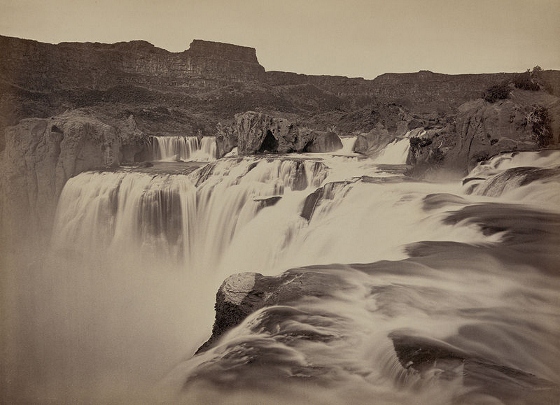
Shoshone Falls 1874 image
pFad - Phonifier reborn

Pfad - The Proxy pFad of © 2024 Garber Painting. All rights reserved.

Note: This service is not intended for secure transactions such as banking, social media, email, or purchasing. Use at your own risk. We assume no liability whatsoever for broken pages.


Alternative Proxies:

Alternative Proxy

pFad Proxy

pFad v3 Proxy

pFad v4 Proxy