Skip Navigation Links weather.gov 
NOAA logo - Click to go to the NOAA homepage National Weather Service   NWS logo - Click to go to the NWS homepage
The Weather Prediction Center


Follow the Weather Prediction Center on Facebook Follow the Weather Prediction Center on Twitter
NCEP Quarterly Newsletter
WPC Home
Analyses and Forecasts
   National High & Low
   WPC Discussions
   Surface Analysis
   Days ½-2½ CONUS
   Days 3-7 CONUS
   Days 4-8 Alaska
   QPF
   PQPF
   Flood Outlook
   Winter Weather
   Storm Summaries
   Heat Index
   Tropical Products
   Daily Weather Map
   GIS Products
Current Watches/
Warnings

Satellite and Radar Imagery
  GOES-East Satellite
  GOES-West Satellite
  National Radar
Product Archive
WPC Verification
   QPF
   Medium Range
   Model Diagnostics
   Event Reviews
   Winter Weather
International Desks
Development and Training
   Development
WPC Overview
   About the WPC
   Staff
   WPC History
   Other Sites
   FAQs
Meteorological Calculators
Contact Us
   About Our Site
 
USA.gov is the U.S. Government's official web portal to all federal, state, and local government web resources and services.

 
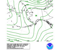
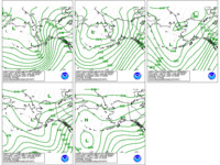
WPC's Day 4-8 Alaskan 500mb Height Forecasts


View Sea Level Pressures and Fronts Forecasts
View WPC's Day 4-8 Gridded Forecasts

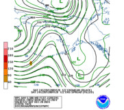
The images below represent 500mb height forecasts utilizing the latest operational models and/or ensemble guidance.

WPC's Day 4-8 500mb Heights for Alaska Day 4-8  WPC Versus GFS 500mb Heights for Alaska Day 4-8  WPC 500mb Forecast & Ensemble Mean/Spread
WPC Forecast
WPC vs GFS
WPC vs Ensemble Mean
& Spread
 
To view individual forecast days and day 4-8 loops, please click on the appropriate link below.
WPC 500mb Forecasts
WPC vs GFS
WPC vs Ensemble Mean and Spread
Information regarding preferred models and forecaster confidence in the preparation of this forecast can be found in the following product:
 
WPC 500mb Graphics Description


The following images represent WPC's forecast.

Day 4 500mb Heights
Day 4
Day 5 500mb Heights
Day 5
Day 6 500mb Heights
Day 6
Day 7 500mb Heights
Day 7
Day 8 500mb Heights
Day 8
Day 4 to 8 500mb Heights
Days 4 to 8
Loop of WPC's forecasts from days 4-8.


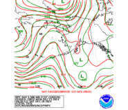
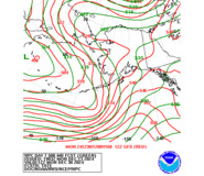
Comparison between the 00Z or 12Z GFS (in red) and WPC's forecast.

Day 4 WPC and GFS 500mb Height Forecasts
Day 4
Day 5 WPC and GFS 500mb Height Forecasts
Day 5
Day 6 WPC and GFS 500mb Height Forecasts
Day 6
Day 7 WPC and GFS 500mb Height Forecasts
Day 7
Day 8 WPC and GFS 500mb Height Forecasts
Day 8
Day 4-8 WPC and GFS 500mb Height Forecasts
Days 4 to 8
Loop of WPC's forecast versus the 00Z or 12Z GFS from days 4-8.


Comparison between the 00Z or 12Z GFS Ensemble Mean (in black) and WPC's forecast. The shaded regions represent the spread (in meters) of the ensemble forecasts.

Day 4 500mb Heights - WPC Versus GFS Ensemble Mean
Day 4
Day 5 500mb Heights - WPC Versus GFS Ensemble Mean
Day 5
Day 6 500mb Heights - WPC Versus GFS Ensemble Mean
Day 6
Day 7 500mb Heights - WPC Versus GFS Ensemble Mean
Day 7
Day 8 500mb Heights - WPC Versus GFS Ensemble Mean
Day 8
Day 4 to 8 500mb Heights - WPC Versus GFS Ensemble Mean
Days 4 to 8
Loop of WPC forecast/Ensemble Mean and Spread for days 4-8.


NOAA/ National Weather Service
National Centers for Environmental Prediction
Weather Prediction Center
5830 University Research Court
College Park, Maryland 20740
Weather Prediction Center Web Team
Disclaimer
Credits
Glossary
Privacy Policy
About Us
Career Opportunities
Page last modified: Tuesday, 24-May-2022 18:26:05 UTC
pFad - Phonifier reborn

Pfad - The Proxy pFad of © 2024 Garber Painting. All rights reserved.

Note: This service is not intended for secure transactions such as banking, social media, email, or purchasing. Use at your own risk. We assume no liability whatsoever for broken pages.


Alternative Proxies:

Alternative Proxy

pFad Proxy

pFad v3 Proxy

pFad v4 Proxy