Saltar al conteníu

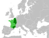
Ficheru:West Germany 1956-1990.svg

Contenido de la página no disponible en otros idiomas.
De Wikipedia

Ficheru orixinal (ficheru SVG, 450 × 456 píxels nominales, tamañu de ficheru: 471 kB)

Esti ficheru ye de Wikimedia Commons y puen usalu otros proyeutos. La descripción de la páxina de descripción del ficheru amuésase darréu.

Resume

Descripción
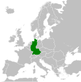
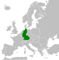
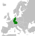
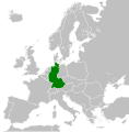
English: Map of West Germany (Federal Republic of Germany) as it was from 1949-1990. Surrounding countries accurate from 1956-1990.
Data (UTC)
Fonte
Autor
Otres versiones

Derivative works of this file:  Europe Jewish % change 1945 2010.png

English: This map is part of a series of historical political maps of Europe. All maps by Alphathon and based upon Blank map of Europe.svg unless otherwise stated.
Deutsch: Diese Karte ist Teil einer Serie historischer politischer Europakarten. Solange nicht anders angegeben, wurden alle Karten durch Alphathon auf Basis von Blank map of Europe.svg erstellt, sofern nicht anders angegeben.
Français : Cette carte fait partie d'une série de cartes historiques et politiques d'Europe. Toutes les cartes ont été créées par Alphathon et basées sur Blank map of Europe.svg sauf indication contraire.
Evolution of specific states

Greece/Byzantine Empire
Byzantine Empire: ca. 330 – 1204; 1261 – 1453
Byzantine Empire – 814 Byzantine Empire – 1190
1453 – 1832
Between 1453 and 1832 there was no independent Greek state. During this period the region was ruled by the Byzantine Empire's Turkish successor: the Ottoman Empire.
Greece: 1832 – Today
Kingdom of Greece – 1890 Kingdom of Greece – 1914 Second Hellenic Republic – 1935 Hellenic State – 1942 Kingdom of Greece – 1973
9th Century

11th Century

12th Century

18th Century

19th Century

1812
Europe at the height of Napoleon's power.
Blank map of Europe 1812.svg
1839
1890
Blank map of Europe 1890.svg
20th Century

1914
Blank map of Europe 1914.svg
March - September 1939
1942
Europe 1942.svg


Esta ye una imaxe retocada, lo que significa que foi modificada dixitalmente de la so versión orixinal. La orixinal pue vese equí: Blank map of Europe 1956-1990.svg.

Llicencia

Yo, la persona titular de los drechos d'autor d'esta obra, espublízola baxo la siguiente llicencia:
w:es:Creative Commons
reconocimientu compartir igual
Esti ficheru ta disponible baxo la llicencia Creative Commons Reconocimientu-Compartir igual 3.0 xenérica.
Ye llibre:
  • pa compartir – pa copiar, distribuir y comunicar públicamente la obra
  • pa remezclar – p'adautar la obra
Baxo les condiciones siguientes:
  • reconocimientu – Tienes de dar el créitu apropiáu, apurrir un enllaz a la llicencia ya indicar si realizasti dalgún cambéu. Puedes faelo de cualquier mou razonable ,pero non de manera que suxera l'encontu del autor pa ti o pal usu que faigas.
  • compartir igual – Si entemeces, tresformes o te bases nesti material, tienes de distribuir les tos contribuciones baxo la mesma llicencia o una compatible cola orixinal.

Rexistru de xubíes orixinal

This image is a derivative work of the following images:

  • File:Blank_map_of_Europe_1956-1990.svg licensed with Cc-by-sa-3.0
    • 2011-10-30T04:43:42Z Alphathon 450x456 (485146 Bytes) == {{int:filedesc}} == {{Information |Description={{en|Blank map of Europe showing national borders as they stood from 1956-1990.}} |Source=*[[:File:Blank_map_of_Europe.svg|]] |Date=2011-10-30 04:42 (UTC) |Author=*[[:File:Bla

Pies

Añade una esplicación d'una llinia de lo que representa esti archivu

Elementos representados en este archivo

representa a

Historial del ficheru

Calca nuna fecha/hora pa ver el ficheru como taba daquella.

Data/HoraMiniaturaDimensionesUsuariuComentariu
actual01:31 28 set 2018Miniatura de la versión a fecha de 01:31 28 set 2018450 × 456 (471 kB)FelipeRevSe incluye Berlín Oeste pero con un color diferente, para marcar que pertenecía a su espacio económico
04:04 15 xnt 2015Miniatura de la versión a fecha de 04:04 15 xnt 2015450 × 456 (476 kB)ElevatorrailfanBreaking apart West Germany and West Berlin paths.
01:43 10 avi 2014Miniatura de la versión a fecha de 01:43 10 avi 2014450 × 456 (476 kB)ElevatorrailfanWest Berlin was not part of West Germany.
00:39 26 pay 2011Miniatura de la versión a fecha de 00:39 26 pay 2011450 × 456 (474 kB)StalwartUK== {{int:filedesc}} == {{Information |Description={{en|Map of West Germany (Federal Republic of Germany) as it was from 1949-1990. Surrounding countries accurate from 1956-1990.}} |Source=*[[:File:Blank_map_of_Europe_1956-1990.svg|Bla

La páxina siguiente usa esti ficheru:

Usu global del ficheru

Estes otres wikis usen esti ficheru:

Ver más usos globales d'esti ficheru.

Metadatos

pFad - Phonifier reborn

Pfad - The Proxy pFad of © 2024 Garber Painting. All rights reserved.

Note: This service is not intended for secure transactions such as banking, social media, email, or purchasing. Use at your own risk. We assume no liability whatsoever for broken pages.


Alternative Proxies:

Alternative Proxy

pFad Proxy

pFad v3 Proxy

pFad v4 Proxy