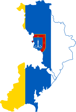
File:Flag-map of Odesa Oblast.svg

Size of this PNG preview of this SVG file: 250 × 364 pixels. Other resolutions: 165 × 240 pixels | 330 × 480 pixels | 527 × 768 pixels | 703 × 1,024 pixels | 1,406 × 2,048 pixels.
Original file (SVG file, nominally 250 × 364 pixels, file size: 71 KB)
File information
Structured data
Captions
Captions
Add a one-line explanation of what this file represents
Summary
edit| DescriptionFlag-map of Odesa Oblast.svg |
English: Flag-map of Odesa Oblast, Ukraine
Українська: Прапор-карта Одеської області, Україна
Русский: Флаг-карта Одесской области, Украина |
| Date | |
| Source | Own work |
| Author | Дмитрий-5-Аверин |
Licensing
editI, the copyright holder of this work, hereby publish it under the following license:
This file is licensed under the Creative Commons Attribution-Share Alike 4.0 International license.
- You are free:
- to share – to copy, distribute and transmit the work
- to remix – to adapt the work
- Under the following conditions:
- attribution – You must give appropriate credit, provide a link to the license, and indicate if changes were made. You may do so in any reasonable manner, but not in any way that suggests the licensor endorses you or your use.
- share alike – If you remix, transform, or build upon the material, you must distribute your contributions under the same or compatible license as the original.
File history
Click on a date/time to view the file as it appeared at that time.
| Date/Time | Thumbnail | Dimensions | User | Comment | |
|---|---|---|---|---|---|
| current | 17:54, 15 August 2020 |  | 250 × 364 (71 KB) | Дмитрий-5-Аверин (talk | contribs) | Uploaded own work with UploadWizard |
You cannot overwrite this file.
File usage on Commons
The following 3 pages use this file:
File usage on other wikis
The following other wikis use this file:
- Usage on en.wikipedia.org
- Dniester Estuary
- Kotlovyna
- Cuciurgan Reservoir
- Arcadia Beach
- Berezivka
- Plavni, Odesa Oblast
- Novosilske, Odesa Oblast
- Lymanske, Izmail Raion, Odesa Oblast
- Nahirne, Odesa Oblast
- Lake Yalpuh
- Prorva Channel
- Template:Odesa-geo-stub
- Nova Nekrasivka
- Vasylivka, Bolhrad Raion, Odesa Oblast
- Gulf of Odesa
- Small Adzhalyk Estuary
- Lake Kuhurlui
- Khadzhibey Estuary
- Sarata (river)
- North Odesa Cape
- Cape Velykyi Fontan
- Cape Langeron
- Cape Malyi Fontan
- Kuialnyk Estuary
- Tuzly Lagoons
- Shahany Lagoon
- Alibey Lagoon
- Burnas Lagoon
- Dalnyk
- Mahala Lagoon
- Solone Ozero
- Bilhorod-Dnistrovsky Seaport
- Akkarzhanka
- Great Adzhalyk Estuary
- Shevchenkove, Izmail Raion, Odesa Oblast
- Port of Chornomorsk
- Maican Island
- Tuzly Lagoons National Nature Park
- Desantne
- Vasylivka, Izmail Raion, Odesa Oblast
- Dmytrivka, Izmail Raion, Odesa Oblast
- Myrne, Izmail Raion, Odesa Oblast
- Novoselivka, Ananiv urban hromada, Podilsk Raion, Odesa Oblast
- Pryozerne, Izmail Raion, Odesa Oblast
- Furmanivka, Odesa Oblast
- Lisky, Izmail Raion, Odesa Oblast
- Prymorske, Serhiivka settlement hromada, Bilhorod-Dnistrovskyi Raion, Odesa Oblast
- Prymorske, Lyman rural hromada, Bilhorod-Dnistrovskyi Raion, Odesa Oblast
- Bolharka, Rozdilna Raion, Odesa Oblast
- Berezivka Raion
View more global usage of this file.
Metadata
This file contains additional information such as Exif metadata which may have been added by the digital camera, scanner, or software program used to create or digitize it. If the file has been modified from its original state, some details such as the timestamp may not fully reflect those of the original file. The timestamp is only as accurate as the clock in the camera, and it may be completely wrong.
| Width | 249.67693 |
|---|---|
| Height | 364.46991 |