Dolton, Illinois: Difference between revisions
→Notable people: William shaw |
Rescuing 3 sources and tagging 0 as dead. #IABot (v1.2.7.1) |
||
| Line 167: | Line 167: | ||
|estimate=23197 |
|estimate=23197 |
||
|estref=<ref name="USCensusEst2015">{{cite web|url=http://www.census.gov/popest/data/cities/totals/2015/SUB-EST2015.html|title=Annual Estimates of the Resident Population for Incorporated Places: April 1, 2010 to July 1, 2015|accessdate=July 2, 2016}}</ref> |
|estref=<ref name="USCensusEst2015">{{cite web|url=http://www.census.gov/popest/data/cities/totals/2015/SUB-EST2015.html|title=Annual Estimates of the Resident Population for Incorporated Places: April 1, 2010 to July 1, 2015|accessdate=July 2, 2016}}</ref> |
||
|footnote=<center>U.S. Decennial Census<ref name="DecennialCensus">{{cite web|url=http://www.census.gov/prod/www/decennial.html|title=Census of Population and Housing|publisher=Census.gov|accessdate=June 4, 2015}}</ref></center> |
|footnote=<center>U.S. Decennial Census<ref name="DecennialCensus">{{cite web|url=http://www.census.gov/prod/www/decennial.html |title=Census of Population and Housing |publisher=Census.gov |accessdate=June 4, 2015 |deadurl=yes |archiveurl=http://www.webcitation.org/6YSasqtfX?url=http%3A%2F%2Fwww.census.gov%2Fprod%2Fwww%2Fdecennial.html |archivedate=May 11, 2015 |df= }}</ref></center> |
||
}} |
}} |
||
As of the [[census]]<ref name="GR2">{{cite web|url=http://factfinder2.census.gov|publisher=[[United States Census Bureau]]|accessdate=2008-01-31|title=American FactFinder}}</ref> of 2000, there were 25,614 people, 8,512 households, and 6,494 families residing in the village. The [[population density]] was 5,627.6 people per square mile (2,173.5/km²). There were 8,944 housing units at an average density of 1,965.1 per square mile (759.0/km²). The racial makeup of the village was 82.4% [[African American (U.S. Census)|African American]], 14.3% [[White (U.S. Census)|White]], 0.6% [[Asian (U.S. Census)|Asian]], 0.2% [[Native American (U.S. Census)|Native American]], 1.4% from [[Race (United States Census)|other races]], and 1.1% from two or more races. [[Hispanic (U.S. Census)|Hispanic]] or [[Latino (U.S. Census)|Latino]] of any race were 3.1% of the population. |
As of the [[census]]<ref name="GR2">{{cite web|url=http://factfinder2.census.gov |publisher=[[United States Census Bureau]] |accessdate=2008-01-31 |title=American FactFinder |deadurl=yes |archiveurl=https://web.archive.org/web/20130911234518/http://factfinder2.census.gov |archivedate=2013-09-11 |df= }}</ref> of 2000, there were 25,614 people, 8,512 households, and 6,494 families residing in the village. The [[population density]] was 5,627.6 people per square mile (2,173.5/km²). There were 8,944 housing units at an average density of 1,965.1 per square mile (759.0/km²). The racial makeup of the village was 82.4% [[African American (U.S. Census)|African American]], 14.3% [[White (U.S. Census)|White]], 0.6% [[Asian (U.S. Census)|Asian]], 0.2% [[Native American (U.S. Census)|Native American]], 1.4% from [[Race (United States Census)|other races]], and 1.1% from two or more races. [[Hispanic (U.S. Census)|Hispanic]] or [[Latino (U.S. Census)|Latino]] of any race were 3.1% of the population. |
||
There were 8,512 households out of which 41.6% had children under the age of 18 living with them, 44.6% were [[Marriage|married couples]] living together, 26.1% had a female householder with no husband present, and 23.7% were non-families. 20.8% of all households were made up of individuals and 7.9% had someone living alone who was 65 years of age or older. The average household size was 2.98 and the average family size was 3.42. |
There were 8,512 households out of which 41.6% had children under the age of 18 living with them, 44.6% were [[Marriage|married couples]] living together, 26.1% had a female householder with no husband present, and 23.7% were non-families. 20.8% of all households were made up of individuals and 7.9% had someone living alone who was 65 years of age or older. The average household size was 2.98 and the average family size was 3.42. |
||
| Line 181: | Line 181: | ||
Dolton is in [[Illinois' 2nd congressional district]] and the 15th State Senate District. Approximately 3/4 of the village is within the Illinois Legislature's 29th Representative District, with the remainder in the 30th district. The village is split evenly between the Cook County Judicial Circuit 1st Subcircuit and 2nd Subcircuit. |
Dolton is in [[Illinois' 2nd congressional district]] and the 15th State Senate District. Approximately 3/4 of the village is within the Illinois Legislature's 29th Representative District, with the remainder in the 30th district. The village is split evenly between the Cook County Judicial Circuit 1st Subcircuit and 2nd Subcircuit. |
||
Most of the village is part of the Dolton Park District, with a small portion served by the Calumet Memorial Park District. The entire village is part of the Dolton Public Library District and the Metropolitan Water Reclamation District.<ref name="County clerk">[http://www.cookcountyclerk.gov Cook County Clerks Office]</ref> |
Most of the village is part of the Dolton Park District, with a small portion served by the Calumet Memorial Park District. The entire village is part of the Dolton Public Library District and the Metropolitan Water Reclamation District.<ref name="County clerk">[http://www.cookcountyclerk.gov Cook County Clerks Office] {{wayback|url=http://www.cookcountyclerk.gov |date=20130801113624 }}</ref> |
||
==Education== |
==Education== |
||
Revision as of 21:31, 14 December 2016
Dolton, Illinois | |
|---|---|
Village | |
| Motto: "A community working together" | |
 Location in Cook County and the state of Illinois. | |
 Location of Illinois in the United States | |
| Country | United States |
| State | Illinois |
| County | Cook |
| Township | Thornton |
| Incorporated | 1893 |
| Government | |
| • Type | Mayor-council |
| • Mayor | Riley Rogers |
| Area | |
| • Total | 4.68 sq mi (12.1 km2) |
| • Land | 4.56 sq mi (11.8 km2) |
| • Water | 0.12 sq mi (0.3 km2) 2.56% |
| Population (2010) | |
| • Total | 23,153 |
| • Density | 5,077.4/sq mi (1,960.4/km2) |
| Down 9.61% from 2000 | |
| Standard of living (2009-11) | |
| • Per capita income | $21,742 |
| • Median home value | $131,600 |
| ZIP code(s) | 60419 |
| Area code(s) | 708 |
| Geocode | 17-20292 |
| Website | vodolton |
| Demographics (2010)[1] | |||
|---|---|---|---|
| White | Black | Asian | |
| 6.2% | 90.9% | 0.3% | |
| Islander | Native | Other | Hispanic (any race) |
| 0.01% | 0.1% | 2.4% | 2.7% |
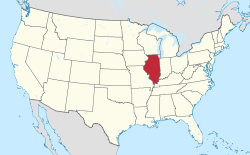
Dolton (pronounced "DAWL-ton") is a village in Cook County, Illinois, United States. The population was 23,153 at the 2010 census.[1] Dolton is located just west of the expressway Interstate 94 and immediately south of the city limits of Chicago. Its most common ZIP code is 60419.
Dolton is bordered by Chicago to the north, Riverdale and Harvey to the west, South Holland to the south and Calumet City to the east.
History
A post office has been in operation in Dolton since 1854.[2] The village was named for a family of early settlers.[3]
Geography
Dolton is located at 41°37′39″N 87°35′55″W / 41.62750°N 87.59861°W (41.627509, -87.598512).[4]
According to the 2010 census, Dolton has a total area of 4.68 square miles (12.12 km2), of which 4.56 square miles (11.81 km2) (or 97.44%) is land and 0.12 square miles (0.31 km2) (or 2.56%) is water.[5]
Demographics
| Census | Pop. | Note | %± |
|---|---|---|---|
| 1880 | 448 | — | |
| 1890 | 1,110 | 147.8% | |
| 1900 | 1,229 | 10.7% | |
| 1910 | 1,869 | 52.1% | |
| 1920 | 2,076 | 11.1% | |
| 1930 | 2,923 | 40.8% | |
| 1940 | 3,058 | 4.6% | |
| 1950 | 5,338 | 74.6% | |
| 1960 | 18,746 | 251.2% | |
| 1970 | 25,937 | 38.4% | |
| 1980 | 24,766 | −4.5% | |
| 1990 | 23,956 | −3.3% | |
| 2000 | 25,614 | 6.9% | |
| 2010 | 23,153 | −9.6% | |
| 2015 (est.) | 23,197 | [6] | 0.2% |
As of the census[8] of 2000, there were 25,614 people, 8,512 households, and 6,494 families residing in the village. The population density was 5,627.6 people per square mile (2,173.5/km²). There were 8,944 housing units at an average density of 1,965.1 per square mile (759.0/km²). The racial makeup of the village was 82.4% African American, 14.3% White, 0.6% Asian, 0.2% Native American, 1.4% from other races, and 1.1% from two or more races. Hispanic or Latino of any race were 3.1% of the population.
There were 8,512 households out of which 41.6% had children under the age of 18 living with them, 44.6% were married couples living together, 26.1% had a female householder with no husband present, and 23.7% were non-families. 20.8% of all households were made up of individuals and 7.9% had someone living alone who was 65 years of age or older. The average household size was 2.98 and the average family size was 3.42.
In the village the population was spread out with 32.0% under the age of 18, 8.3% from 18 to 24, 29.8% from 25 to 44, 20.6% from 45 to 64, and 9.2% who were 65 years of age or older. The median age was 33 years. For every 100 females there were 86.7 males. For every 100 females age 18 and over, there were 79.1 males.
The median income for a household in the village was $48,020, and the median income for a family was $52,725. Males had a median income of $38,646 versus $31,773 for females. The per capita income for the village was $18,102. About 6.7% of families and 8.4% of the population were below the poverty line, including 10.8% of those under age 18 and 8.3% of those age 65 or over.
Government
Dolton is in Illinois' 2nd congressional district and the 15th State Senate District. Approximately 3/4 of the village is within the Illinois Legislature's 29th Representative District, with the remainder in the 30th district. The village is split evenly between the Cook County Judicial Circuit 1st Subcircuit and 2nd Subcircuit.
Most of the village is part of the Dolton Park District, with a small portion served by the Calumet Memorial Park District. The entire village is part of the Dolton Public Library District and the Metropolitan Water Reclamation District.[9]
Education
Dolton is served primarily by Dolton School District 148 and Dolton School District 149. A small portion of the village is within South Holland School District 151. High school students are served by Thornton Township High School District Number 205, which operates Thornridge High School in Dolton.
The entire village is part of South Suburban Community College District 510.[9]
Notable people
Dolton is the hometown of former NFL star Donovan McNabb, At the Movies with Ebert & Roeper co-host Richard Roeper, actress Jane Lynch, writer Mac Gretz and Chicago Sun-Times editor-in-chief Jim Kirk. William Shaw, Illinois state legislator, served as mayor of Dolton.[10]
References
- ^ a b "Profile of General Population and Housing Characteristics: 2010 Demographic Profile Data (DP-1): Dolton village, Illinois". U.S. Census Bureau, American Factfinder. Retrieved February 22, 2013.
- ^ "Cook County". Jim Forte Postal History. Retrieved 4 November 2015.
- ^ Callary, Edward (29 September 2008). Place Names of Illinois. University of Illinois Press. p. 95. ISBN 978-0-252-09070-7.
- ^ "US Gazetteer files: 2010, 2000, and 1990". United States Census Bureau. 2011-02-12. Retrieved 2011-04-23.
- ^ "G001 - Geographic Identifiers - 2010 Census Summary File 1". United States Census Bureau. Retrieved 2015-08-02.
- ^ "Annual Estimates of the Resident Population for Incorporated Places: April 1, 2010 to July 1, 2015". Retrieved July 2, 2016.
- ^ "Census of Population and Housing". Census.gov. Archived from the original on May 11, 2015. Retrieved June 4, 2015.
{{cite web}}: Unknown parameter|deadurl=ignored (|url-status=suggested) (help) - ^ "American FactFinder". United States Census Bureau. Archived from the original on 2013-09-11. Retrieved 2008-01-31.
{{cite web}}: Unknown parameter|deadurl=ignored (|url-status=suggested) (help) - ^ a b Cook County Clerks Office Archived 2013-08-01 at the Wayback Machine
- ^ 'William "Bill" Shaw: 1937-2008,' Chicago Tribune, Rick Pearson and Stacy St. Clair, November 28, 2008

