Cala, South Africa: Difference between revisions
Appearance
BilledMammal (talk | contribs) m BilledMammal moved page Kala, Eastern Cape to Cala, Eastern Cape over redirect: Reverting undiscussed move; while the official name has changed, based on sources it is unclear whether the common name has followed. Please get a consensus before moving again |
DesertInfo (talk | contribs) m Desertambition moved page Cala, Eastern Cape to Kala, Eastern Cape over redirect: Cala was renamed to Kala in 2004 to correct the previous spelling. |
(No difference)
| |
Revision as of 04:35, 27 November 2021
Cala | |
|---|---|
| Coordinates: 31°31′23″S 27°41′53″E / 31.523°S 27.698°E | |
| Country | South Africa |
| Province | Eastern Cape |
| District | Chris Hani |
| Municipality | Sakhisizwe |
| Area | |
| • Total | 46.60 km2 (17.99 sq mi) |
| Population (2011)[1] | |
| • Total | 14,520 |
| • Density | 310/km2 (810/sq mi) |
| Racial makeup (2011) | |
| • Black African | 98.8% |
| • Coloured | 0.3% |
| • Indian/Asian | 0.3% |
| • White | 0.2% |
| • Other | 0.4% |
| First languages (2011) | |
| • Xhosa | 92.0% |
| • English | 2.7% |
| • Sign language | 1.3% |
| • Other | 4.1% |
| Time zone | UTC+2 (SAST) |
| Postal code (street) | 5455 |
| PO box | 5455 |
| Area code | 047 |
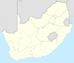
Cala is a town in Sakhisizwe Local Municipality, part of the Chris Hani District Municipality in the Eastern Cape province of South Africa.
The village is located on the Tsomo River, 28 km southwest of Elliot. The name is Xhosa for ‘adjacent to’, referring to its situation west of the Drakensberg, which here extends north and south.[2]
References
- ^ a b c d "Main Place Cala". Census 2011.
- ^ "Dictionary of Southern African Place Names (Public Domain)". Human Science Research Council. p. 104.


