Encinacorba: Difference between revisions
Appearance
Content deleted Content added
m Robot - Speedily moving category Municipalities in Zaragoza to Category:Municipalities in the Province of Zaragoza per CFDS. |
No edit summary |
||
| (22 intermediate revisions by 15 users not shown) | |||
| Line 1: | Line 1: | ||
{{Infobox |
{{Infobox settlement |
||
<!-- See Template:Infobox settlement for additional fields and descriptions --> |
|||
| ⚫ | |||
| type = [[municipalities of Spain|municipality]] |
|||
| ⚫ | |||
| ⚫ | |||
image_flag = | |
|||
| ⚫ | |||
| ⚫ | |||
| image_flag = Bandera de Encinacorba.svg |
|||
image_map = | |
|||
| ⚫ | |||
| ⚫ | |||
| ⚫ | |||
| ⚫ | |||
| ⚫ | |||
| ⚫ | |||
| ⚫ | |||
subdivision_type1 = [[Autonomous communities of Spain|Autonomous community]] | |
|||
| ⚫ | |||
| ⚫ | |||
| subdivision_type1 = [[Autonomous communities of Spain|Autonomous community]] |
|||
| ⚫ | |||
| ⚫ | |||
| subdivision_type2 = [[Provinces of Spain|Province]] |
|||
subdivision_type3 = [[List of municipalities in Zaragoza|Municipality]] | |
|||
| ⚫ | |||
| ⚫ | |||
leader_title = |
| leader_title = |
||
leader_name = |
| leader_name = |
||
area_magnitude = |
| area_magnitude = |
||
area_total_km2 = 36 |
| area_total_km2 = 36 |
||
area_land_km2 = |
| area_land_km2 = |
||
area_water_km2 = |
| area_water_km2 = |
||
elevation_m = 762 |
| elevation_m = 762 |
||
| ⚫ | |||
population_as_of = 2004 | |
|||
| population_as_of = {{Spain metadata Wikidata|population_as_of}} |
|||
| ⚫ | |||
| population_footnotes = {{Spain metadata Wikidata|population_footnotes}} |
|||
population_total = 294 | |
|||
| population_total = {{Spain metadata Wikidata|population_total}} |
|||
population_density_km2 = |
| population_density_km2 = auto |
||
timezone = [[Central European Time|CET]] |
| timezone = [[Central European Time|CET]] |
||
utc_offset = +1 |
| utc_offset = +1 |
||
timezone_DST = [[Central European Summer Time|CEST]] |
| timezone_DST = [[Central European Summer Time|CEST]] |
||
utc_offset_DST = +2 |
| utc_offset_DST = +2 |
||
latitude = | |
|||
| pushpin_map =Spain Aragon#Spain#Europe |
|||
longitude = | |
|||
| ⚫ | |||
website = | |
|||
| website = |
|||
| footnotes = |
|||
}} |
| }} |
||
'''Encinacorba''' is a municipality located in the [[Zaragoza (province)|province of Zaragoza]], [[Aragon]], [[Spain]]. According to the |
'''Encinacorba''' is a municipality located in the [[Zaragoza (province)|province of Zaragoza]], [[Aragon]], [[Spain]]. According to the 2004 [[census]] ([[Instituto Nacional de Estadística (Spain)|INE]]), the municipality has a population of 294 inhabitants. |
||
This town is located near the [[Sierra de Algairén]] in the [[Comarcas of Aragon|comarca]] of [[Campo de Cariñena]]. |
This town is located near the [[Sierra de Algairén]] in the [[Comarcas of Aragon|comarca]] of [[Campo de Cariñena]]. |
||
==References== |
|||
{{reflist}} |
|||
{{Municipalities in Zaragoza}} |
{{Municipalities in Zaragoza}} |
||
{{authority control}} |
|||
| ⚫ | |||
[[Category:Municipalities in the Province of Zaragoza]] |
[[Category:Municipalities in the Province of Zaragoza]] |
||
| ⚫ | |||
[[Category:Populated places in Zaragoza]] |
|||
| ⚫ | |||
[[an:Lecinacorba]] |
|||
[[ca:Encinacorba]] |
|||
[[es:Encinacorba]] |
|||
[[eu:Encinacorba]] |
|||
[[fr:Encinacorba]] |
|||
[[it:Encinacorba]] |
|||
[[pt:Encinacorba]] |
|||
[[ru:Энсинакорба]] |
|||
[[uk:Енсінакорба]] |
|||
[[vi:Encinacorba]] |
|||
[[war:Encinacorba]] |
|||
Latest revision as of 19:10, 21 August 2024
Encinacorba | |
|---|---|
 | |
| Coordinates: 41°17′N 1°16′W / 41.283°N 1.267°W | |
| Country | |
| Autonomous community | |
| Province | Zaragoza |
| Area | |
| • Total | 36 km2 (14 sq mi) |
| Elevation | 762 m (2,500 ft) |
| Population (2018)[1] | |
| • Total | 189 |
| • Density | 5.3/km2 (14/sq mi) |
| Time zone | UTC+1 (CET) |
| • Summer (DST) | UTC+2 (CEST) |
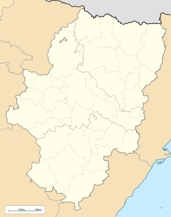
Encinacorba is a municipality located in the province of Zaragoza, Aragon, Spain. According to the 2004 census (INE), the municipality has a population of 294 inhabitants.
This town is located near the Sierra de Algairén in the comarca of Campo de Cariñena.
References
[edit]- ^ Municipal Register of Spain 2018. National Statistics Institute.


