Jhalda: Difference between revisions
→Demographics: Correction in Pollution figures... Tag: references removed |
→Police station: Demographic data |
||
| Line 98: | Line 98: | ||
==Police station== |
==Police station== |
||
Jhalda police station has jurisdiction over a part of Jhalda municipal town, [[Jhalda I]] CD block and part of [[Jhalda II]] CD block. The area covered is 290 km<sup>2</sup> and the population covered is 157,064. It has 48.7 km of inter-state border with Silli PS in Ranchi district and Kashmar and Jaridih police stations in Bokaro district of Jharkhand.<ref>{{cite web |url = http://www.dospiwb.org.in/site.php |title = District Statistical Handbook 2014 Purulia |work = Tables 2.1, 2.2 |publisher = Department of Statistics and Programme Implementation, Government of West Bengal |access-date = 5 October 2016 |url-status = dead |archive-url = https://web.archive.org/web/20170729135056/http://www.dospiwb.org.in/site.php |archive-date = 29 July 2017 }}</ref><ref>{{cite web| url = https://puruliapolice.org/ps/jhalda-ps/ |title = Jhalda PS | publisher= Purulia District Police | access-date = 5 October 2016}}</ref> |
Jhalda police station has jurisdiction over a part of Jhalda municipal town, [[Jhalda I]] CD block and part of [[Jhalda II]] CD block. The area covered is 290 km<sup>2</sup> and the population covered is 157,064. It has 48.7 km of inter-state border with Silli PS in Ranchi district and Kashmar and Jaridih police stations in Bokaro district of Jharkhand.<ref>{{cite web |url = http://www.dospiwb.org.in/site.php |title = District Statistical Handbook 2014 Purulia |work = Tables 2.1, 2.2 |publisher = Department of Statistics and Programme Implementation, Government of West Bengal |access-date = 5 October 2016 |url-status = dead |archive-url = https://web.archive.org/web/20170729135056/http://www.dospiwb.org.in/site.php |archive-date = 29 July 2017 }}</ref><ref>{{cite web| url = https://puruliapolice.org/ps/jhalda-ps/ |title = Jhalda PS | publisher= Purulia District Police | access-date = 5 October 2016}}</ref> |
||
==Demographic Data== |
|||
The Jhalda Municipality has population of 19,544 of which 10,050 are males while 9,494 are females as per report released by Census India 2011. |
The Jhalda Municipality has population of 19,544 of which 10,050 are males while 9,494 are females as per report released by Census India 2011. |
||
Revision as of 07:27, 30 November 2021
Jhalda
Jhalida | |
|---|---|
City | |
 Shilphore Hillock, Jhalda | |
| Coordinates: 23°22′N 85°58′E / 23.37°N 85.97°E | |
| Country | |
| State | West Bengal |
| District | Purulia |
| Government | |
| • Type | Municipality |
| • Body | Jhalda Municipality |
| Area | |
| • Total | 3.85 km2 (1.49 sq mi) |
| Elevation | 293 m (961 ft) |
| Population (2011) | |
| • Total | 19,544 |
| • Density | 5,100/km2 (13,000/sq mi) |
| Languages | |
| • Official | Bengali,Santali English |
| Time zone | UTC+5:30 (IST) |
| PIN | 723202 |
| Telephone code | +91 3254 |
| Vehicle registration | WB 56 |
| Lok Sabha constituency | Purulia |
| Vidhan Sabha constituency | Baghmundi, Joypur |
| Website | www |
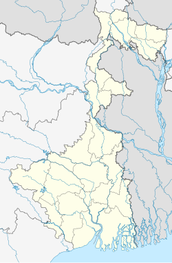
Jhalda is a city and a municipality in Purulia district in the Indian state of West Bengal. It is the headquarters of the Jhalda subdivision.
Geography

5miles
Hills
Storage Project
M: municipality, CT: census town, R: rural/ urban centre, H: historical/ religious centre, C: craft centre, T: tourist cetre
Owing to space constraints in the small map, the actual locations in a larger map may vary slightly
Location
Jhalda is located at 23°22′N 85°58′E / 23.37°N 85.97°E.[1] It has an average elevation of 293 m (961 ft).
According to the District Census Handbook 2011, Puruliya, Jhalda municipality covered an area of 3.85 km2.[2]
Area overview
Purulia district forms the lowest step of the Chota Nagpur Plateau. The general scenario is undulating land with scattered hills. Jhalda subdivision, shown in the map alongside, is located in the western part of the district, bordering Jharkhand. The Subarnarekha flows along a short stretch of its western border. It is an overwhelmingly rural subdivision with 91.02% of the population living in the rural areas and 8.98% living in the urban areas. There are 3 census towns in the subdivision. The map alongside shows some of the tourist attractions in the Ajodhya Hills. The area is home to Purulia Chhau dance with spectacular masks made at Charida. The remnants of old temples and deities are found in the subdivision also, as in other parts of the district.[3][4][5][6][7][8]
Note: The map alongside presents some of the notable locations in the subdivision. All places marked in the map are linked in the larger full screen map.
Police station
Jhalda police station has jurisdiction over a part of Jhalda municipal town, Jhalda I CD block and part of Jhalda II CD block. The area covered is 290 km2 and the population covered is 157,064. It has 48.7 km of inter-state border with Silli PS in Ranchi district and Kashmar and Jaridih police stations in Bokaro district of Jharkhand.[9][10]
Demographic Data
The Jhalda Municipality has population of 19,544 of which 10,050 are males while 9,494 are females as per report released by Census India 2011.
Population of Children with age of 0-6 is 2474 which is 12.66 % of total population of Jhalda (M). In Jhalda Municipality, Female Sex Ratio is of 945 against state average of 950. Moreover Child Sex Ratio in Jhalda is around 982 compared to West Bengal state average of 956. Literacy rate of Jhalda city is 76.78 % higher than state average of 76.26 %. In Jhalda, Male literacy is around 85.49 % while female literacy rate is 67.50 %.
Jhalda Municipality has total administration over 3,676 houses to which it supplies basic amenities like water and sewerage. It is also authorize to build roads within Municipality limits and impose taxes on properties coming under its jurisdiction
Tourism
It is a small town surrounded by small hillocks. The main hills of the area are Shikra, Bansa, Kopla, Silphor, etc. The places of interest of the area are Norahara, Murguma Dam, Dimu Dam, Kanrior, etc. Jhalda is adjacent to the state of Jharkhand (9 km from Muri. Jhalda Station is the railway station in the region. The village of Kotogara is on the other side of the mountains at Jhalda. Kotogara village is in Jharkhand. One of the main visit place is Ayodhya Hills its about 35 km from jhalda which situated in Baghmundi.

Transport
Jhalda railway station is situated on the Gomoh-Muri line. This town is also well connected with district headquarters Purulia and Ranchi by bus services. Toto and rickshaw is also available here for more comfort to travel.
Healthcare
Jhalda Rural Hospital, with 30 beds, is the major government medical facility in Jhalda I CD block.
References
- ^ Falling Rain Genomics, Inc - Jhalda
- ^ "District Census Handbook Puruliya, Census of India 2011, Series 20, Part XII A" (PDF). Section II Town Directory, Page 1073 Statement I: Status and Growth History. Directorate of Census Operations V, West Bengal. Retrieved 30 January 2020.
- ^ Houlton, Sir John, Bihar, the Heart of India, 1949, p. 170, Orient Longmans Ltd.
- ^ "District Statistical Handbook 2014 Purulia". Tables 2.1, 2.2. Department of Planning and Statistics, Government of West Bengal. Retrieved 12 January 2020.
- ^ "Purulia". Department of Tourism. Government of West Bengal. Retrieved 1 February 2020.
- ^ "Chhau dance of Purulia". Itsavpedia. Retrieved 1 February 2020.
- ^ "District Census Handbook: Puruliya – Series 20, Part Xii A, Census of India 2011" (PDF). Page 102: Brief Description of Places of Religious, Historical or Archaeological Importance and Places of Tourist Interest of the District. Directorate of Census Operations, West Bengal. Retrieved 28 January 2020.
- ^ "Deuli, Harup and Suisa, Crumbling Temples, Scattered Statues and Single Room Museum". Rangan Dutta/ Wordpress. Retrieved 21 January 2020.
- ^ "District Statistical Handbook 2014 Purulia". Tables 2.1, 2.2. Department of Statistics and Programme Implementation, Government of West Bengal. Archived from the original on 29 July 2017. Retrieved 5 October 2016.
- ^ "Jhalda PS". Purulia District Police. Retrieved 5 October 2016.


