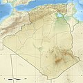
File:Algeria location map.svg
Appearance

Size of this PNG preview of this SVG file: 604 × 600 pixels. Other resolutions: 242 × 240 pixels | 483 × 480 pixels | 773 × 768 pixels | 1,031 × 1,024 pixels | 2,062 × 2,048 pixels | 1,287 × 1,278 pixels.
Original file (SVG file, nominally 1,287 × 1,278 pixels, file size: 281 KB)
File history
Click on a date/time to view the file as it appeared at that time.
| Date/Time | Thumbnail | Dimensions | User | Comment | |
|---|---|---|---|---|---|
| current | 19:01, 16 March 2020 |  | 1,287 × 1,278 (281 KB) | NordNordWest | upd 2019 |
| 12:51, 17 November 2009 |  | 1,287 × 1,278 (364 KB) | Sting | == {{int:filedesc}} == {{Location|28|19|00|N|1|39|00|E|scale:8000000}} <br/> {{Information |Description={{en|Blank administrative map of Algeria, for geo-location purposes.}} {{fr|Carte administrative vierge de l'Algérie, |
File usage
More than 100 pages use this file. The following list shows the first 100 pages that use this file only. A full list is available.
- 1990 African Cup of Nations
- 2007 All-Africa Games
- Abadla
- Adrar, Algeria
- Algerian Cup
- Amguid crater
- Aoulef
- Arak gorges
- Arzew
- Aïn Defla
- Aïn Témouchent
- Badji Mokhtar Annaba University
- Batna (city)
- Bir Mourad Raïs
- Biskra
- Blida
- Bordj Bou Arréridj
- Bou Saâda
- Boufarik
- Bouïra
- Béchar
- Béjaïa
- Béni Ounif
- Cirta
- Dellys
- Djanet
- Djelfa
- Djémila
- El Bayadh
- El Harrach
- El Kantara
- El Marsa, Algiers
- El Menia
- El Oued
- El Taref
- Foggaret el Arab
- Ghardaïa
- Guelma
- Guemar
- Hammaguir
- Hassi Messaoud
- Hassi R'Mel
- Hippo Regius
- Houari Boumediene Airport
- Igli, Algeria
- In Amenas
- In Belbel
- In Guezzam
- In Salah
- Jewish philosophy
- Khenchela
- Kénadsa
- Laghouat
- Lakhdaria
- Lambaesis
- Larbaâ Nath Irathen
- M'Sila, Algeria
- Maghnia
- Menaceur
- Mers El Kébir
- Messaâd
- Mila (city)
- Miliana
- Mostaganem
- Médéa
- Operation Reservist
- Ouaguenoun
- Ouargla
- Ouarkziz crater
- Qal'at Bani Hammad
- Reggane
- Relizane
- Saldae
- Saïda, Algeria
- Siga
- Skikda
- Staouéli
- Tabelbala
- Tadjmout
- Talemzane crater
- Tamanrasset
- Taourirt, Algeria
- Thagaste
- Theveste
- Thubursicum
- Tiaret
- Timgad
- Timimoun
- Tin Bider crater
- Tindouf
- Tipasa
- Tissemsilt
- Tizi Ouzou
- Tnihaia
- Touat
- Touggourt
- Touila
- Tébessa
- Zaraï
- Zerhamra
View more links to this file.
Global file usage
The following other wikis use this file:
- Usage on ab.wikipedia.org
- Usage on af.wikipedia.org
- Usage on als.wikipedia.org
- Usage on am.wikipedia.org
- Usage on an.wikipedia.org
- Usage on ar.wikipedia.org
- أولاد تبان
- العلمة (ولاية سطيف)
- كأس الأمم الإفريقية 1990
- صالح باي (ولاية سطيف)
- قالب:خريطة مواقع الجزائر
- عين آزال
- بوقاعة
- قنزات
- مطار الشلف - أبو بكر بلقايد
- الحامة (ولاية سطيف)
- تالة ايفاسن
- بابور (سطيف)
- الولايات المنتدبة في الجزائر
- زلزال الشلف 1980
- تيزي نبشار
- قالب:خارطة جبال الجزائر
- قالب:خريطة مدن الجزائر
- ماوكلان
- بوطالب
- سيدي حمادوش
- قالب:ص.م/موقع جغرافي
- قالب:ص.م/موقع جغرافي/شرح
- بطولة إفريقيا تحت 20 سنة لكرة القدم 2013
- حمام قرقور
- مستخدم:عبد المؤمن/ملعب
- عين السبت
- بوعنداس
- بني فودة
- بني حسين (ولاية سطيف)
- ذراع قبيلة
- الأوريسية
- قلال
View more global usage of this file.


