Not an official forecast
Hunga Tonga-Hunga Ha'apa Volcano-generated Tsunami, January 15, 2022
Main Event Page
On January 15, 2022, the Hunga Tonga-Hunga Ha'apai volcano (20.5°S 175.4°W), located about 60 km north of Fua'amotu, the main island of Tonga, violently erupted with a powerful explosion, culminating the period of volcanic activity that started in December of 2021. The explosion generated a strong tsunami that was recorded all over the Pacific Ocean, the waves were also reported in other ocean basins, including the Caribbean and Mediterranean seas.
Multiple tsunami generation mechanisms were at play during this event and not all of them are currently fully understood. Research is on-going to analyze all the event data for conclusive tsunami source assessment.
This page provides an overview of the preliminary analysis of the tsunami using the tsunami forecast modeling tools developed at NCTR and the real-time tsunami data available for this event. The goal of this preliminary analysis is to develop forecast capabilities for tsunami events of this type. The components of this page will be updated when new data and new models are available.
Tsunami Data
The tsunami was detected by virtually all available DART systems (Deep-ocean Assessment and Reporting of Tsunamis) and the majority of coastal sea-level gauges around the U.S. and the Pacific.
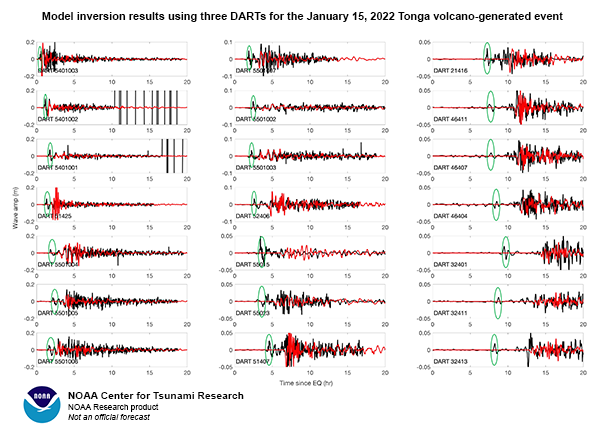
The Bottom Pressure Recorders (BPRs) of the DART systems recorded the waves of the Tonga tsunami led by the air pressure waves from the volcano explosion (Figure 1). That mixture of data in the DART records complicated the tsunami analysis and source inversion process for modeling the event.
Preliminary Modeling
A two-fold modeling approach is applied for examining the tsunami generated from the Hunga Tonga-Hunga Ha'apa volcano event.
1. DART inversion model
The initial model of the Tonga volcano tsunami was developed by inverting the parts of the DART records that do not include the air pressure signature. A custom set of 9 Green's functions were computed in real time for the DART data inversion using Gaussian shapes as unit sources at the site of the volcano.
The simulation results are obtained using MOST propagation model and high-resolution inundation forecast models that are available for several tide-gauge locations.
Comparison of the measured tsunami recorded at tide gauges (black) with model results (red) is presented in the following links:
- Coastal sea-level gauge comparisons with model data
Source: 39.26*sc3 + 87.57*sc4 + 65.66*sc7 + 62.99*sc8 (Unit sources not directly available from the NCTR's unit source database.)
While this modeling approach resulted in discrepancies between model results and tide gauge observations, (especially some arrival time differences), the amplitudes are mostly reproduced, even for far-away locations. The difficulty of inverting the mixed data of DART records may be the main reason for the model deficiencies.
2. Tsunami model forced by the air pressure wave
The second approach for modeling the Tonga tsunami used the air-pressure wave generation mechanism, similar to the approach for modeling the meteotsunami generation (Titov and Moore, 2021). The low-frequency air pressure wave generated by the explosion of the Hunga Tonga-Hunga Ha'apa volcano was recorded by barometric instruments around the globe. This air pressure wave is often referred to as the Lamb wave in the literature.
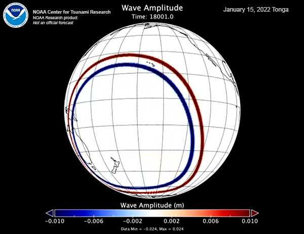
The air pressure records are used to develop a simplified model describing the Lamb wave by a combination of two Gaussian functions propagating axis-symmetrically from the volcano location. The model parameters are scaled to approximately fit available barometric observations for this event (Figure 4).
This air pressure function is used as time-dependent forcing for the tsunami propagation model as described by Titov and Moore (2021).
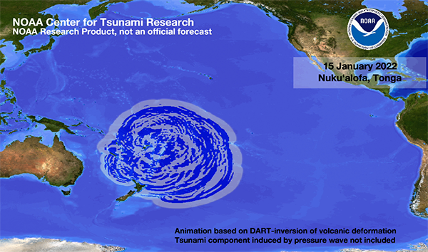
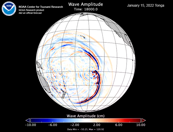
The resulted tsunami simulation is shown in Figure 5.
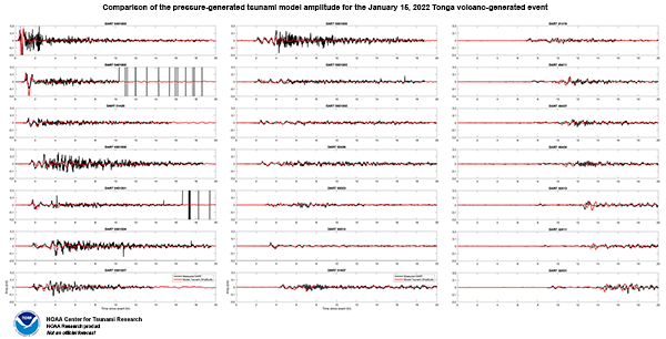
The comparison of the computed tsunami amplitudes in the open ocean are shown in Figure 6.
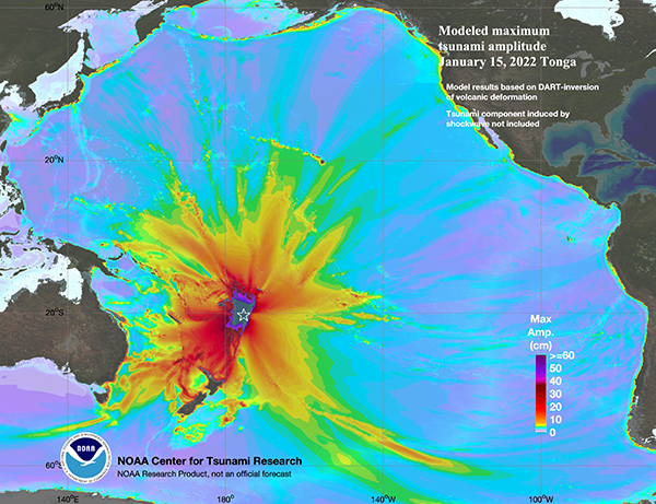
The maximum computed amplitudes for the tsunami generated by the pressure forcing (Figure 7) show significantly different pattern of the tsunami energy distribution around the Pacific, when compared with the source model centered at the volcano (Figure 2).
The tsunami model with Lamb wave generation mechanism explains the arrival time of the first wave signal recorded at most DARTs, which propagated just below the speed of sound in the atmosphere. It also reproduces the arrival of the following wave train propagating with the tsunami long wave celerity. Significant differences remain in amplitudes between the model and the DART observations, especially for DARTs near New Zealand and Australia. Nevertheless, the DART amplitudes in the far-field appear to be reproduced well by this simplified model. The higher-frequency tsunami signals at the near-field DARTs may have been generated by another mechanism related to the volcano eruption, or the models described here may not have enough spatial resolution to reproduce the higher-frequency signals.
Disclaimer: The models on these pages show the results of ongoing research to enhance tsunami science and to improve NOAA operational tsunami forecasts. These products were developed during or shortly after the tsunami event, are intended for research use, and are not an official forecast. They should not be used as the basis of any public or private policy decisions. Please contact NCTR to find if there are more detailed follow-on analysis results.
For media inquiries:
When using information from this page, please credit NOAA / PMEL / Center for Tsunami Research
