Slika:Oceania (orthographic projection).svg
Videz

Velikost tega predogleda PNG datoteke SVG: 541 × 541 točk. Druge ločljivosti: 240 × 240 točk | 480 × 480 točk | 768 × 768 točk | 1.024 × 1.024 točk | 2.048 × 2.048 točk.
Izvorna datoteka (Datoteka SVG, nominalno 541 × 541 pikslov, velikost datoteke: 63 KB)
Zgodovina datoteke
Kliknite datum in čas za ogled datoteke, ki je bila takrat naložena.
| Datum in čas | Sličica | Velikost | Uporabnik | Komentar | |
|---|---|---|---|---|---|
| trenutno | 19:54, 6. februar 2023 |  | 541 × 541 (63 KB) | Golden Mage | A change to the map of Asia will first face debate from others. Hence, a change to the commonly accepted map of Oceania cannot be made without a wider consensus. |
| 07:33, 6. februar 2023 | 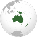 | 541 × 541 (108 KB) | Kwamikagami | rv: then perhaps we need to change the Asia map to match. This is as defined in WP. | |
| 19:19, 5. februar 2023 | 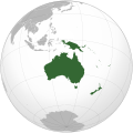 | 541 × 541 (63 KB) | Golden Mage | Reverted to the map that displays the more accepted definition of Oceania's boundaries. Widely accepted geopolitical definitions take precedence over mere geographical ones. The map of the Wikipedia page for Asia already includes the Maluku Islands. | |
| 06:01, 5. februar 2023 | 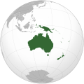 | 541 × 541 (108 KB) | Treetoes023 | Reverted to version as of 06:27, 24 December 2022 (UTC) | |
| 06:00, 5. februar 2023 | 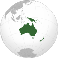 | 541 × 541 (63 KB) | Treetoes023 | Reverted to version as of 13:25, 31 December 2022 (UTC) | |
| 05:55, 5. februar 2023 |  | 541 × 541 (108 KB) | Treetoes023 | Reverted to version as of 00:31, 4 December 2022 (UTC) | |
| 14:25, 31. december 2022 |  | 541 × 541 (63 KB) | Golden Mage | Reverted to the map that displays the more accepted definition of Oceania's boundaries. Widely accepted geopolitical definitions take precedence over mere geographical ones. | |
| 07:27, 24. december 2022 |  | 541 × 541 (108 KB) | Kwamikagami | Reverted to version as of 00:31, 4 December 2022 (UTC) definition per WP-en | |
| 07:13, 22. december 2022 |  | 541 × 541 (63 KB) | Golden Mage | Reverted to the map that displays the more accepted definition of Oceania's boundaries. | |
| 01:31, 4. december 2022 | 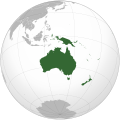 | 541 × 541 (108 KB) | Kwamikagami | the Weber line divides Oceanic from Asian Wallacea |
Uporaba datoteke
Datoteka je del naslednjih 20 strani slovenske Wikipedije (strani drugih projektov niso navedene):
Globalna uporaba datoteke
To datoteko uporabljajo tudi naslednji vikiji:
- Uporaba na ab.wikipedia.org
- Uporaba na ady.wikipedia.org
- Uporaba na af.wikipedia.org
- Afrika
- Asië
- Europa
- Kiribati
- Noord-Amerika
- Suid-Amerika
- Vanuatu
- Guam
- Nieu-Seeland
- Sjabloon:Kontinente
- Australië
- Nauru
- Wellington, Nieu-Seeland
- Hoofstad
- Lys van hoofstede
- Sjabloon:Lande van Oseanië
- Honolulu
- Antarktika
- Gondwana
- Eurasië
- Laurasië
- Kategorie:Lande in Oseanië
- Lys van lande
- Fidji
- Canberra
- Hawaii
- Lys van nasionale leuses
- Clipperton
- Oseanië
- Norfolkeiland
- Amerikas
- Tonga
- Tuvalu
- Sjabloon:Hoofstede in Oseanië
- Palau
- Australië (kontinent)
- Afrika-Eurasië
- Samoa
- Marshalleilande
- Salomonseilande
- Papoea-Nieu-Guinee
- Gefedereerde State van Mikronesië
- Nukuʻalofa
- Port Moresby
- Apia
- Funafuti
- Honiara
- Majuro
Oglejte si globalno uporabo te datoteke.

