Maps
Arctic Boundary Map: Polar
• 150 dpi color jpg (798 KB)
• 150 dpi grayscale jpg (564 KB)
• 300 dpi color jpg (1.97 MB)
• 300 dpi grayscale jpg (1.37 MB)
• pdf file (549 KB)
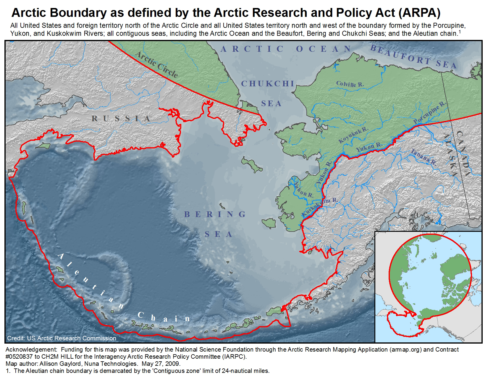
Arctic Boundary Map: Alaska
• 150 dpi color jpg (1.7 MB)
• 150 dpi grayscale jpg (1.3 MB)
• 300 dpi color jpg (5.18 MB)
• 300 dpi grayscale jpg (4.19 MB)
• pdf file (1.7 MB)
Arctic Boundary Map: Alaska with Polar Inset
• 150 dpi color jpg (1.7 MB)
• 150 dpi grayscale jpg (1.3 MB)
• 300 dpi color jpg (5.01 MB)
• 300 dpi grayscale jpg (4.08 MB)
• pdf file (1.9 MB)
Arctic Boundary Map: GIS ShapeFile
• GIS ShapeFile with associated metadata (422 KB zipped folder)
International Scientific Agreement Map
• 150 dpi color jpg (1.22 MB)
• 150 dpi grayscale jpg (839 KB)
• 300 dpi color jpg (3.27 MB)
• 300 dpi grayscale jpg (2.25 MB)
• pdf file (1.77 MB)
Home | About | Publications | Working Groups | News & Events | Policies | Photo Credits | Privacy
Looking for U.S. government information and services? Visit USA.gov
Connect
Looking for U.S. government information and services? Visit USA.gov


