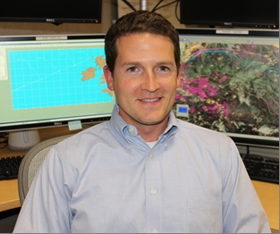
Q & A with NHC - Wallace Hogsett
 Wallace Hogsett
Techniques Development Meteorologist
National Hurricane Center
By Dennis Feltgen
Public Affairs Officer
NOAA Communications & External Affairs
National Hurricane Center
I see you doing a lot of things around here.
My title is Techniques Development Meteorologist. The primary thing I do is work with the hurricane-specific computer models to get a little more into the details than we do in an operational sense. But I like to get involved in other activities and learn from the veterans.
Is this part of the Hurricane Forecast Improvement Program (HFIP)?
Yes, I initially came to NHC under HFIP. Then, (Technology and Science Branch meteorologist) Colin McAdie retired and I got his position. So, I'm no longer technically under HFIP, but I still work a lot with the program.
You're a problem-solver?
I dig down into the models and look for possible problems in them. Then I communicate with the people in Washington DC at the (NOAA) Environmental Modeling Center that develop the models to try to get a feedback going to work towards some improvements. Ideally, this feedback leads to better hurricane forecasts. But it's a lot easier to find problems than it is to solve problems.
In your experience, what is the greatest problem with the models?
None of them are doing a really good job at representing the nuances of the actual hurricane. This goes back decades, but most of the models just put in some kind of generic rotating vortex without a whole lot of attention to details. In the past, that's all we could do because we lacked good data, but I think that's the area where we will grow a lot in the next decade or two.
How are we going to do that?
We have the standard reconnaissance aircraft and we are working to get that data into the models, which will give us more detail. But also, satellites are becoming more advanced, and we are making better use of the data that the satellites give us. As this progress continues, we can get a better structure of the hurricane.
Do you think the GOES-R satellite will help make that leap?
There's a good chance. These next-generation satellites will help a lot. But there is a long way to go to get the data into the models and use them properly.
What are your meteorological roots?
Same story, different day. I grew up in Texas, the Dallas area. I'd sit on the porch with the Dad and watch the storms roll in. I'd walk outside into a hailstorm with an umbrella, trying to find the biggest hailstone. I was about 10 years old, so no fear. I didn't even think of the fact that a baseball-size hailstone can go right through the umbrella. As these squall lines would come through, there would be the calm before the storm and then the wind and temperature would change. To any curious kid, it's like "what is the world is going on?"
How do you make the leap from high plains thunderstorms to tropical meteorology?
Maybe I burned myself out on thunderstorms. I went to the University of Oklahoma and chased storms and tornadoes for four years, and probably drove about ten thousand miles - I might be underestimating that. When I finished OU, there was the chance to continue with tornado research as a Masters candidate, or try something new. I had an offer for grad school at the University of Maryland and my potential advisor there was a hurricane modeler. I wanted to see the world and keep learning about severe weather, so I chose the move to (Washington) DC. After graduation from OU, I packed two suitcases and rode a Greyhound bus - after that trip I vowed never to complain about a delayed flight ever again.
They make movies out of stories like this.
It's like something out the 1950s! I got dropped off in downtown DC, kind of looked around, and that's when the culture shock set in. Long story short, I lived in DC for six years and finished up my Masters and Ph.D. at the University of Maryland.
This job at NHC is your first job after school?
It is, and it's a great start. I've been here about a year and half; it's been fun so far and I've learned a lot.
You were a Hurricane Support Meteorologist this past season, correct?
The HSM program has been very good for me. As I said, I spent six years in graduate school doing research, writing papers about hurricanes, and you think you know all about hurricanes. Well, forecasting a hurricane is quite a different task than researching a hurricane. Working with the folks in operations has been good for me, because I did not even know what I didn't know before I came here.
One of the HSM duties is to assist with media inquiries. You were on duty during Hurricane Irene.
It's is always a challenge to tailor the words, having come from research background. It's harder than I thought it would be, but I am learning fast.
So, where do you see yourself going?
That's a good question. I very rarely set my sights on any one particular goal. I prefer to keep learning constantly and let things happen naturally. I see myself staying here as long as possible.
What do you outside of work?
I like to run a lot - marathons, various things like that. I love food, and exercising keeps that in check. My girlfriend is in DC, so I go up there a lot. And I do like to get back to Texas as that's where my entire family is located. Oh, and I also have a wine collection.
Send comments to: NHC.Public.Affairs@noaa.gov
Return to Q & A index of stories


