|
Special Purpose Imagery > Special Purpose Imagery Archive
Special Purpose Imagery Archive
The following are ad hoc-generated images for special projects, grouped by
geographic region. Note: some of the linked images are large georeferenced
JPG or TIFF files that have been compressed using the tar and
gzip utilities.
| Lower Mississippi Region |
|---|
Black River at Pocahontas, AR - 2011-05-17
|
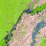
This Landsat 5 TM image depicts flooding along
the Black River as well as the Cache River to the
southeast. This satellite image uses bands 5-4-3
as R-G-B.
The latest reported stage at Pocahontas is 18.71 ft
at 8:00 AM CDT on 05/19. Flood stage is 17 ft.
The latest reported stage at Black Rock is 20.1 ft
at 8:00 AM CDT on 05/19. Flood stage is 14 ft.
|
|
|
| Northwest Region |
|---|
Green River from the Howard Hanson Dam to Auburn, WA - 2009-09-20
|
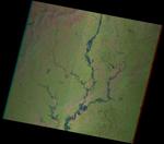
This Landsat 5 TM image shows the Green River and
lake extents near the Howard Hanson Dam, east of
Auburn, WA.
|

|
|
| Southeast Region |
|---|
Oconee River near Milledgeville, Georgia - 2009-09-22
|
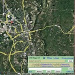
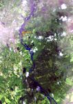
This is a comparison between flooding shown in the
Landsat TM image and a more normal river extent via Google
Maps. Notice the large grassy areas near the river that
are now flooded in the satellite image.
This scene is GIS-ready with the additional
.jgw file.
|
|
|
| Northeast Region |
|---|
Northeast snowstorm - 2011-10-30
|
This is a TERRA MODIS composite image that uses bands
7-2-1 as R-G-B. Snow can be seen on the ground as cyan,
with white being cloud. Image postprocessing was done at
University of Wisconsin SSEC.
This scene is GIS-ready with the additional
.jgw file.
|

|
|
| Upper Midwest Region |
|---|
Devils Lake, ND - 2011-06-03
|
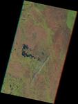
The LANDSAT-5 TM image is a false-color composite
depicting the extents of Devils Lake in eastern
North Dakota.
The TM bands 5, 4, and 3 are displayed as Red, Green,
and Blue.
This scene is GIS-ready with the additional
.jgw file.
|
|
|
| Midwest Region |
|---|
Wabash River near Terre Haute, IN - 2013-04-30
|
This Landsat 7 image shows moderate flooding along the Wabash
River from Terre Haute, IN down to Mt Carmel, IL. This is a
false color composite that uses bands 5-4-3 as
Red-Green-Blue. The LandsatLook scene is from path 22,
rows 33 and 34. Additional XML data for GIS can be found
here.
This scene is GIS-ready with the additional
.jgw file.
|
|
|
|

