A soggy Wednesday across the Bluegrass with more rain to come
Central Kentucky was the favored area for the steady rain mid-week but it should spread east and south into Thursday
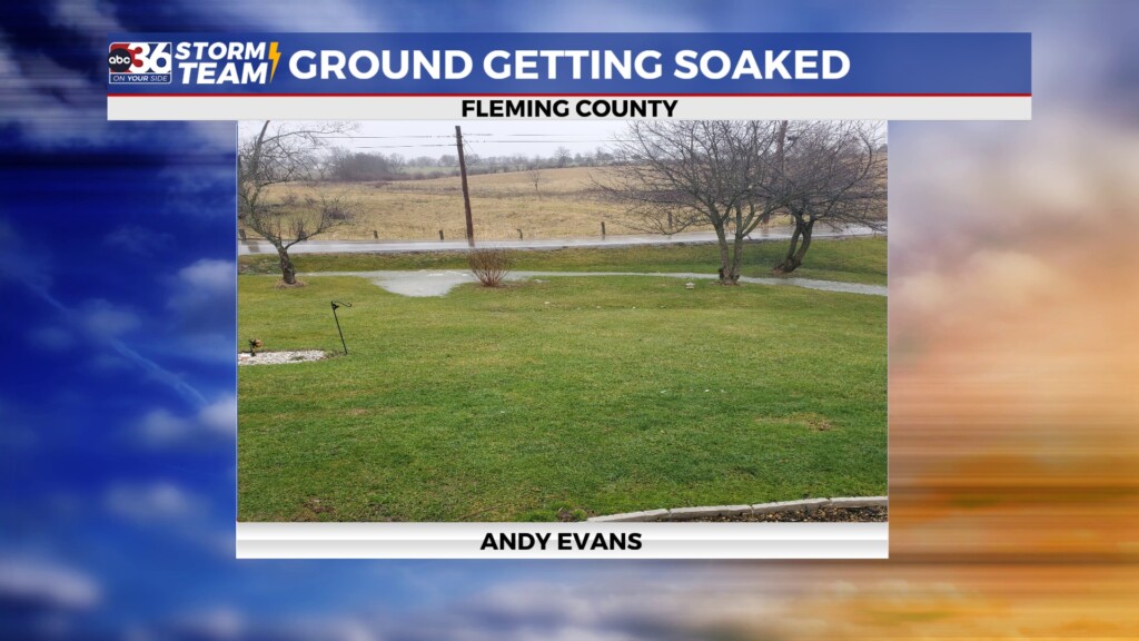
It was all about location across Central and Eastern Kentucky relative to the rain (or the lack thereof) on Wednesday as the Bluegrass region and parts of South Central Kentucky saw a damp day. Meanwhile across the southeastern mountains it stayed relatively dry, which allowed afternoon highs to spike well into the 60s! It’s still hard to believe that a few short days ago were were dealing with sub-zero lows and now it feels like spring! Everyone should get in on the rain heading into the late week as another wave of low pressure spins up from the south. Those areas that saw the steady rain also started to see the water collecting in low lying areas and more of that will be possible in the coming days.
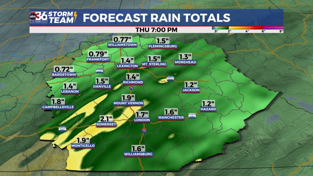
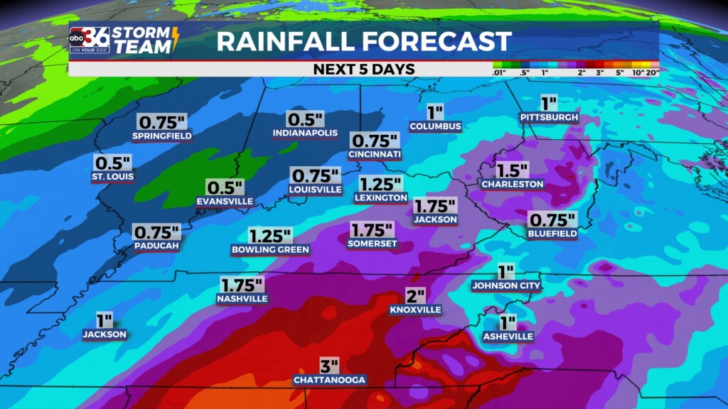
The rain gear will come in handy for all of our area on Thursday as the next wave of energy moves in. The rain could be heavy at times once again (especially across Southern Kentucky) and a few rumbles of thunder can’t be ruled out. Temperatures will continue to be well above the curve for late January as afternoon highs surge into the low and even mid-60s! After a good soaking with .50″ to 1″ totals across the northern half of the state Wednesday, Southern Kentucky will play catch up and we are still looking at a widespread 2″-3″ total rain event by the time things wrap up on Thursday evening.
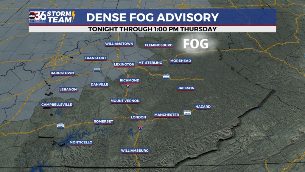
Dense fog is expected Thursday morning, especially across the Bluegrass Regio and points westward where a Dense Fog Advisory is now out until 1pm Thursday afternoon. With all the low level moisture from the recently melted snow and clouds/rain around visibility may be reduced to less than 1/4 of a mile in some locations so use caution late Wednesday night and into Thursday morning.
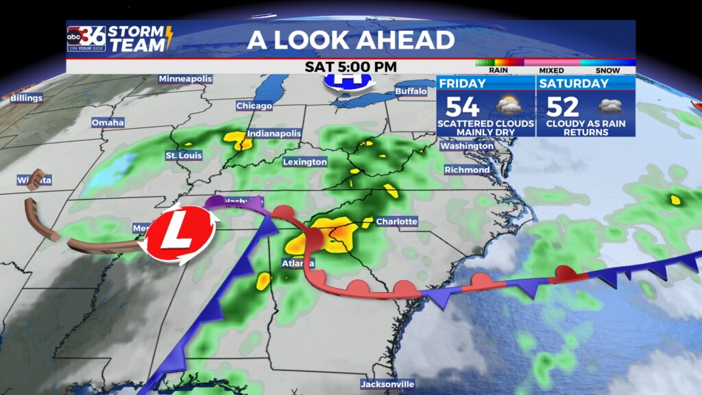
We’ll catch a quick break from the active weather on Friday with temperatures still pretty comfortable for this time of the year as readings top out in the low to mid-50s. Yet another wave of energy will spin in from the west keeping us damp for the beginning of the weekend so keep that in mind. Afternoon highs should be in the low 50s due to the clouds and rain on Saturday. This additional rainfall (around .50″ to possibility up to 1″) combined with the recent snow melt/rainfall should cause some of the smaller rivers around our area to be running high along with streams and creeks. Just keep that in mind if you are out and about this weekend.
We should “cooldown” Sunday and into Monday as more seasonable air wraps in behind the departing low. Luckily we aren’t looking at any big blast of cold air so it won’t be frigid by any means. Highs look to reach either side of the 40 degree mark on Sunday and with some leftover moisture around, a few showers mixed with snowflakes is on the table but we should see any impact as temperatures back off into the mid to upper 30s by the end of the day. Other than a few flurries with the northwest flow set-up Monday, it should be fairly quiet with highs in the upper 30s and low 40s heading into the home stretch for January.
ABC 36 HOUR FORECAST
WEDNESDAY NIGHT: Occasional rain, fog and mild temperatures. Lows in the low-50s.
THURSDAY: Morning fog, the more rain and mild. Highs in the low and mid-60s.
THURSDAY NIGHT: Evening showers then drying out. Lows in the upper-40s.
