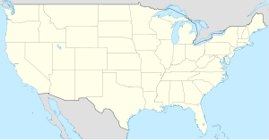
Stephens County (kondado sa Tinipong Bansa, Texas)
- Alang sa ubang mga dapit sa mao gihapon nga ngalan, tan-awa ang Stephens County.
| Stephens County (Comté de Stephens) | |
| Condado de Stephens | |
| Kondado | |
| Nasod | |
|---|---|
| Estado | Texas |
| Gitas-on | 409 m (1,342 ft) |
| Tiganos | 32°44′09″N 98°50′10″W / 32.73586°N 98.83617°W |
| Capital | Breckenridge (kapital sa kondado sa Tinipong Bansa, Texas) |
| Area | 2,387.00 km2 (922 sq mi) |
| Population | 9,630 (2013-03-08) [1] |
| Density | 4 / km2 (10 / sq mi) |
| Timezone | CST (UTC-6) |
| - summer (DST) | CDT (UTC-5) |
| GeoNames | 4734326 |
Kondado ang Stephens County (Prinanses: Comté de Stephens, Kinatsila: Condado de Stephens) sa Tinipong Bansa.[1] Nahimutang ni sa estado sa Texas, sa habagatan-sidlakang bahin sa nasod, 2,100 km sa kasadpan sa Washington, D.C. Adunay 9,630 ka molupyo.[1] Naglangkob kin og 2,387 ka kilometro kwadrado. Stephens County mopakigbahin sa usa ka utlanan sa Palo Pinto County, Eastland County, Shackelford County, Young County, ug Throckmorton County ang ulohan sa nasod.
Ang yuta sa Stephens County kay kasagaran patag, apan sa habagatang-sidlakan nga kini mao ang kabungtoran.[saysay 1]
Stephens County may sa mosunod nga mga subdibisyon:
Mga lungsod sa Stephens County:
Sa mosunod nga mga natural nga mga bahin makita sa Stephens County:
- Mga suba:
- Battle Creek (suba)
- Bear Branch (suba)
- Bee Branch (suba)
- Big Branch (suba)
- Big Branch (suba)
- Big Sandy Creek (suba)
- Bloomfield Branch (suba)
- Brown Branch (suba)
- Brushy Creek (suba)
- Bufford Creek (suba)
- Cat Branch (suba)
- Cedar Creek (suba)
- Cottonwood Creek (suba)
- Davis Creek (suba)
- Dry Branch (suba)
- Dry Branch (suba)
- Duff Branch (suba)
- East Fork Bufford Creek (suba)
- East Fork Gunsolus Creek (suba)
- Edwards Branch (suba)
- Elm Creek (suba)
- Elm Creek (suba)
- Finley Branch (suba)
- Flat Rock Creek (suba)
- Fluehearty Branch (suba)
- Givens Creek (suba)
- Gunsolus Creek (suba)
- Hitson Branch (suba)
- Hitson Branch (suba)
- Hog Branch (suba)
- Horse Branch (suba)
- Hubbard Creek (suba)
- Iron Ore Creek (suba)
- Jones Branch (suba)
- Kings Creek (suba)
- Little Cedar Creek (suba)
- Live Oak Creek (suba)
- Long Branch (suba)
- McDowell Creek (suba)
- Mulberry Creek (suba)
- Norton Branch (suba)
- Peach Creek (suba)
- Pecan Creek (suba)
- Peveler Creek (suba)
- Plum Branch (suba)
- Post Oak Branch (suba)
- Rush Branch (suba)
- Sandy Creek (suba)
- Sink Creek (suba)
- Six Shooter Creek (suba)
- South Bills Creek (suba)
- Sow Branch (suba)
- Turner Branch (suba)
- Wagon Timber Creek (suba)
- Walker Branch (suba)
- Veale Creek (suba)
- West Fork Bufford Creek (suba)
- West Fork Gunsolus Creek (suba)
- Yellow Branch (suba)
- Mga lanaw:
- A A Atkins Reservoir (tubiganan)
- Carey Lake (tubiganan)
- Conner Lake (tubiganan)
- Crystal Falls Reservoir (tubiganan)
- Dooley Lake (tubiganan)
- Glynn Wilson Lake (tubiganan)
- Grand Lake (tubiganan)
- H Graden Dye Reservoir (tubiganan)
- Hubbard Creek Reservoir (tubiganan)
- Humble Lake (tubiganan)
- J Dye Lake (tubiganan)
- J M Frambo Lake (tubiganan)
- J S McDowell Reservoir (tubiganan)
- Kelly Lake (tubiganan)
- Lake Daniel (tubiganan)
- Lake Necessity (tubiganan)
- Lester Clark Reservoir (tubiganan)
- Ohio Oil Company Reservoir (tubiganan)
- Petes Pride Lake (tubiganan)
- Petroleum Corporation of Texas Reservoir (tubiganan)
- Pitzer Lake (tubiganan)
- Powers Reservoir (tubiganan)
- Robbins Lake (tubiganan)
- Rogers Lake (tubiganan)
- Stephens Company Water Company Reservoir (tubiganan)
- Stevens Company Water Company Lake (tubiganan)
- T C Fambro Reservoir (tubiganan)
- T P Lake (tubiganan)
- Texas Company Reservoir (tubiganan)
- Texas Company Reservoir (tubiganan)
- Tullos Lake (tubiganan)
- Twin Lakes (tubiganan)
- Union Lake (tubiganan)
- Kapuloan:
- Mga lawis:
- Mga walog:
- Kabukiran:
- Bald Mountain (bukid)
- Ball Mountain (bukid)
- Beaver Mountain (bukid)
- Bee Branch Mountain (bukid)
- Brown Pen Mountain (bukid)
- Buck Mountain (bukid)
- C J Mountain (bukid)
- Coal Mountain (bukid)
- Coon Mountain (bukid)
- Devils Reservation Mountain (bukid)
- Donkey Mountain (bukid)
- Double mountain (bukid)
- Gore Mountain (bukid)
- Hog Mountain (bukid)
- Hughes Mountain (bukid)
- Lime Rock Mountain (bukid)
- Maxwell Mountain (bukid)
- Round Mountain (bukid)
- Spy Mountain (bukid)
- Steal Easy Mountain (bukid)
- Yates Hill (bukid)
Ang klima umogon ug subtropikal.[3] Ang kasarangang giiniton 20 °C. Ang kinainitan nga bulan Hulyo, sa 30 °C, ug ang kinabugnawan Disyembre, sa 8 °C.[4] Ang kasarangang pag-ulan 704 milimetro matag tuig. Ang kinabasaan nga bulan Septiyembre, sa 87 milimetro nga ulan, ug ang kinaugahan Oktubre, sa 31 milimetro.[5]
| ||||||||||||||||||||||||||||||||||||||||||||||||||||||||||||||||||||||||||||||||||||||||||||||||||||||||||||||||||||||||||||
Saysay
[usba | usba ang wikitext]- ↑ Kalkulado gikan sa gitas-on data (DEM 3") gikan sa Viewfinder Panoramas.[2] Ang bug-os nga algoritmo anaa dinhi.
Ang mga gi basihan niini
[usba | usba ang wikitext]- ↑ 1.0 1.1 1.2 Stephens County sa Geonames.org (cc-by); post updated 2013-03-08; database download sa 2017-02-28
- ↑ "Viewfinder Panoramas Digital elevation Model". 2015-06-21.
- ↑ Peel, M C; Finlayson, B L. "Updated world map of the Köppen-Geiger climate classification". Hydrology and Earth System Sciences. 11: 1633–1644. doi:10.5194/hess-11-1633-2007. Retrieved 30 Enero 2016.
{{cite journal}}: CS1 maint: unflagged free DOI (link) - ↑ 4.0 4.1 "NASA Earth Observations Data Set Index". NASA. Retrieved 30 Enero 2016.
- ↑ "NASA Earth Observations: Rainfall (1 month - TRMM)". NASA/Tropical Rainfall Monitoring Mission. Retrieved 30 Enero 2016.
Gikan sa gawas nga tinubdan
[usba | usba ang wikitext]| Aduna'y mga payl ang Wikimedia Commons nga may kalabotan sa artikulong: Stephens County. |

