The Scottish Borders
| The Scottish Borders (Scottish Borders) | |
| Borders, Borders Region | |
| Dapit sa konseho | |
| Nasod | |
|---|---|
| Apil sa nasod | Scotland |
| Gitas-on | 156 m (512 ft) |
| Tiganos | 55°35′00″N 2°50′00″W / 55.58333°N 2.83333°W |
| Area | 4.73 km2 (2 sq mi) |
| Population | 113,870 gikan sa eswiki |
| Density | 24,074 / km2 (62,351 / sq mi) |
| Timezone | UTC (UTC+0) |
| - summer (DST) | BST (UTC+1) |
| ISO 3166-2 code | GB-SCB- |
| GeoNames | 2655192 |
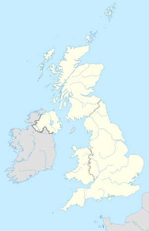
Dapit sa konseho ang The Scottish Borders (Ininggles: Scottish Borders) sa Hiniusang Gingharian.[1] Nahimutang ni sa apil sa nasod sa Scotland, sa sentro nga bahin sa nasod, 500 km sa amihanan sa London ang ulohan sa nasod. Adunay 113,870 ka molupyo.[2] Naglangkob kin og 4.7 ka kilometro kwadrado. The Scottish Borders mopakigbahin sa usa ka utlanan sa South Lanarkshire.
Ang yuta sa The Scottish Borders kasagaran patag, apan sa kasadpan nga kini mao ang kabungtoran.[saysay 1]
The Scottish Borders may sa mosunod nga mga subdibisyon:
Mga lungsod sa The Scottish Borders:
- Galashiels
- Hawick
- Peebles
- Selkirk
- Kelso
- Jedburgh
- Eyemouth
- Duns
- Innerleithen
- Coldstream
- Earlston
- Melrose
- West Linton
- Allanton
- Newtown St Boswells
- Chirnside
- Lauder
- St Boswells
- Newcastleton
- Walkerburn
- Coldingham
- Denholm
- Town Yetholm
- Greenlaw
- Stow
- Ayton
- Roxburgh
- Cockburnspath
- Lilliesleaf
- Reston
- Bowden
- Teviothead
- Newstead
Sa mosunod nga mga natural nga mga bahin makita sa The Scottish Borders:
- Mga suba:
- Mga lanaw:
- Mga bungtod:
- Byrehope Mount (bungtod)
- Carlops Hill (bungtod)
- Catstone (bungtod)
- Craigengar (bungtod)
- Dun Rig (bungtod)
- Fadden (bungtod)
- Faw Mount (bungtod)
- Glenwhappen Rig (bungtod)
- Grain Heads (bungtod)
- King Seat (bungtod)
- Lamb Rig (bungtod)
- Lead Law (bungtod)
- Meikle Says Law (bungtod)
- Millstone Rig (bungtod)
- Mount Maw (bungtod)
- Muckle Knock (bungtod)
- North Muir (bungtod)
- Slipperfield Mount (bungtod)
- Soutra Hill (bungtod)
- The Mount (bungtod)
- Wether Law (bungtod)
- Mga lawis:
- Kabukiran:
Ang klima baybayon.[4] Ang kasarangang giiniton 6 °C. Ang kinainitan nga bulan Hulyo, sa 14 °C, ug ang kinabugnawan Enero, sa −2 °C.[5]
Saysay
[usba | usba ang wikitext]- ↑ Kalkulado gikan sa gitas-on data (DEM 3") gikan sa Viewfinder Panoramas.[3] Ang bug-os nga algoritmo anaa dinhi.
Ang mga gi basihan niini
[usba | usba ang wikitext]- ↑ The Scottish Borders sa Geonames.org (cc-by); post updated 2012-11-27; database download sa 2016-05-06
- ↑ (gikopiya gikan sa eswiki 2015-07-18)
- ↑ "Viewfinder Panoramas Digital elevation Model". 2015-06-21.
- ↑ Peel, M C; Finlayson, B L. "Updated world map of the Köppen-Geiger climate classification". Hydrology and Earth System Sciences. 11: 1633–1644. doi:10.5194/hess-11-1633-2007. Retrieved 30 Enero 2016.
{{cite journal}}: CS1 maint: unflagged free DOI (link) - ↑ "NASA Earth Observations Data Set Index". NASA. Retrieved 30 Enero 2016.
Gikan sa gawas nga tinubdan
[usba | usba ang wikitext]| Aduna'y mga payl ang Wikimedia Commons nga may kalabotan sa artikulong: The Scottish Borders. |
