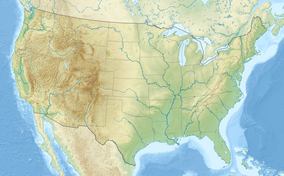
The Red River National Wildlife Refuge (established 2001) is a preservation project which will ultimately consist of approximately 50,000 acres (200 km2) of United States federal lands and water along that section of the Red River between Colfax in Grant Parish, Louisiana, and the Arkansas state line, a distance of approximately 120 miles (190 km). Currently the refuge has acquired approximately 16,000 acres (65 km2) of the proposed 50,000 acres (200 km2).
| Red River National Wildlife Refuge | |
|---|---|
IUCN category IV (habitat/species management area) | |
Map of the United States | |
| Location | Louisiana |
| Nearest city | Shreveport |
| Coordinates | 31°49′18″N 93°15′07″W / 31.82156°N 93.25195°W |
| Established | 2001 |
| Governing body | United States Fish and Wildlife Service |
| Website | Red River National Wildlife Refuge |
The four focus areas for land purchase are:
- Lower Cane River (Natchitoches Parish)
- Spanish Lake Lowlands (Natchitoches Parish)
- Bayou Pierre Floodplain (DeSoto and Red River parishes)
- Wardview (Caddo and Bossier parishes)
See also
editReferences
editThis article incorporates public domain material from websites or documents of the United States Fish and Wildlife Service.
- "The Red River National Wildlife Refuge". Retrieved August 19, 2011.
External links
edit- Red River National Wildlife Refuge - US Fish & Wildlife Service
- "The Red River National Wildlife Refuge Profile". Retrieved August 19, 2011.
- http://www.facebook.com/RedRiverNWR

