This article needs additional citations for verification. (November 2009) |
You can help expand this article with text translated from the corresponding article in Vietnamese. (November 2023) Click [show] for important translation instructions.
|
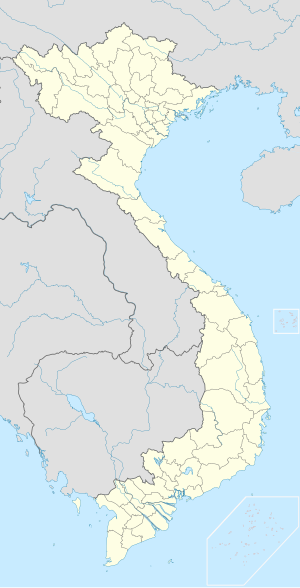
Tuy Hòa () is the coastal city and capital of Phú Yên Province in South-Central Vietnam. The city has a total area of 106.82 square kilometres or 41 square miles and a population of 155.921 (in 2019). The city is located approximately midway between Nha Trang and Qui Nhơn. The city is formulated mainly from alluvial of the downstream of Đà Rằng River. There are two mountains in the center of the city: Chóp Chài Mountain and Nhạn Mountain. There is a Champa Temple on the top of Nhạn Mountain.
Tuy Hòa
Thành phố Tuy Hòa | |
|---|---|
| Tuy Hòa City | |
 The city at night | |
 | |
| Coordinates: 13°04′55″N 109°17′42″E / 13.08194°N 109.29500°E | |
| Country | |
| Province | Phú Yên |
| Area | |
• Total | 106.82 km2 (41.24 sq mi) |
| Population (2019) | |
• Total | 155.921 |
| • Density | 1.460/km2 (3.78/sq mi) |
| Time zone | UTC+7 (Indochina Time) |
Climate
editTuy Hòa has a tropical savanna climate (Köppen climate classification: As).[1][2]
| Climate data for Tuy Hòa | |||||||||||||
|---|---|---|---|---|---|---|---|---|---|---|---|---|---|
| Month | Jan | Feb | Mar | Apr | May | Jun | Jul | Aug | Sep | Oct | Nov | Dec | Year |
| Record high °C (°F) | 33.7 (92.7) |
36.5 (97.7) |
36.4 (97.5) |
39.8 (103.6) |
40.5 (104.9) |
40.0 (104.0) |
39.0 (102.2) |
40.1 (104.2) |
38.4 (101.1) |
36.1 (97.0) |
34.5 (94.1) |
33.1 (91.6) |
40.5 (104.9) |
| Mean daily maximum °C (°F) | 26.4 (79.5) |
27.6 (81.7) |
29.5 (85.1) |
31.8 (89.2) |
33.9 (93.0) |
34.5 (94.1) |
34.2 (93.6) |
34.0 (93.2) |
32.7 (90.9) |
29.8 (85.6) |
28.0 (82.4) |
26.6 (79.9) |
30.8 (87.4) |
| Daily mean °C (°F) | 23.3 (73.9) |
23.9 (75.0) |
25.4 (77.7) |
27.4 (81.3) |
28.9 (84.0) |
29.4 (84.9) |
29.1 (84.4) |
28.9 (84.0) |
27.9 (82.2) |
26.5 (79.7) |
25.4 (77.7) |
24.0 (75.2) |
26.7 (80.1) |
| Mean daily minimum °C (°F) | 21.0 (69.8) |
21.3 (70.3) |
22.4 (72.3) |
24.0 (75.2) |
25.4 (77.7) |
26.1 (79.0) |
25.8 (78.4) |
25.6 (78.1) |
24.8 (76.6) |
24.1 (75.4) |
23.4 (74.1) |
22.0 (71.6) |
23.9 (75.0) |
| Record low °C (°F) | 15.2 (59.4) |
16.0 (60.8) |
16.4 (61.5) |
18.8 (65.8) |
21.4 (70.5) |
21.9 (71.4) |
21.7 (71.1) |
22.0 (71.6) |
20.9 (69.6) |
19.1 (66.4) |
17.7 (63.9) |
15.2 (59.4) |
15.2 (59.4) |
| Average rainfall mm (inches) | 66.9 (2.63) |
22.5 (0.89) |
36.0 (1.42) |
46.1 (1.81) |
90.8 (3.57) |
54.3 (2.14) |
45.5 (1.79) |
55.2 (2.17) |
227.4 (8.95) |
539.5 (21.24) |
507.9 (20.00) |
216.5 (8.52) |
1,911.3 (75.25) |
| Average rainy days | 12.5 | 6.2 | 5.0 | 5.0 | 9.0 | 7.0 | 7.1 | 9.4 | 15.3 | 20.8 | 21.5 | 19.0 | 137.5 |
| Average relative humidity (%) | 83.4 | 83.3 | 82.9 | 81.7 | 78.3 | 73.9 | 73.9 | 74.7 | 79.9 | 85.1 | 85.5 | 84.2 | 80.6 |
| Mean monthly sunshine hours | 160.5 | 196.0 | 251.6 | 269.7 | 272.8 | 239.9 | 239.3 | 230.6 | 203.6 | 168.0 | 128.3 | 118.2 | 2,472.9 |
| Source: Vietnam Institute for Building Science and Technology[3] | |||||||||||||
Infrastructure
editTransportation
editBy air
editThe city is served by Đông Tác Airport which lies south of Tuy Hòa.
By land
editTuy Hòa Railway Station is a stop on the North-South Railway. National Route 1 runs through the city, providing road connections to Hanoi in the north and Ho Chi Minh City in the south.
Gallery
edit-
Đà Rằng Bridge, Tuy Hòa, Phú Yên
-
Street in Tuy Hòa viewed from Nghinh Phong tower
-
Nhạn Tower
-
Tuy Hòa city view from Champa Temple on Nhan mountain
References
edit- ^ Kottek, Markus; Grieser, Jürgen; Beck, Christoph; Rudolf, Bruno; Rubel, Franz (2006). "World Map of the Köppen-Geiger climate classification updated" (PDF). Meteorologische Zeitschrift. 15 (3): 259–263. Bibcode:2006MetZe..15..259K. doi:10.1127/0941-2948/2006/0130.
- ^ Peel, M. C.; Finlayson B. L. & McMahon, T. A. (2007). "Updated world map of the Köppen–Geiger climate classification" (PDF). Hydrol. Earth Syst. Sci. 11 (5): 1633–1644. doi:10.5194/hess-11-1633-2007. ISSN 1027-5606.
- ^ "Vietnam Institute for Building Science and Technology" (PDF).

