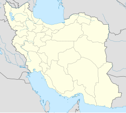
Akhtarabad
Appearance
Akhtarabad
Persian: اختراباد | |
|---|---|
Village | |
| Coordinates: 35°35′32″N 50°35′46″E / 35.59222°N 50.59611°E[1] | |
| Country | Iran |
| Province | Tehran |
| County | Malard |
| District | Safadasht |
| Rural District | Akhtarabad |
| Population (2016)[2] | |
• Total | 430 |
| Time zone | UTC+3:30 (IRST) |
Akhtarabad (Persian: اختراباد)[a] is a village in, and the capital of, Akhtarabad Rural District[4] of Safadasht District of Malard County, Tehran province, Iran.
Demographics
[edit]Population
[edit]At the time of the 2006 National Census, the village's population was 498 in 134 households, when it was in the former Malard District of Shahriar County.[5] The following census in 2011 counted 561 people in 129 households,[6] by which time the district had been separated from the county in the establishment of Malard County. The rural district was transferred to the new Safadasht District.[7] The 2016 census measured the population of the village as 430 people in 135 households. It was the most populous village in its rural district.[2]
See also
[edit]Notes
[edit]References
[edit]- ^ OpenStreetMap contributors (20 September 2024). "Akhtarabad, Malard County" (Map). OpenStreetMap (in Persian). Retrieved 20 September 2024.
- ^ a b Census of the Islamic Republic of Iran, 1395 (2016): Tehran Province. amar.org.ir (Report) (in Persian). The Statistical Center of Iran. Archived from the original (Excel) on 12 December 2021. Retrieved 19 December 2022.
- ^ Akhtarabad can be found at GEOnet Names Server, at this link, by opening the Advanced Search box, entering "-3765633" in the "Unique Feature Id" form, and clicking on "Search Database".
- ^ Mousavi, Mirhossein (30 September 1391) [Approved 10 April 1366]. Creation and formation of 29 rural districts including villages, farms and places in Karaj County under Tehran province. rc.majlis.ir (Report) (in Persian). Ministry of the Interior, Council of Ministers. Notification 118172T943. Archived from the original on 20 December 2012. Retrieved 15 December 2023 – via The Islamic Council Research Center.
- ^ Census of the Islamic Republic of Iran, 1385 (2006): Tehran Province. amar.org.ir (Report) (in Persian). The Statistical Center of Iran. Archived from the original (Excel) on 20 September 2011. Retrieved 25 September 2022.
- ^ Census of the Islamic Republic of Iran, 1390 (2011): Tehran Province. irandataportal.syr.edu (Report) (in Persian). The Statistical Center of Iran. Archived from the original (Excel) on 20 January 2023. Retrieved 19 December 2022 – via Iran Data Portal, Syracuse University.
- ^ Davodi, Parviz (22 April 2009). "The government's agreement with 18 changes in national divisions: Three counties were added to the geographical map of the country". dolat.ir (in Persian). Ministry of the Interior, Board of Ministers. Archived from the original on 5 February 2018. Retrieved 22 November 2023 – via Secretariat of the Government Information Council.

