Aourir
Appearance
Aourir
Awrir / ⴰⵡⵔⵉⵔ | |
|---|---|
Rural commune | |
 | |
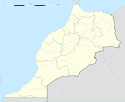
| Coordinates: 30°29′00″N 9°38′00″W / 30.48333°N 9.63333°W | |
| Country | |
| Region | Souss-Massa |
| Province | Agadir-Ida Ou Tanane |
| Population (2004)[1] | |
• Rural commune | 36,948 |
| • Urban | 35,365 |
| Time zone | UTC+0 (WET) |
| • Summer (DST) | UTC+1 (WEST) |
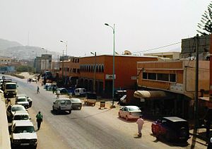
Aourir (Berber: Awrir, ⴰⵡⵔⵉⵔ) is a town and rural commune in Morocco, situated in the suburban area of Agadir (at 12 km from the city of Agadir). According to the 2004 census the town had a population of 21,796 inhabitants.[2] It produces an important quantity of bananas.
References
[edit]- ^ "POPULATION LÉGALE DES RÉGIONS, PROVINCES, PRÉFECTURES, MUNICIPALITÉS, ARRONDISSEMENTS ET COMMUNES DU ROYAUME D'APRÈS LES RÉSULTATS DU RGPH 2014" (in Arabic and French). High Commission for Planning, Morocco. 8 April 2015. Retrieved 29 September 2017.
- ^ "2004 Morocco Population census". Archived from the original on 2017-09-06. Retrieved 2011-07-24.

