Aytat
Aitat | |
|---|---|
Town | |
| Coordinates: 33°47′30″N 35°33′26″E / 33.79167°N 35.55722°E | |
| Country | Lebanon |
| Governorate | Mount Lebanon |
| District | Aley |
| City | Aley |
| Area | |
| • Total | 2.40 km2 (0.93 sq mi) |
| Elevation | 630 m (2,070 ft) |
| Time zone | UTC+2 (EET) |
| • Summer (DST) | UTC+3 (EEST) |
| ISO 3166 code | LB |
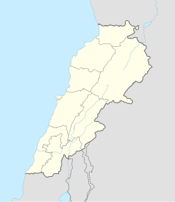
Aitat, or Aytat (Arabic: عيتات), is a town located 5 kilometres (3.1 mi) west of the town of Aley within the district of the same name in the Lebanese governorate of Mount Lebanon. It was a strategic place during the Lebanese Civil War (1975–1990), due to its view to Beirut.
History
[edit]In 1838, Eli Smith noted the place, called Aithath, located in El-Ghurb el-Fokany, upper el-Ghurb.[2]
With its neighboring Christian town of Souk El-Gharb, this town remains one of the most memorable places in Lebanon for the Druze and the Christians as a reminder the fierce and deadly battles that occurred during the Lebanese Civil War. Today Aitat and Souk El-Gharb are considered to be the symbol of unity and forgiveness.[citation needed]
The Abi Saab's, Timani's and Talhouq's, are the most well known families of Aitat and the Aley district.[citation needed]
References
[edit]Bibliography
[edit]External links
[edit]- Aaytat, Localiban

