Beechland (Jeffersontown, Kentucky)
Appearance
Beechland | |
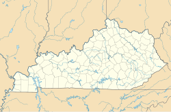
| Location | Jeffersontown, Kentucky |
|---|---|
| Coordinates | 38°11′43″N 85°35′53″W / 38.19526°N 85.59813°W |
| Area | 0.4 acres (0.16 ha) |
| Built | 1812 |
| MPS | Jefferson County MRA |
| NRHP reference No. | 83002633[1] |
| Added to NRHP | July 12, 1983 |
Beechland, in Jeffersontown, Kentucky, was built in 1812. It was listed on the National Register of Historic Places in 1983. The listing included three contributing buildings.[1]
It is a two-story, three-bay, brick side hall plan house with a Flemish bond front facade, with a two-story original ell and a later one-story ell.[2]
The property included a brick smokehouse and a one-story, brick slave quarters, plus later non-contributing farm buildings.[2]
The house was moved to 8808 Stara Way, at 38°11′43″N 85°35′53″W / 38.19528°N 85.59806°W. It previously was located at 8500 Six Mile Lane before suburb construction.[citation needed]
References
[edit]- ^ a b "National Register Information System". National Register of Historic Places. National Park Service. November 2, 2013.
- ^ a b Carol Tobe (August 9, 1979). "Kentucky Historic Resources Inventory: Beechland / Springlake Farm". National Park Service. Retrieved May 7, 2018. With accompanying aerial photo
Categories:
- National Register of Historic Places in Jefferson County, Kentucky
- Houses completed in 1812
- Slave cabins and quarters in the United States
- 1812 establishments in Kentucky
- Houses on the National Register of Historic Places in Kentucky
- Relocated buildings and structures in Kentucky
- Jeffersontown, Kentucky
- Jefferson County, Kentucky Registered Historic Place stubs

