Bower, South Australia
| Bower South Australia | |||||||||||||||
|---|---|---|---|---|---|---|---|---|---|---|---|---|---|---|---|
Public hall | |||||||||||||||
| Coordinates | 34°07′16″S 139°21′18″E / 34.12111°S 139.35500°E | ||||||||||||||
| Population | 41 (SAL 2021)[1] | ||||||||||||||
| Postcode(s) | 5374 | ||||||||||||||
| Location | |||||||||||||||
| LGA(s) | |||||||||||||||
| State electorate(s) | Stuart | ||||||||||||||
| Federal division(s) | Barker, Grey | ||||||||||||||
| |||||||||||||||
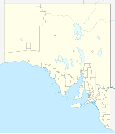
Bower is a town in South Australia, approximately halfway between Eudunda and Morgan[2] on the Thiele Highway.
The area was originally the territory of the Ngadjuri people.[3] The name Bower honours David Bower, a South Australian Member of Parliament (1865 – 1887) who donated land in the state for institutional purposes.[4] By 1916, Bower had become a dispatch centre for mallee timber and roots. These were loaded at the railway station on the Morgan railway line and sent to Adelaide.[5] Bower Public School operated in the town between 1917 and 1960, replacing an earlier Lutheran school forcibly closed during World War I.[4][6][7]
The historic Lime Kiln Ruins on Bower Boundary Road are listed on the South Australian Heritage Register.[8]
References
[edit]- ^ Australian Bureau of Statistics (28 June 2022). "Bower (suburb and locality)". Australian Census 2021 QuickStats. Retrieved 28 June 2022.
- ^ "2905.0 – Statistical Geography: Volume 2 -- Census Geographic Areas, Australia, 2006". Australian Bureau of Statistics. Retrieved 8 December 2009.
- ^ Emmaus to Worlds End: a history of the Robertstown Council Area. "The Area – Its Settlement and Development": District Council of Robertstown. 1986.
- ^ a b "The Manning Index of South Australian History". State Library South Australia. Archived from the original on 24 November 2009. Retrieved 1 February 2010.
- ^ "Bower Railway-Station". The Advertiser. Adelaide. 8 November 1916. Retrieved 1 February 2010.
- ^ Dreckow, Betty (1986). Hills, Valley and Plains: History of the Eudunda District. p. 141.
- ^ "CLOSING GERMAN SCHOOLS". Daily Herald. Vol. 8, no. 2260. South Australia. 18 June 1917. p. 3. Retrieved 24 December 2016 – via National Library of Australia.
- ^ "Lime Kiln Ruins". South Australian Heritage Register. Department of Environment, Water and Natural Resources. Retrieved 8 April 2016.
