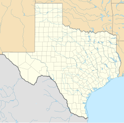
Burrantown, Texas
Appearance
Burrantown, Texas | |
|---|---|
| Coordinates: 31°29′34″N 95°12′18″W / 31.49278°N 95.20500°W | |
| Country | United States |
| State | Texas |
| County | Houston |
| Elevation | 361 ft (110 m) |
| Time zone | UTC-6 (Central (CST)) |
| • Summer (DST) | UTC-5 (CDT) |
| Area code(s) | 430 & 903 |
| GNIS feature ID | 1381557[1] |
Burrantown is an unincorporated community in Houston County, Texas, United States.[1] According to the Handbook of Texas, the community had a population of 70 in 2000.
History
[edit]The area may have been found around 1900.[2]
Geography
[edit]Burrantown is located on Farm to Market Road 1733, 20 mi (32 km) northeast of Crockett in eastern Houston County.[2]
Education
[edit]Children in Burrantown attended school in either Glover or Weches.[2] Today, the community is served by the Kennard Independent School District.
References
[edit]


