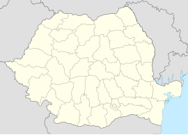
Chirnogeni
Appearance
Chirnogeni | |
|---|---|
 Location in Constanța County | |
| Coordinates: 43°54′0″N 28°14′0″E / 43.90000°N 28.23333°E | |
| Country | Romania |
| County | Constanța |
| Subdivisions | Chirnogeni, Credința, Plopeni |
| Government | |
| • Mayor (2020–2024) | Gheorghe Manta[1] (PSD) |
Area | 116.06 km2 (44.81 sq mi) |
| Population (2021-12-01)[2] | 2,959 |
| • Density | 25/km2 (66/sq mi) |
| Time zone | EET/EEST (UTC+2/+3) |
| Vehicle reg. | CT |
| Website | www |
Chirnogeni is a commune in Constanța County, Northern Dobruja, Romania.
The commune includes two villages:
- Chirnogeni (historical name: Ghiuvenlia, Turkish: Güvenli), named after Chirnogi, whence many settlers came[3]
- Credința (historical name: Sofular, Turkish: Sofular)
- Plopeni (historical name: Cavaclar, Turkish: Kavaklar)
Demographics
[edit]At the 2011 census, Chirnogeni had 3,105 Romanians (98.98%), 26 Roma (0.83%), 4 Turks (0.13%), 2 others (0.06%).
Natives
[edit]References
[edit]- ^ "Results of the 2020 local elections". Central Electoral Bureau. Retrieved 15 June 2021.
- ^ "Populaţia rezidentă după grupa de vârstă, pe județe și municipii, orașe, comune, la 1 decembrie 2021" (XLS). National Institute of Statistics.
- ^ Chirnogeni Village Hall, History of Chirnogeni, accessed on June 3, 2012

