Circle Hot Springs Airport
Appearance
Circle Hot Springs Airport | |||||||||||
|---|---|---|---|---|---|---|---|---|---|---|---|
| Summary | |||||||||||
| Airport type | Public | ||||||||||
| Owner | Alaska DOT&PF - Northern Region | ||||||||||
| Serves | Circle Hot Springs, Alaska | ||||||||||
| Elevation AMSL | 956 ft / 291 m | ||||||||||
| Coordinates | 65°29′08″N 144°36′39″W / 65.48556°N 144.61083°W | ||||||||||
| Map | |||||||||||
 | |||||||||||
| Runways | |||||||||||
| |||||||||||
| Statistics (2015) | |||||||||||
| |||||||||||
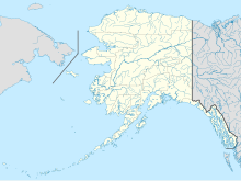
Circle Hot Springs Airport (IATA: CHP, FAA LID: CHP) is a state-owned public-use airport serving Circle Hot Springs, in the Yukon-Koyukuk Census Area of the U.S. state of Alaska.[1]
Facilities and aircraft
[edit]Circle Hot Springs Airport covers an area of 37 acres (15 ha) at an elevation of 956 feet (291 m) above mean sea level. It has one runway designated 8/26 with a gravel surface measuring 3,650 by 80 feet (1,113 x 24 m). For the 12-month period ending December 31, 2005, the airport had 3,600 aircraft operations, an average of 300 per month: 72% general aviation and 28% air taxi.[1]
See also
[edit]References
[edit]- ^ a b c FAA Airport Form 5010 for CHP PDF, effective January 5, 2017.
External links
[edit]- FAA Alaska airport diagram (GIF)
- Resources for this airport:
- FAA airport information for CHP
- AirNav airport information for CHP
- ASN accident history for CHP
- FlightAware airport information and live flight tracker
- SkyVector aeronautical chart for CHP
