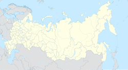
Gandalbos
Gandalbos
Гандалбос | |
|---|---|
| Other transcription(s) | |
| • Ingush | ГӀандал-Босе |
| Coordinates: 43°03′54″N 45°08′33″E / 43.06500°N 45.14250°E | |
| Country | Russia |
| Federal subject | Ingushetia |
| Government | |
| • Head | Khairov Bakhit Khasanovich |
| Population | |
• Total | 0 |
| 0 | |
| • Subordinated to | Sunzhensky District |
Gandalbos (Ingush: ГӀандал-Босе, romanized: Ghandal-Bose)[4] is rural locality (a selo) in Sunzhensky District of the Republic of Ingushetia, Russia, located on the left bank of the river Fortanga. It is part of the municipality of the rural settlement of Dattykh.
Etymology
[edit]The name Gandalbos comes from the Ingush language and is a combination of Gandal (a proper noun) and bos (hillside), literally translates as the hillside of Gandal.[5]
History
[edit]Gandalbos is an ancient ancestral village of the Gandaloy clan (teip).
On January 6, 1851, in order to punish the highlanders for their insolence, General Sleptsov gathered a detachment and under the command of Lieutenant Colonel Mezentsev made a punitive expedition on Dattykh and Gandalbos, which has long been known as the nest of the most courageous robbers. The punitive expedition ended successfully for the Russian Empire and the detachment continued cutting down forests.[6]
Since 1926, Gandalbos was part of the Galashkinsky District of the Ingush Autonomous Oblast.[7] The Ingush lived in the village (according to the 1926 census).[8] The population of the village as of 1988 was about 10 people.[9] As of 1995, Gandalbos was still marked on maps as a residential settlement.[citation needed] The village was abandoned by the inhabitants, probably in the second half of the 1990s, or in the 2000s.
In 2021, on the territory of the village of Dattykh, work began on laying an asphalt road.[10]
Geography
[edit]Gandalbos is located on the left bank of the Fortanga river, at the foot of the Azhduk mountain range. The nearest settlements: in the north - the village of Arshty, in the southwest (upstream of the Fortanga) - the village of Dattykh, in the northeast (downstream of the Fortanga) - the village of Bamut.[11]
Notes
[edit]References
[edit]- ^ Russian Federal State Statistics Service (2011). Всероссийская перепись населения 2010 года. Том 1 [2010 All-Russian Population Census, vol. 1]. Всероссийская перепись населения 2010 года [2010 All-Russia Population Census] (in Russian). Federal State Statistics Service.
- ^ "Таблица 5. Численность населения России, федеральных округов, субъектов Российской Федерации, городских округов, муниципальных районов, муниципальных округов, городских и сельских поселений, городских населенных пунктов, сельских населенных пунктов с населением 3000 человек и более".
- ^ Reestr zaregistrirovannykh v AGKGN geograficheskikh nazvaniy ob'ektov na 17.12.2021: Republika Ingushetia, p. 4.
- ^ Кодзоев & Киева 2021, p. 37.
- ^ Доклад о границах и территории Ингушетии 2021, p. 73.
- ^ Новоселов, Семен, ed. (1857). Кавказцы или подвиги и жизнь замѣчательныхъ лицъ дѣйствовавшихъ на Кавказѣ. Выпуски 1 и 2 [Caucasians or the exploits and lives of remarkable persons who acted in the Caucasus. Issues 1 and 2] (in Russian). Санктпетербургъ: Типографія Якова Трея. p. 17.
- ^ "Всемирный исторический проект. Республика Ингушетия" [Worldwide Historical Project. The Republic of Ingushetia]. www.wwhp.ru (in Russian). Archived from the original on 2012-01-07.
- ^ Северо-Кавказское кравое статистическое управление (1929). Поселенные итоги переписи 1926 года по Северо-Кавказскому краю [Settled results of the 1926 census in the North Caucasus region] (in Russian). Ростов-на-Дону: Отдел переписи. p. 405.
- ^ Лист карты K-38-31 Орджоникидзевская. Масштаб: 1 : 100 000. Состояние местности на 1984 год. Издание 1988 г.
- ^ Евлоев, Магомет (2021-06-03). "Жизнь возвращается в село 17-километровую дорогу начали строить в Ингушетии от федеральной трассы к селу Даттых" [Life returns to the village 17-kilometer road started to be built in Ingushetia from the federal highway to the village of Dattykh]. «Ингушетия» (in Russian). Archived from the original on 2022-05-14. Retrieved 2022-05-14.
- ^ "Map of Chechnya and Ingushetia".(rar) (not earlier than 1995). Volume 8 MB
Bibliography
[edit]- Кодзоев, Н. Д.; Киева, З. Х. (2021). Накостхоев, Х. А.; Хайрова, Р. Р. (eds.). Ономастикон Ингушетии [Onomasticon of Ingushetia] (in Russian). Москва: ТПК «Центробланк». pp. 1–121. ISBN 978-5-91303-022-1.
- Общенациональная Комиссия по рассмотрению вопросов, связанных с определением территории и границ Ингушетии (2021). Всемирный конгресс ингушского народа (ed.). Доклад о границах и территории Ингушетии (общие положения) [Report on the borders and territory of Ingushetia (general provisions)] (archival documents, maps, illustrations) (in Russian). Назрань. pp. 1–175.
{{cite book}}: CS1 maint: location missing publisher (link) - "Реестр зарегистрированных в АГКГН географических названий объектов на 17.12.2021: Республика Ингушетия" [Register of registered in AGKGN geographical names of objects as of 12/17/2021: Republic of Ingushetia] (in Russian).


