Keewaywin Airport
Appearance
Keewaywin Airport | |||||||||||
|---|---|---|---|---|---|---|---|---|---|---|---|
| Summary | |||||||||||
| Airport type | Public | ||||||||||
| Operator | Government of Ontario | ||||||||||
| Location | Keewaywin First Nation | ||||||||||
| Time zone | CST (UTC−06:00) | ||||||||||
| • Summer (DST) | CDT (UTC−05:00) | ||||||||||
| Elevation AMSL | 990 ft / 302 m | ||||||||||
| Coordinates | 52°59′28″N 092°50′11″W / 52.99111°N 92.83639°W | ||||||||||
| Map | |||||||||||
 | |||||||||||
| Runways | |||||||||||
| |||||||||||
Source: Canada Flight Supplement[1] | |||||||||||
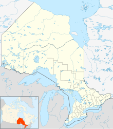
Keewaywin Airport (IATA: KEW, TC LID: CPV8) is located 2 nautical miles (3.7 km; 2.3 mi) southwest of the First Nations community of Keewaywin, Ontario, Canada.
References
[edit]
