Khafrak-e Olya Rural District
Appearance
Khafrak-e Olya Rural District
Persian: دهستان خفرک علیا | |
|---|---|
| Coordinates: 30°04′44″N 52°54′36″E / 30.07889°N 52.91000°E[1] | |
| Country | Iran |
| Province | Fars |
| County | Marvdasht |
| District | Seyyedan |
| Capital | Seyyedan |
| Population (2016)[2] | |
• Total | 11,310 |
| Time zone | UTC+3:30 (IRST) |
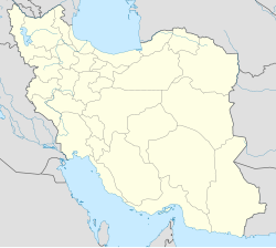
Khafrak-e Olya Rural District (Persian: دهستان خفرک علیا)[3] is in Seyyedan District of Marvdasht County, Fars province, Iran.[4] It is administered from the city of Seyyedan.[5]
Demographics
[edit]Population
[edit]At the time of the 2006 National Census, the rural district's population was 9,987 in 2,621 households.[6] There were 9,974 inhabitants in 2,919 households at the following census of 2011.[7] The 2016 census measured the population of the rural district as 11,310 in 3,533 households. The most populous of its 50 villages was Faruq (now a city),[8] with 5,860 people.[2]
See also
[edit]References
[edit]- ^ OpenStreetMap contributors (8 October 2024). "Khafrak-e Olya Rural District (Marvdasht County)" (Map). OpenStreetMap (in Persian). Retrieved 8 October 2024.
- ^ a b Census of the Islamic Republic of Iran, 1395 (2016): Fars Province. amar.org.ir (Report) (in Persian). The Statistical Center of Iran. Archived from the original (Excel) on 6 April 2022. Retrieved 19 December 2022.
- ^ "INCSGN Search". Iranian National Committee for Standardization of Geographical Names (in Persian). Tehran: National Cartographic Center of Iran. Archived from the original on 2 May 2019.
- ^ Habibi, Hassan (c. 2023) [Approved 16 November 1373]. Creation and establishment of Seyyedan and Meymand Districts in Fars province. lamtakam.com (Report) (in Persian). Ministry of the Interior, Political-Defense Commission of the Government Board. Proposal 1.4.42.5231; Notification 4313/T14138AH. Archived from the original on 8 December 2023. Retrieved 8 December 2023 – via Lam ta Kam.
- ^ Mousavi, Mirhossein (12 March 2014) [Approved 10 April 1366]. Creation and formation of 17 rural districts including villages, farms and places in a part of Marvdasht County under Fars province. rc.majlis.ir (Report) (in Persian). Ministry of the Interior, Council of Ministers. Proposal 53.1.11954; Notification 77352/T618. Archived from the original on 2 June 2014. Retrieved 7 December 2023 – via Research Center, the System of Laws of the Islamic Council of the Farabi Library.
- ^ Census of the Islamic Republic of Iran, 1385 (2006): Fars Province. amar.org.ir (Report) (in Persian). The Statistical Center of Iran. Archived from the original (Excel) on 20 September 2011. Retrieved 25 September 2022.
- ^ Census of the Islamic Republic of Iran, 1390 (2011): Fars Province. irandataportal.syr.edu (Report) (in Persian). The Statistical Center of Iran. Archived from the original (Excel) on 16 January 2023. Retrieved 19 December 2022 – via Iran Data Portal, Syracuse University.
- ^ Jahangiri, Ishaq (c. 2023) [Approved 8 December 2017]. Letter of approval regarding the conversion of Faruq village of Marvdasht County and Dehkuyeh village of Larestan County in Fars province into cities. qavanin.ir (Report) (in Persian). Ministry of the Interior, Council of Ministers. Proposal 160540. Archived from the original on 24 September 2023. Retrieved 24 September 2023 – via Laws and Regulations Portal of the Islamic Republic of Iran.

