Kinney Point State Park
Appearance
| Kinney Point State Park | |
|---|---|
| Location | Jefferson, Washington, United States |
| Coordinates | 48°00′31″N 122°41′23″W / 48.00861°N 122.68972°W[1] |
| Area | 67 acres (27 ha) |
| Elevation | 39 ft (12 m)[1] |
| Established | Unspecified |
| Operator | Washington State Parks and Recreation Commission |
| Website | Kinney Point State Park |
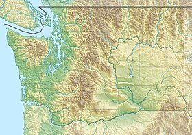
Kinney Point State Park is a 67-acre (27 ha) Washington marine state park in Jefferson County. The park sits on 683 feet (208 m) of shoreline at the south end of Marrowstone Island and has no upland access. The park is part of the Cascadia Marine Trail with campsites restricted to boaters arriving by other than motorized means. Park activities include fishing, clam digging, and crabbing.[2]
References
[edit]- ^ a b "Kinney Point". Geographic Names Information System. United States Geological Survey, United States Department of the Interior.
- ^ "Kinney Point State Park". Washington State Parks and Recreation Commission. Retrieved August 14, 2018.
External links
[edit]- Kinney Point State Park Washington State Parks and Recreation Commission
- Kinney Point State Park Map Washington State Parks and Recreation Commission

