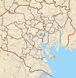
Kita-Aoyama
Appearance
Kita-Aoyama
北青山 | |
|---|---|
District | |
 | |
| Coordinates: 35°40′21.39″N 139°43′5.43″E / 35.6726083°N 139.7181750°E | |
| Country | Japan |
| City | Tokyo |
| Ward | Minato |
| Area | |
• Total | 0.50 km2 (0.19 sq mi) |
| Population (August 1, 2019)[2] | |
• Total | 2,633 |
| • Density | 5,300/km2 (14,000/sq mi) |
| Time zone | UTC+9 (JST) |
| Postal code | 107-0061[3] |
| Area code | 03 |
Kita-Aoyama (北青山, Kitaaoyama) is a district of Minato, Tokyo, Japan.
Education
[edit]Minato City Board of Education operates public elementary and junior high schools.
Kita-Aoyama 1-2-chōme and 3-chōme 1-4-ban are zoned to Aoyama Elementary School (青山小学校). 3-chōme 5-15-ban are zoned to Seinan Elementary School (青南小学校). All of Kita Aoyama is zoned to Aoyama Junior High School (青山中学校)[4]
-
Aoyama Junior High School (青山中学校)
References
[edit]- ^ "平成27年国勢調査による各総合支所管内別の町丁目別面積・昼夜人口等". 港区. 2015-10-01. Retrieved 2019-09-08.
- ^ "各月1日現在の各総合支所管内別の町丁目別人口・世帯数(平成14年~平成31年・令和元年)". 港区. 2019-08-01. Retrieved 2019-09-08.
- ^ "郵便番号". 日本郵便. Retrieved 2019-08-30.
- ^ "港区立小・中学校通学区域一覧表(令和4年4月以降)" (PDF). City of Minato. Retrieved 2022-10-08.


