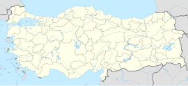
Obalı, Baykan
Appearance
Obalı | |
|---|---|
| Coordinates: 38°09′22″N 41°48′40″E / 38.156°N 41.811°E | |
| Country | Turkey |
| Province | Siirt |
| District | Baykan |
| Population (2021)[1] | 378 |
| Time zone | UTC+3 (TRT) |
Obalı (Kurdish: Nêrban) is a village in the Baykan District of Siirt Province in Turkey.[2] The village is populated by Kurds of the Etmanekî tribe and had a population of 378 in 2021.[1][3]
The hamlets of Akbudak (Çemê Çawîş), Akdiken (Gayîna), Dumanlı (Tahtêreş), Köklü (Ginê), Ocaklı and Yelkesen are attached to Obalı.[2]
References
[edit]- ^ a b "31 ARALIK 2021 TARİHLİ ADRESE DAYALI NÜFUS KAYIT SİSTEMİ (ADNKS) SONUÇLARI" (XLS). TÜİK (in Turkish). Retrieved 16 December 2022.
- ^ a b "Türkiye Mülki İdare Bölümleri Envanteri". T.C. İçişleri Bakanlığı (in Turkish). Retrieved 19 December 2022.
- ^ Çabuk, Mehmet Ali (2017). Etmi-Etmaneki Aşireti Tarihi ve Röportajlar (in Turkish). Ozan. p. 41.
