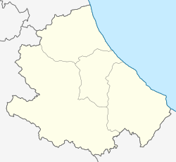
Palmoli
Appearance
Palmoli | |
|---|---|
| Comune di Palmoli | |
 The tower | |
| Coordinates: 41°56′22″N 14°34′53″E / 41.93944°N 14.58139°E | |
| Country | Italy |
| Region | Abruzzo |
| Province | Chieti (CH) |
| Frazioni | Cannavela, Fonte la Casa, Immerse, Melania, Pezzo Grosso, Santo Ianni |
| Government | |
| • Mayor | Giuseppe Rosario Masciulli |
| Area | |
• Total | 32.78 km2 (12.66 sq mi) |
| Elevation | 711 m (2,333 ft) |
| Population (31 December 2017)[2] | |
• Total | 922 |
| • Density | 28/km2 (73/sq mi) |
| Demonym | Palmolesi |
| Time zone | UTC+1 (CET) |
| • Summer (DST) | UTC+2 (CEST) |
| Postal code | 66050 |
| Dialing code | 0873 |
| Patron saint | San Valentino |
| Saint day | 14 February |
| Website | Official website |
Palmoli (Abruzzese: Pàlmërë) is a comune and town in the province of Chieti, Abruzzo, south-eastern Italy.
Climate
[edit]| Climate data for Palmoli, elevation 650 m (2,130 ft), (1951–2000) | |||||||||||||
|---|---|---|---|---|---|---|---|---|---|---|---|---|---|
| Month | Jan | Feb | Mar | Apr | May | Jun | Jul | Aug | Sep | Oct | Nov | Dec | Year |
| Record high °C (°F) | 17.9 (64.2) |
20.7 (69.3) |
24.0 (75.2) |
27.5 (81.5) |
32.0 (89.6) |
40.0 (104.0) |
39.0 (102.2) |
38.8 (101.8) |
34.3 (93.7) |
29.1 (84.4) |
25.3 (77.5) |
19.5 (67.1) |
40.0 (104.0) |
| Mean daily maximum °C (°F) | 6.9 (44.4) |
7.7 (45.9) |
10.3 (50.5) |
14.6 (58.3) |
19.6 (67.3) |
23.9 (75.0) |
27.1 (80.8) |
27.1 (80.8) |
23.1 (73.6) |
17.1 (62.8) |
11.7 (53.1) |
8.4 (47.1) |
16.5 (61.6) |
| Daily mean °C (°F) | 4.1 (39.4) |
4.6 (40.3) |
6.8 (44.2) |
10.5 (50.9) |
15.2 (59.4) |
19.2 (66.6) |
22.2 (72.0) |
22.2 (72.0) |
18.6 (65.5) |
13.5 (56.3) |
8.7 (47.7) |
5.7 (42.3) |
12.6 (54.7) |
| Mean daily minimum °C (°F) | 1.4 (34.5) |
1.4 (34.5) |
3.3 (37.9) |
6.4 (43.5) |
10.8 (51.4) |
14.5 (58.1) |
17.2 (63.0) |
17.2 (63.0) |
14.1 (57.4) |
9.9 (49.8) |
5.7 (42.3) |
3.0 (37.4) |
8.7 (47.7) |
| Record low °C (°F) | −13.0 (8.6) |
−10.4 (13.3) |
−11.7 (10.9) |
−4.8 (23.4) |
1.5 (34.7) |
5.9 (42.6) |
8.3 (46.9) |
6.6 (43.9) |
1.8 (35.2) |
−1.5 (29.3) |
−4.9 (23.2) |
−8.7 (16.3) |
−13.0 (8.6) |
| Average precipitation mm (inches) | 67.6 (2.66) |
51.0 (2.01) |
63.2 (2.49) |
63.1 (2.48) |
50.8 (2.00) |
46.0 (1.81) |
35.7 (1.41) |
42.2 (1.66) |
60.3 (2.37) |
74.3 (2.93) |
89.3 (3.52) |
71.3 (2.81) |
714.8 (28.15) |
| Average precipitation days | 8.0 | 7.4 | 8.6 | 7.4 | 7.0 | 6.0 | 4.1 | 4.8 | 5.9 | 7.9 | 9.2 | 8.7 | 85 |
| Source: Regione Abruzzo[3] | |||||||||||||
See also
[edit]References
[edit]Wikimedia Commons has media related to Palmoli.
- ^ "Superficie di Comuni Province e Regioni italiane al 9 ottobre 2011". Italian National Institute of Statistics. Retrieved 16 March 2019.
- ^ All demographics and other statistics from the Italian statistical institute (Istat)
- ^ "VALORI MEDI CLIMATICI DAL 1951 AL 2000 NELLA REGIONE ABRUZZO" (PDF). Regione Abruzzo. Archived from the original (PDF) on 30 June 2024. Retrieved 30 June 2024.


