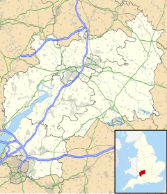
Rudford and Highleadon
Appearance
| Rudford and Highleadon | |
|---|---|
 St Mary's Church, Rudford | |
 New houses, Highleadon | |
Location within Gloucestershire | |
| Area | 5.283 km2 (2.040 sq mi) |
| Population | 288 (2011 census) |
| • Density | 55/km2 (140/sq mi) |
| Civil parish |
|
| District | |
| Shire county | |
| Region | |
| Country | England |
| Sovereign state | United Kingdom |
| Police | Gloucestershire |
| Fire | Gloucestershire |
| Ambulance | South Western |
Rudford and Highleadon is a civil parish in Gloucestershire, England, made up of Rudford and Highleadon. It is in the Forest of Dean District. In 2011, its population was 288.[1] It has a parish council, the lowest tier of local government.[2][3]
The area of the parish is 527.88 hectares (2.0382 sq mi).[1]
History
[edit]On 1 April 1935 the parish of Highleadon was merged with Rudford,[4] on 16 September 1976 the parish was renamed "Rudford and Highleadon".[5][6]
References
[edit]- ^ a b UK Census (2011). "Local Area Report – Rudford and Highleadon Parish (E04004322)". Nomis. Office for National Statistics. Retrieved 23 June 2024.
- ^ "Rudford and Highleadon Parish Council". Retrieved 23 June 2024.
- ^ "Parish council - Rudford & Highleadon". meetings.fdean.gov.uk. Forest of Dean District Council. 23 June 2024. Retrieved 23 June 2024.
- ^ "Newent Registration District". UKBMD. Retrieved 7 December 2022.
- ^ "Gloucester Registration District". UKBMD. Retrieved 7 December 2022.
- ^ "Parishes within Forest of Dean". Gloucestershire County Council. 2007. Archived from the original on 2007-08-28. Retrieved 2008-05-01.
External links
[edit]- Rudford and Highleadon Civil parish at MapIt UK
