Santa Luzia, Minas Gerais
Appearance
From Wikipedia, the free encyclopedia
Municipality in Southeast, Brazil
Santa Luzia | |
|---|---|
| Municipality of Santa Luzia | |
| Motto: Hodie et Semper Nihil Déficit | |
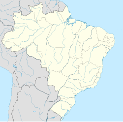
 Location in the state of Minas Gerais | |
| Coordinates: 19°46′12″S 43°51′2″W / 19.77000°S 43.85056°W / -19.77000; -43.85056 | |
| Country | Brazil |
| Region | Southeast |
| State | Minas Gerais |
| Founded | 1692 |
| Incorporated (as city) | March 18, 1847 |
| Government | |
| • Mayor | Carlos Calixto |
| Area | |
| 233.7 km2 (90.2 sq mi) | |
| • Urban | 35 km2 (14 sq mi) |
| Elevation | 751 m (2,464 ft) |
| Population (2020 [1]) | |
| 220,444 | |
| • Density | 880/km2 (2,300/sq mi) |
| Demonym | luziense |
| Time zone | UTC−3 (BRT) |
| HDI (2010) | 0.715 – high[2] |
Santa Luzia is a Brazilian municipality located in the state of Minas Gerais. The city belongs to the mesoregion Metropolitana de Belo Horizonte and to the microregion of Belo Horizonte. Its population in 2020 was 220,444.
See also
[edit]References
[edit]- ^ IBGE 2020
- ^ "Archived copy" (PDF). United Nations Development Programme (UNDP). Archived from the original (PDF) on July 8, 2014. Retrieved August 1, 2013.
{{cite web}}: CS1 maint: archived copy as title (link)
This geographical article relating to Minas Gerais is a stub. You can help Wikipedia by expanding it. |
Hidden categories:


