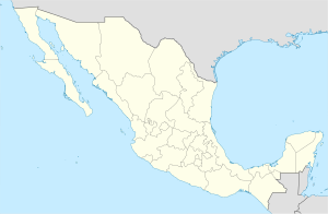
Santa María Temaxcaltepec
Santa María Temaxcaltepec | |
|---|---|
Municipality and town | |
| Coordinates: 16°10′N 97°12′W / 16.167°N 97.200°W | |
| Country | |
| State | Oaxaca |
| Area | |
| • Total | 86.8 km2 (33.5 sq mi) |
| Elevation | 1,320 m (4,330 ft) |
| Population (2005) | |
| • Total | 2,628 |
| Time zone | UTC-6 (Central Standard Time) |
| • Summer (DST) | UTC-5 (Central Daylight Time) |
Santa María Temaxcaltepec is a town and municipality in Oaxaca in south-western Mexico. It is part of the Juquila District in the center of the Costa Region.
Name
[edit]The name "Temaxcaltepec" means "hill of baths", a reference to the use of steam baths or sweat lodges to cure the sick.[1]
Geography
[edit]The municipality covers an area of 86.8 km2 at an elevation of 1,320 above sea level. The terrain is rugged, in the foothills of the Sierra Madre del Sur. Rainfall of 2,057 mm occurs mostly between June and October.
Flora and fauna
[edit]Flora include amate, fig, locust, avocado, mahogany, oak, cedar, palm, hormiguillo and pastures. Wildlife includes squirrels, armadillos, opossum, fox and badger.[1]
Demography
[edit]As of 2005, the municipality had 505 households with a total population of 2,628 of whom 2,081 spoke an indigenous language. Agriculture is the main economic activity.[1] Temaxcaltepec is one of the centers of the Chatino people, related to the Zapotec but with a distinct language.[2] Municipal representatives are selected according to the traditional indigenous system (usos y costumbres). In December 2007 there were disturbances when the state electoral authority failed to recognize the leaders who had been selected in this way.[3]
References
[edit]- ^ a b c "Santa María Temaxcaltepec". Enciclopedia de los Municipios de México. Instituto Nacional para el Federalismo y el Desarrollo Municipal. Retrieved 2010-07-24.
- ^ "Chatino of Oaxaca". Mexican Textiles. Retrieved 2010-07-24.
- ^ "Lauro Juárez : Disappeared". Protection International AISBL. 8 January 2008. Retrieved 2010-07-24.
