Shoal Lake 39A
Appearance
Shoal Lake 39A | |
|---|---|
| Shoal Lake Indian Reserve No. 39A | |
| Coordinates: 49°39′N 95°05′W / 49.650°N 95.083°W | |
| Country | |
| Provinces | |
| District / Division | Kenora / Division 1 |
| First Nation | Iskatewizaagegan 39 |
| Area | |
| • Land | 34.33 km2 (13.25 sq mi) |
| Population | |
| • Total | 388 |
| • Density | 11.3/km2 (29/sq mi) |
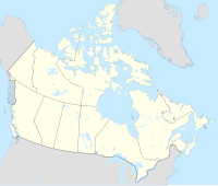
Shoal Lake 39A is a First Nations reserve straddling the border of Manitoba and Ontario on the shores of Shoal Lake. It is one of the reserves of the Iskatewizaagegan 39 Independent First Nation.
References
[edit]- ^ a b "Shoal Lake (part) 39A census profile". 2011 Census of Population. Statistics Canada. 8 February 2012. Retrieved 22 June 2015.
- ^ a b "Shoal Lake (part) 39A census profile". 2011 Census of Population. Statistics Canada. 8 February 2012. Retrieved 22 June 2015.


