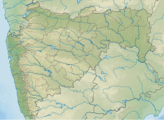
Tikhol Dam
Appearance
| Tikhol Dam | |
|---|---|
| Official name | Tikhol Dam |
| Location | Tikhol, Parner India |
| Coordinates | 19°8′31″N 74°25′28″E / 19.14194°N 74.42444°E |
| Opening date | 1975 |
| Owner(s) | Government of Maharashtra, India |
| Dam and spillways | |
| Type of dam | Earth-fill (Earthen) |
| Impounds | Kalu River |
| Height | 18.53 m (60.8 ft) |
| Length | 360 m (1,180 ft) |
| Reservoir | |
| Creates | Tikhol lake |
| Total capacity | 1,700 km3 (410 cu mi) |
| Surface area | 64 km2 (25 sq mi) |
Tikhol Dam (Marathi: तिखोल धरण) is an earth-fill dam on Kalu river in Tikhol village in Parner taluka of Ahmednagar district of state of Maharashtra in India.
Specifications
[edit]The height of the dam above lowest foundation is 18.53 m (60.8 ft) while the length is 360 m (1,180 ft). The gross storage capacity is 2,430 km3 (580 cu mi).[1]
Purpose
[edit]- Irrigation
- Drinking water for neatest villages
See also
[edit]References
[edit]- ^ Specifications of large dams in India Archived 2011-07-21 at the Wayback Machine


