Tlacotepec
Appearance
Tlacotepec | |
|---|---|
Municipal seat and city | |
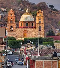
 Church of St. James the Apostle in Tlacotepec | |
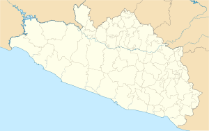
| Coordinates: 17°46′N 99°59′W / 17.767°N 99.983°W | |
| Country | |
| State | Guerrero |
| Municipality | General Heliodoro Castillo |
| Time zone | UTC-6 (Zona Centro) |
Tlacotepec is a city in the southern Mexican state of Guerrero. It serves as the seat of the municipality of General Heliodoro Castillo.[1]
Home to many ranchos called Aguacate, El Limoncito,Huautla,Ojo de Agua, Tepehuaje,Tiquimil, Chichiltepec, Tepetlapa, Los Naranjos (El Amatito del Naranjo), Pelón Xóchitl,La Cucaracha (La Guadalupe),Las Piñas, and many more.
References
[edit]- ^ Instituto Nacional de Estadística y Geografía. Principales resultados por localidad 2005 (ITER). Retrieved on December 23, 2008

