Jump to content

User:Rob984/Locator maps of countries in Europe

From Wikipedia, the free encyclopedia

Geographic features, regions and geopolitical organisations

[edit]
Orthographic map
(green-grey)
Orthographic map
(green-grey, no internal borders)
Orthographic map
(green-grey, no borders)
Map within Europe
(green-grey globe)
Map within Europe
(green-grey globe, no internal borders)
Map within Europe
(green-grey zoom)
Map within Europe
(green-grey zoom, no internal borders)
Map within Europe
(green-grey zoom, no borders)
Notes
Category C:Category:SVG locator maps of Europe (green and grey globe scheme)

C:Category:SVG locator maps of countries of Europe (green and grey globe scheme)

C:Category:SVG locator maps of Europe (green and grey scheme)

C:Category:SVG locator maps of countries of Europe (green and grey scheme)

Blank Version of File:Europe-Blank (with borders).svg without inset (and neutral grey with different disputed borders): File:Location European nation states.svg
Europe Version of File:Europe-Europe (with borders).svg without inset: File:Locator map of Europe.svg
Mainland Europe File:Europe-Mainland Europe.svg
Northern Europe File:Northern Europe (orthographic projection; no borders).svg File:Europe-Northern Europe (orthographic projection).svg File:Europe-Northern Europe.svg File:Europe-Northern Europe (no borders).svg
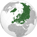
Eastern Europe File:Eastern Europe (orthographic projection; no borders).svg File:Europe-Eastern Europe (orthographic projection).svg File:Europe-Eastern Europe.svg File:Europe-Eastern Europe (no borders).svg
Southeast Europe File:Southeast Europe (orthographic projection).svg File:Southeast Europe (orthographic projection; no borders).svg File:Europe-Southeast Europe (orthographic projection).svg File:Europe-Southeast Europe.svg File:Europe-Southeast Europe (no borders).svg
Southern Europe File:Southern Europe (orthographic projection; no borders).svg File:Europe-Southern Europe (orthographic projection).svg File:Europe-Southern Europe.svg File:Europe-Southern Europe (no borders).svg
Southwest Europe / Iberia File:Iberia (orthographic projection; no borders).svg File:Europe-Iberia (orthographic projection).svg File:Europe-Iberia.svg File:Europe-Iberia (no borders).svg
Western Europe File:Western Europe (orthographic projection; no borders).svg File:Europe-Western Europe (orthographic projection).svg File:Europe-Western Europe.svg File:Europe-Western Europe (no borders).svg
Northwestern Europe File:Northwestern Europe (orthographic projection; no borders).svg File:Europe-Northwestern Europe (orthographic projection).svg File:Europe-Northwestern Europe.svg File:Europe-Northwestern Europe (no borders).svg
Fennoscandia File:Fennoscandia (orthographic projection; no borders).svg File:Europe-Fennoscandia (orthographic projection).svg File:Europe-Fennoscandia.svg File:Europe-Fennoscandia (no borders).svg
Scandinavian Peninsula File:Scandinavian Peninsula (orthographic projection; no borders).svg File:Europe-Scandinavian Peninsula (orthographic projection).svg File:Europe-Scandinavian Peninsula.svg File:Europe-Scandinavian Peninsula (no borders).svg
British Isles File:British Isles (orthographic projection; no borders).svg File:Europe-British Isles (orthographic projection).svg File:Europe-British Isles.svg File:Europe-British Isles (no borders).svg
Great Britain File:Great Britain (orthographic projection; with borders).svg File:Europe-Island of Great Britain.svg
Ireland
European countries / European Union maximum enlargement File:European countries (orthographic projection; no borders).svg File:Europe-European countries (orthographic projection).svg File:Europe-European countries (orthographic projection; no internal borders).svg File:Europe-European countries.svg File:Europe-European countries (no internal borders).svg File:Europe-European countries (no borders).svg
Council of Europe File:Europe-Council of Europe (orthographic projection).svg
European Union File:Europe-EU (orthographic projection; no internal borders).svg
European Free Trade Association File:EFTA (orthographic projection).svg File:Europe-EFTA (orthographic projection).svg
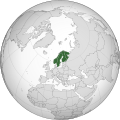
Nordic countries File:Europe-Nordic countries (orthographic projection).svg
Nordic Council File:Nordic Council (orthographic projection).svg File:Nordic Council (orthographic projection; no internal borders).svg File:Europe-Nordic Council (orthographic projection).svg File:Europe-Nordic Council (orthographic projection; no internal borders).svg File:Europe-Nordic Council.svg File:Europe-Nordic Council (no internal borders).svg
Scandinavia File:Europe-Scandinavia (orthographic projection).svg
Benelux File:Benelux (orthographic projection; no internal borders).svg File:Europe-Benelux (orthographic projection).svg File:Europe-Benelux (orthographic projection; no internal borders).svg File:Europe-Benelux (no internal borders).svg

Countries

[edit]
Orthographic map
(green-grey)
Map within Europe
(green-grey globe)
Map within Europe
(green-grey zoom)
Notes
Category C:Category:SVG locator maps of countries of Europe (green and grey globe scheme)

C:Grey-green orthographic projections maps#Europe

C:Category:SVG locator maps of countries of Europe (green and grey globe scheme)

C:Category:SVG locator maps of countries in European Union (green and grey globe scheme)

C:Category:SVG locator maps of countries of Europe (green and grey scheme)

C:Category:SVG locator maps of countries in European Union (green and grey scheme)

Belarus
Finland
France
Germany
Italy
Norway
Poland
Romania
Spain
Sweden
Ukraine
United Kingdom
United Kingdom (post-EU)
pFad - Phonifier reborn

Pfad - The Proxy pFad of © 2024 Garber Painting. All rights reserved.

Note: This service is not intended for secure transactions such as banking, social media, email, or purchasing. Use at your own risk. We assume no liability whatsoever for broken pages.


Alternative Proxies:

Alternative Proxy

pFad Proxy

pFad v3 Proxy

pFad v4 Proxy