Waubonsie State Park
| Waubonsie State Park | |
|---|---|
 Waubonsie State Park, May 2014 | |
| Location | Fremont County, Iowa, United States |
| Coordinates | 40°40′20″N 95°41′18″W / 40.67222°N 95.68833°W |
| Area | 1,990 acres (8.1 km2)[1] |
| Elevation | 1,099 ft (335 m)[2] |
| Established | 1926 |
| Named for | Chief Wabaunsee |
| Governing body | Iowa Department of Natural Resources |
| Website | Waubonsie State Park |
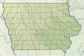
Waubonsie State Park is a state park in Fremont County, Iowa, United States, located in the Loess Hills region. It is named for Chief Wabaunsee of the Potawatomi people.
Waubonsie State Park is located in the unique Loess Hills, a landform found only along the Missouri River in Iowa and Missouri. As glaciers melted 14,000 to 28,000 years ago, the Missouri River became a major channel for huge volumes of water and sediment during the summer. In winter, the volume of the meltwater was reduced, leaving the deposited sediments exposed to the wind. These sediments of silt, clay and very fine sand particles called "loess," were then carried by strong westerly winds and deposited when these winds encountered the steep slopes of the east valley wall.
There are several distinctive features of loess hills topography. Because of the fine texture of the soil, deep, steep-sided and very narrow ridge tops have been eroded in the hills. Small, step-like terraces called "cat steps" resulting from repeated slipping of the soil can be seen on many west-facing slopes. Since the soil drains rapidly, nearly vertical cuts can be made in the soil without erosion. The unique topography of the park resembles the "badlands" of the west and harbors plants like the yucca which are normally found in more arid climates.
Nearby towns
[edit]Sidney, Iowa is 6 miles (9.7 km) north and holds Iowa's largest continuous outdoor rodeo, held during July. Hamburg is 9 miles (14 km) south of the park. Nebraska City is 9 miles (14 km) west across the Missouri River in Nebraska and is the home of Julius Sterling Morton, founder of Arbor Day. His home is now a museum at Arbor Lodge State Historical Park and Arboretum in Nebraska.
Picnicking and shelters
[edit]A scenic open picnic shelter may be reserved online through the park reservation system.
Camping
[edit]There are 40 campsites, 24 with electrical hookups, modern shower and rest room facilities and a trailer dump station. The equestrian campground contains 32 campsites and non-modern rest room facilities. Advance campsite reservations can be made online through the park reservation system. Half of the campsites are available on a first-come, first-served basis.
Trails
[edit]There are 7 miles (11 km) of foot trails and 8 miles (13 km) of equestrian trails winding along ridges down into gorges and valleys. The Sunset Ridge Interpretive Trail provides visitors a chance to learn about many of the park's important plants and trees, as well as enjoy the views. Waubonsie State Park is a site on the Lewis and Clark National Historic Trail.
References
[edit]- ^ Iowa Department of Natural Resources. "Waubonsie State Park" (PDF). Iowa Department of Natural Resources. Retrieved January 26, 2011.
- ^ "Waubonsie State Park". Geographic Names Information System. United States Geological Survey. April 30, 1979. Retrieved February 27, 2011.

