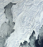
Snow Cover/Sea Ice

MODIS snow cover data are based on a snow mapping algorithm that employs a Normalized Difference Snow Index (NDSI) and other criteria tests.
The MODIS snow product suite is composed of products covering a range of spatial and temporal resolutions, from 500 m to 0.05°, and from swath
to daily, to 8-day to monthly. All products provide fractional snow cover, and snow albedo is provided in the 500 m resolution products. The
overall absolute accuracy of the 500 m resolution products is ~93%, varying by land cover and snow condition. The snow products are used by
climatologists, and by modelers both as input to hydrological models, e.g., to develop snow cover depletion curves, and to compare with GCM
output.
The MODIS sea ice product is the sea ice extent and ice-surface temperature (IST) measured during daylight and darkness. The sea
ice algorithm uses a Normalized Difference Snow Index (NDSI) modified for sea ice to distinguish sea ice from open ocean based on reflective
and thermal characteristics. The sea ice product suite is composed of both swath and gridded products at a range of spatial and temporal
resolutions, from 1 km to 0.05° (or ~4 km), and temporal resolutions ranging from swath to daily with gridded data in a polar grid
(EASE-grid). IST under frozen conditions is accurate to ±1.6 K.
Product PI: George Riggs
PI-maintained product web page
User Guide
ATBD
See links below to the Product Description pages located at the NSIDC DAAC (product details, data access links, and more....), see also the MODIS Overview page there.
Product NameSnow Cover 5-Min L2 Swath 500m Snow Cover Daily L3 Global 500m Grid Snow Cover 8-Day L3 Global 500m Grid Snow Cover 8-Day L3 Global 0.05Deg CMG Snow Cover Daily L3 Global 0.05Deg CMG Snow Cover Monthly L3 Global 0.05Deg CMG Sea Ice Extent 5-Min L2 Swath 1km Sea Ice Extent Daily L3 Global 1km EASE-Grid Day Sea Ice Extent Daily L3 Global 1km EASE-Grid Night Sea Ice Extent and IST Daily L3 Global 4km EASE-Grid Day |
Terra Product ID |
Aqua Product ID |
|


