Tramonti di Sotto
Aspetto
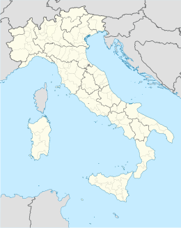
| Tramonti di Sotto comune tagliàne | ||
|---|---|---|
 | ||
| ||
| State | ||
| Reggione | ||
| Provinge | stemma Pordenone | |
| Coordinate | 46°17′00″N 12°48′00″E | |
| Altitudine | 366 m s.l.m. | |
| Superficie | 85 km² | |
| Crestiàne | 426 (04-2009 (ISTAT)) | |
| Denzetà | 5 cr./km² | |
| Fraziune | vedi elenco | |
| Comune 'nzeccate | Castelnovo del Friuli, Clauzetto, Frisanco, Meduno, Preone (UD), Socchieve (UD), Tramonti di Sopra, Travesio, Verzegnis (UD), Vito d'Asio | |
| CAP | 33090 | |
| Prefisse | 0427 | |
| Codece ISTAT | 093046 | |
| Cod. catastale | L325 | |
| Nome javetande | tramontini | |
| Site istituzionale | ||
Tramonti di Sotto éte 'nu comune tagliáne de 438 crestiáne.
Friuli-Venezia Giulia · Comune d'a Provinge de Pordenone
| Andreis · Arba · Arzene · Aviano · Azzano Decimo · Barcis · Brugnera · Budoia · Caneva · Casarsa della Delizia · Castelnovo del Friuli · Cavasso Nuovo · Chions · Cimolais · Claut · Clauzetto · Cordenons · Cordovado · Erto e Casso · Fanna · Fiume Veneto · Fontanafredda · Frisanco · Maniago · Meduno · Montereale Valcellina · Morsano al Tagliamento · Pasiano di Pordenone · Pinzano al Tagliamento · Polcenigo · Porcia · Pordenone · Prata di Pordenone · Pravisdomini · Roveredo in Piano · Sacile · San Giorgio della Richinvelda · San Martino al Tagliamento · San Quirino · San Vito al Tagliamento · Sequals · Sesto al Reghena · Spilimbergo · Tramonti di Sopra · Tramonti di Sotto · Travesio · Vajont · Valvasone · Vito d'Asio · Vivaro · Zoppola |
Categorije:
- Stub
- P625 uguale sus Uicchidate
- Prefisso telefonico locale uguale a Wikidata
- Codice ISTAT uguale a Wikidata
- P94 assende sus Uicchidate
- P281 uguale sus Uicchidate
- P806 uguale sus Uicchidate
- P856 lette da Uicchidate
- P2044 uguale sus Uicchidate
- P2046 differende sus Uicchidate
- Comune d'u Friuli Venezia Giulia
- Comune d'a provinge de Pordenone
- Pàggene cu le mappe
