Papers by Pir W Hoebe

Quaternary International, 2024
Sea-level rise was a key factor changing environments during the Early Holocene in Northwest Euro... more Sea-level rise was a key factor changing environments during the Early Holocene in Northwest Europe. It affected Mesolithic hunter-gatherer communities by inundating large areas in the current North Sea, commonly referred to as Doggerland. In this paper we present novel inundation models for the southern North Sea providing visualisations of lateral inundation driven by sea-level rise and relate it to frequency analysis of radiocarbon dates from archaeological sites. These improve on previous studies that relied on bathymetric data, which includes post-inundation overprints of Holocene sedimentation and erosion, and thus significantly underestimates the timing of inundation in some areas. We constructed a paleoDEM (a composite elevation grid of the top of the Pleistocene) for the eastern part of the southern North Sea; and sea level surfaces that combine relative sea-level curves from glacio-isostatic adjustment models optimised for Britain and southern Scandinavia respectively. We corrected our paleoDEMs for tectonic background basin subsidence, and in the inundation modelling account for pre-compaction elevation of peat in coastal areas. We evaluated the impact of these model components on our results and describe the possible inundation history of Doggerland. We suggest earlier inundation than predicted by previous models, showing significant area loss around 10.5-10 ka cal BP. Palaeogeographic changes are compared with archaeological radiocarbon data using a dates-as-data approach. Composite Kernel Density Estimate and permutation tested Summed Probability Distributions are used as a proxy for the visibility, nature and intensity of human activity. Results indicate key periods of growth and decline recorded in the dataset, as well as regional differences in growth rate, some correlating with inundation phases. Chiefly, we find elevated growth rates around 10.5-10 ka in northwest Germany and the Netherlands, contemporaneous with the abovementioned phase of extensive area loss, and moreover, with changes in culture and practices on Early Mesolithic sites. However, the spatiotemporal distribution of archaeological data is significantly influenced by accessibility and preservation of sediments of a certain age. We discuss the importance of inundation modelling and sediment data in understanding how landscape taphonomy affects archaeological patterning, especially in dates-as-data approaches.
Journal of Archaeological Science: Reports, 2023
This paper is a reply to a comment by professor Pierre Vermeersch, on our previous contribution t... more This paper is a reply to a comment by professor Pierre Vermeersch, on our previous contribution to JASrep 'Parsing Prehistoric Patterns' (Hoebe et al. 2023a). The concerns expressed by Vermeersch address our assessment of data quality/reliability, and our conclusions regarding the use of large radiocarbon datasets to investigate the correlation of climate and environmental changes with fluctuations in activity intensity among Late Glacial and Holocene hunter gatherers. In our reply we take the opportunity to further elucidate some relevant matters regarding the data collection and filtering process, as well as the effect on model test outcomes when using more stringent selection procedures.
Journal of Archaeological Science: Reports, 2023
Hunter-gatherer populations in northwest Europe were variably affected by Late Glacial and Early ... more Hunter-gatherer populations in northwest Europe were variably affected by Late Glacial and Early Holocene climate fluctuations and their effects on sea level and the environment. We investigate the impact of these fluctuations with a dates-as-data approach to a large radiocarbon dataset. Radiocarbon dates are used as a proxy for past human activity, the intensity, nature and archaeological visibility of which will indirectly influence date density. The significance of changes is explored using Kernel Density Estimates and model tested Summed Probability Distributions. Whereas previous studies have focused on smaller highly curated datasets to minimise research and preservation biases, our more inclusive approach maximises sample size, which is essential for these methods to reliably reflect underlying patterns. To deal with biases, we test subsets of the dataset that are potentially affected by differences in formation processes. The summed radiocarbon dataset follows the general fluctuations of climate conditions, showing increased activity in temperate periods and decreased activity during cold phases. Our results indicate significant periods of interest where the data deviates positively or negatively from our models. Notably we observe the impact of the Younger Dryas, Preboreal Oscillation and the 8.2 ka event on the density of hunter-gatherer activity. Additionally we see peaks in activity in our dataset during the Early and Late Boreal. Permutation testing of different regions in the research area shows these patterns are geographically differentiated. Our exploration of biasing factors indicates that we should be careful to interpret the abovementioned patterns, as different sampling processes and national policies may lie at the basis of several patterns. Furthermore, calibration artefacts may also cause issues at key parts of the timeline. Dates-as-data approaches require an understanding of the archaeology, the timing of external events, the impact of the calibration curve and how biases inherent to the dataset and research area may have influenced the formation of patterns in the result.
Archeologie in Nederland, 2020
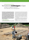
Vuursteen uit Helgoland vertelt over verre trektochten van de Hamburgcultuur van de gemeente Deve... more Vuursteen uit Helgoland vertelt over verre trektochten van de Hamburgcultuur van de gemeente Deventer. Hierbij werden grote, aaneengeslo-ten delen opgegraven waarbij sporen werden aangetroff en van grafvelden en nederzettingen uit de bronstijd, de ijzertijd en de Romeinse tijd, zoals beschreven in het rapport Afslag Olthof. Ook werden resten aangetroff en van mesolithische en neolithische activiteit. Het onderzoek naar deze steentijdresten vond plaats in nauwe samenwerking met de Rijksuniversiteit Groningen, waarbij bijzondere aandacht werd besteed aan de ontwikkeling van alternatieve methoden om vindplaatsen uit deze periode te kunnen opsporen. In 2012 organiseerde Saxion Hogeschool een veldpracticum op het noordwestelijk deel van de top van de dekzandrug. Bij dit onderzoek konden de laatste 'postzegels' die niet door de ge-meentelijke archeologen waren opgegraven alsnog worden onderzocht. Nadat bij het aanleggen van het vlak een aantal grote vuur-stenen artefacten waren aangetroff en, werd besloten een deel Bij opgravingen in Epse, nabij gemeente Deventer, werden in 2012 vuurstenen artefacten aangetroffen die toegeschreven worden aan de laat-paleolithische Hamburgcultuur. Mensen van de Hamburgcultuur (circa 13.000-12.000 voor Christus) waren de eerste bewoners van Noord-Nederland na de lange koude periode van het laatste glaciale maximum. De vind-plaats is niet alleen bijzonder vanwege de zuidelijke ligging, maar ook vanwege de gebruikte grondstof: enkele artefacten waren vervaardigd uit rode Helgolandvuursteen. Dit is een zeldzame vuursteensoort die alleen bij het (huidige) eiland Helgoland (Duitsland) gevonden kan worden en biedt daarom inzicht in de afstanden waarover deze jager-verzamelaars-groepen zich verplaatsten. Onderzoeksgeschiedenis De dekzandrug bij boerderij De Olthof te Epse is in de afgelopen decennia grootschalig opgegraven door de archeologische dienst
Past Landscapes, questioning function and meaning, 2014
Books by Pir W Hoebe
Deze Rapportage Archeologische Monumentenzorg (RAM) beschrijft de resultaten van een veldonderzoe... more Deze Rapportage Archeologische Monumentenzorg (RAM) beschrijft de resultaten van een veldonderzoek in 2011, 2012 en 2013 rond de vuursteenmijnen in het Limburgse Rijckholt – St. Geertruid.

Huisplaatsen in de Onlanden. De geschiedenis van een Drents Veenweidegebied, 2018
(english abstract)
Excavations of late-medieval and younger farmstead sites in the peatland of th... more (english abstract)
Excavations of late-medieval and younger farmstead sites in the peatland of the Matsloot-Roderwolde
polder, nowadays part of De Onlanden, yielded hundreds of flint artefacts. Surprisingly, these finds did
not only originate from the top of the Pleistocene sands below the peat, but also from medieval settlement
layers and the present-day topsoil. A typological analysis was performed to determine
whether the artefacts represent particular prehistoric cultural groups. The assessment was in part
based on knowledge of local landscape-formation processes in relation to the context of the material.
The material from most locations could not be identified. One concentration of flint and prehistoric
ceramics, found in Pleistocene sand below the peat at the site of a later, medieval farmstead
(no. 8), was ascribed to the Funnel Beaker Culture (FBC, 3400-2900 cal. BC). At this small site 234
flint artefacts were discovered, including a transverse arrowhead, a scraper and a large amount of
debitage. The 25 ceramic fragments from the same site may possibly derive from the Early-Neolithic
Pre-Drouwen phase, which would date the site even earlier (4000-3400 cal. BC). In addition, several
ard-marks were found. These marks are situated directly beneath the prehistoric find level, dating
the agricultural activities to the Neolithic period as well. In Neolithic times, the site was located in a
‘liminal zone’ between the higher Pleistocene sands of the Drents Plateau to the northeast, and the
low-lying, boggy peatland to the southwest.
The site is interpreted as part of a settlement assemblage and the location of the site fits in with
theories on FBC landscape use. Although small in extent, the site exhibits evidence of different activities
that are typical of the Early Neolithic ‘extended-broad-spectrum’ economies, such as FBC and the
preceding Swifterbant Culture: besides indications of hunting (arrowhead) and the working of leather
(scraper), domestic activities (pottery, flint) and agriculture (ard-marks) left their traces as well.
To what extent flint may have been used in late- or post-medieval times is difficult to ascertain.
In one case, the retouch on a piece of flint may have resulted from its use as a fire-maker (in a tinderbox
or with a piece of pyrite) during the 17th or 18th century. At least part of the flint had been
transported to the area within the soil used for creating platforms or floors for several farmsteads
– as indicated by debitage material in a till clay sod at farmstead 3. Some of the flint from medieval
contexts was burnt, which might be explained by burning prior to deposition at the farmstead sites
(e.g. in prehistory). Another possibility is in-situ heating in medieval house fires, which have been
documented at several farmsteads where burnt flint was found. Finally, the flint may have been
heated in medieval times to weaken its internal structure before being crushed, e.g. for use as temper
in pottery clay.

In the last ten to fifteen years development-led archaeology has boosted the number of prospectio... more In the last ten to fifteen years development-led archaeology has boosted the number of prospections and subsequent excavations in the Netherlands. Despite the number of excavations and the availability of much data little is known with regard to the actual gain of knowledge in connection to the wide range of research questions and topics of the National Archaeological Research Agenda. This book reports on a synthetic analysis of reports produced in the context of development-led projects over the past 10-15 years and concerning the early prehistory of the Netherlands. The degree to which development-led work permits to take major steps forward is highly variable. A limited number of topics has profited from the generated data, and in some cases development-led research has shown to be on the forefront of innovative approaches. A larger number of topics and research questions, however, appear to remain unanswerable; data have been generated, but remain of an anecdotal nature. This volume discusses various issues with regard to the gain of knowledge regarding the early prehistory of the Netherlands, and identifies problems, yet also provides possible solutions. This scientific report is aimed at archaeologists and other professionals occupied with Archaeology. With knowledge and advice the Cultural Heritage Agency of the Netherlands gives the future a past.
(Contact the author for a high-res version) In the last ten to fifteen years development-led arch... more (Contact the author for a high-res version) In the last ten to fifteen years development-led archaeology has boosted the number of surveys and subsequent excavations in the Netherlands. Despite the number of excavations and the availability of much data little is known with regard to the actual gain of knowledge in connection to the wide range of research questions and topics of the National Archaeological Research Agenda. This book reports on a synthetic analysis of reports produced in the context of development-led projects over the past 10-15 years and concerning the early prehistory of the Netherlands. The degree to which development-led work permits to take major steps forward is highly variable. A limited number of topics has profited from the generated data, and in some cases development-led research has shown to be on the forefront of innovative approaches. A larger number of topics and research questions, however, appear to remain unanswerable; data have been generated, but remain of an anecdotal nature. This volume discusses various issues with regard to the gain of knowledge regarding the early prehistory of the Netherlands, and identifies problems, yet also provides possible solutions. This scientific report is aimed at archaeologists and other professionals occupied with Archaeology. With knowledge and advice the Cultural Heritage Agency of the Netherlands gives the future a past.
Papers in English by Pir W Hoebe
Quaternary International, 2024
Sea-level rise was a key factor changing environments during the Early Holocene in Northwest Euro... more Sea-level rise was a key factor changing environments during the Early Holocene in Northwest Europe. It affected Mesolithic hunter-gatherer communities by inundating large areas in the current North Sea, commonly referred to as Doggerland. In this paper we present novel inundation models for the southern North Sea providing visualisations of lateral inundation driven by sea-level rise and relate it to frequency analysis of radiocarbon dates from archaeological sites. These improve on previous studies that relied on bathymetric data, which includes post-inundation overprints of Holocene sedimentation and erosion, and thus significantly underestimates the timing of inundation in some areas. We constructed a paleoDEM (a composite elevation grid of the top of the Pleistocene) for the eastern part of the southern North Sea; and sea level surfaces that combine relative sea-level curves from glacio-isostatic adjustment models optimised for Britain and southern Scandinavia respectively. We corrected our paleoDEMs for tectonic background basin subsidence, and in the inundation modelling account for pre-compaction elevation of peat in coastal areas. We evaluated the impact of these model components on our results and describe the possible inundation history of Doggerland. We suggest earlier inundation than predicted by previous models, showing significant area loss around 10.5-10 ka cal BP. Palaeogeographic changes are compared with archaeological radiocarbon data using a dates-as-data approach. Composite Kernel Density Estimate and permutation tested Summed Probability Distributions are used as a proxy for the visibility, nature and intensity of human activity. Results indicate key periods of growth and decline recorded in the dataset, as well as regional differences in growth rate, some correlating with inundation phases. Chiefly, we find elevated growth rates around 10.5-10 ka in northwest Germany and the Netherlands, contemporaneous with the abovementioned phase of extensive area loss, and moreover, with changes in culture and practices on Early Mesolithic sites. However, the spatiotemporal distribution of archaeological data is significantly influenced by accessibility and preservation of sediments of a certain age. We discuss the importance of inundation modelling and sediment data in understanding how landscape taphonomy affects archaeological patterning, especially in dates-as-data approaches.
Journal of Archaeological Science: Reports, 2023
Hunter-gatherer populations in northwest Europe were variably affected by Late Glacial and Early ... more Hunter-gatherer populations in northwest Europe were variably affected by Late Glacial and Early Holocene climate fluctuations and their effects on sea level and the environment. We investigate the impact of these fluctuations with a dates-as-data approach to a large radiocarbon dataset. Radiocarbon dates are used as a proxy for past human activity, the intensity, nature and archaeological visibility of which will indirectly influence date density. The significance of changes is explored using Kernel Density Estimates and model tested Summed Probability Distributions. Whereas previous studies have focused on smaller highly curated datasets to minimise research and preservation biases, our more inclusive approach maximises sample size, which is essential for these methods to reliably reflect underlying patterns. To deal with biases, we test subsets of the dataset that are potentially affected by differences in formation processes. The summed radiocarbon dataset follows the general fluctuations of climate conditions, showing increased activity in temperate periods and decreased activity during cold phases. Our results indicate significant periods of interest where the data deviates positively or negatively from our models. Notably we observe the impact of the Younger Dryas, Preboreal Oscillation and the 8.2 ka event on the density of hunter-gatherer activity. Additionally we see peaks in activity in our dataset during the Early and Late Boreal. Permutation testing of different regions in the research area shows these patterns are geographically differentiated. Our exploration of biasing factors indicates that we should be careful to interpret the abovementioned patterns, as different sampling processes and national policies may lie at the basis of several patterns. Furthermore, calibration artefacts may also cause issues at key parts of the timeline. Dates-as-data approaches require an understanding of the archaeology, the timing of external events, the impact of the calibration curve and how biases inherent to the dataset and research area may have influenced the formation of patterns in the result.
Supplementary material is available from the journal website





Uploads
Papers by Pir W Hoebe
Books by Pir W Hoebe
Excavations of late-medieval and younger farmstead sites in the peatland of the Matsloot-Roderwolde
polder, nowadays part of De Onlanden, yielded hundreds of flint artefacts. Surprisingly, these finds did
not only originate from the top of the Pleistocene sands below the peat, but also from medieval settlement
layers and the present-day topsoil. A typological analysis was performed to determine
whether the artefacts represent particular prehistoric cultural groups. The assessment was in part
based on knowledge of local landscape-formation processes in relation to the context of the material.
The material from most locations could not be identified. One concentration of flint and prehistoric
ceramics, found in Pleistocene sand below the peat at the site of a later, medieval farmstead
(no. 8), was ascribed to the Funnel Beaker Culture (FBC, 3400-2900 cal. BC). At this small site 234
flint artefacts were discovered, including a transverse arrowhead, a scraper and a large amount of
debitage. The 25 ceramic fragments from the same site may possibly derive from the Early-Neolithic
Pre-Drouwen phase, which would date the site even earlier (4000-3400 cal. BC). In addition, several
ard-marks were found. These marks are situated directly beneath the prehistoric find level, dating
the agricultural activities to the Neolithic period as well. In Neolithic times, the site was located in a
‘liminal zone’ between the higher Pleistocene sands of the Drents Plateau to the northeast, and the
low-lying, boggy peatland to the southwest.
The site is interpreted as part of a settlement assemblage and the location of the site fits in with
theories on FBC landscape use. Although small in extent, the site exhibits evidence of different activities
that are typical of the Early Neolithic ‘extended-broad-spectrum’ economies, such as FBC and the
preceding Swifterbant Culture: besides indications of hunting (arrowhead) and the working of leather
(scraper), domestic activities (pottery, flint) and agriculture (ard-marks) left their traces as well.
To what extent flint may have been used in late- or post-medieval times is difficult to ascertain.
In one case, the retouch on a piece of flint may have resulted from its use as a fire-maker (in a tinderbox
or with a piece of pyrite) during the 17th or 18th century. At least part of the flint had been
transported to the area within the soil used for creating platforms or floors for several farmsteads
– as indicated by debitage material in a till clay sod at farmstead 3. Some of the flint from medieval
contexts was burnt, which might be explained by burning prior to deposition at the farmstead sites
(e.g. in prehistory). Another possibility is in-situ heating in medieval house fires, which have been
documented at several farmsteads where burnt flint was found. Finally, the flint may have been
heated in medieval times to weaken its internal structure before being crushed, e.g. for use as temper
in pottery clay.
Papers in English by Pir W Hoebe
Supplementary material is available from the journal website
Excavations of late-medieval and younger farmstead sites in the peatland of the Matsloot-Roderwolde
polder, nowadays part of De Onlanden, yielded hundreds of flint artefacts. Surprisingly, these finds did
not only originate from the top of the Pleistocene sands below the peat, but also from medieval settlement
layers and the present-day topsoil. A typological analysis was performed to determine
whether the artefacts represent particular prehistoric cultural groups. The assessment was in part
based on knowledge of local landscape-formation processes in relation to the context of the material.
The material from most locations could not be identified. One concentration of flint and prehistoric
ceramics, found in Pleistocene sand below the peat at the site of a later, medieval farmstead
(no. 8), was ascribed to the Funnel Beaker Culture (FBC, 3400-2900 cal. BC). At this small site 234
flint artefacts were discovered, including a transverse arrowhead, a scraper and a large amount of
debitage. The 25 ceramic fragments from the same site may possibly derive from the Early-Neolithic
Pre-Drouwen phase, which would date the site even earlier (4000-3400 cal. BC). In addition, several
ard-marks were found. These marks are situated directly beneath the prehistoric find level, dating
the agricultural activities to the Neolithic period as well. In Neolithic times, the site was located in a
‘liminal zone’ between the higher Pleistocene sands of the Drents Plateau to the northeast, and the
low-lying, boggy peatland to the southwest.
The site is interpreted as part of a settlement assemblage and the location of the site fits in with
theories on FBC landscape use. Although small in extent, the site exhibits evidence of different activities
that are typical of the Early Neolithic ‘extended-broad-spectrum’ economies, such as FBC and the
preceding Swifterbant Culture: besides indications of hunting (arrowhead) and the working of leather
(scraper), domestic activities (pottery, flint) and agriculture (ard-marks) left their traces as well.
To what extent flint may have been used in late- or post-medieval times is difficult to ascertain.
In one case, the retouch on a piece of flint may have resulted from its use as a fire-maker (in a tinderbox
or with a piece of pyrite) during the 17th or 18th century. At least part of the flint had been
transported to the area within the soil used for creating platforms or floors for several farmsteads
– as indicated by debitage material in a till clay sod at farmstead 3. Some of the flint from medieval
contexts was burnt, which might be explained by burning prior to deposition at the farmstead sites
(e.g. in prehistory). Another possibility is in-situ heating in medieval house fires, which have been
documented at several farmsteads where burnt flint was found. Finally, the flint may have been
heated in medieval times to weaken its internal structure before being crushed, e.g. for use as temper
in pottery clay.
Supplementary material is available from the journal website