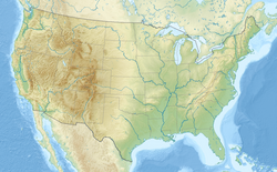
Paducah, Kentucky
Appearance
Paducah, Kentucky | |
|---|---|
 Broadway, Paducah Downtown Commercial District | |
| Coordinates: 37°4′20″N 88°37′39″W / 37.07222°N 88.62750°W | |
| Country | United States |
| State | Kentucky |
| County | McCracken |
| Settled | c. 1821[1] |
| Established | 1830[2] |
| Incorporated | 1838[2] |
| Named for | the Chickasaw Tribe[3] |
| Government | |
| • Type | Council-Manager |
| Area | |
| • City | 20.75 sq mi (53.74 km2) |
| • Land | 20.30 sq mi (52.59 km2) |
| • Water | 0.45 sq mi (1.15 km2) |
| Elevation | 341 ft (104 m) |
| Population | |
| • City | 27,137 |
| • Density | 1,336.60/sq mi (516.06/km2) |
| • Metro | 103,481 |
| Demonym | Paducahan |
| Time zone | UTC−6 (CST) |
| • Summer (DST) | UTC−5 (CDT) |
| ZIP Code | 42001-42002-42003 |
| Area code(s) | 270 & 364 |
| FIPS code | 21-58836 |
| GNIS feature ID | 0500106 |
| Website | paducahky |
Paducah is a city in Kentucky in the United States. It is the county seat of McCracken County.
Sources
[change | change source]- ↑ University of Kentucky. Kentucky Atlas & Gazetteer, "Paducah". Accessed September 24, 2013.
- ↑ 2.0 2.1 Commonwealth of Kentucky. Office of the Secretary of State. Land Office. "Paducah, Kentucky". Accessed September 24, 2013.
- ↑ Rennick, Robert. Kentucky Place Names, p. 224. University Press of Kentucky (Lexington), 1987. Accessed August 1, 2013.
- ↑ "2020 U.S. Gazetteer Files". United States Census Bureau. Retrieved March 18, 2022.
- ↑ "QuickFacts: Paducah city, Kentucky". United States Census Bureau. Retrieved November 13, 2023.

