Carnesville
Utseende
| Carnesville | |
| city | |
Ayers-Little Boarding House
| |
| Land | |
|---|---|
| Delstat | Georgia |
| County | Franklin County |
| Höjdläge | 216 m ö.h. |
| Koordinater | 34°22′17″N 83°14′1″V / 34.37139°N 83.23361°V |
| Yta | 6,85 km² (2010) |
| - land | 6,79 km² |
| - vatten | 0,06 km² |
| Folkmängd | 577 (2010) |
| Befolkningstäthet | 85 invånare/km² |
| Tidszon | EST (UTC-5) |
| - sommartid | EDT (UTC-4) |
| ZIP-kod | 30521 |
| FIPS | 1313352 |
| Geonames | 4186352 |
|
Ortens läge i Georgia
| |
|
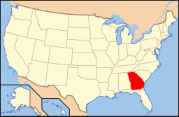
Georgias läge i USA
| |
Carnesville är administrativ huvudort i Franklin County i Georgia.[1][2] Orten har fått sitt namn efter juristen och politikern Thomas P. Carnes.[3]
Källor
[redigera | redigera wikitext]- ^ Georgia County Map with County Seat Cities. Geology.com Geoscience News and Information. Läst 13 juni 2016.
- ^ Profile for Carnesville, Georgia. ePodunk. Läst 13 juni 2016.
- ^ Carnesville Arkiverad 16 juni 2016 hämtat från the Wayback Machine.. Georgia.gov Läst 13 juni 2016.


